Last year, I went to visit my brother who is working on the large US-50 construction happening between Gunnison and Montrose. I got a small taste of Colorado dirt, and I knew that I had to come back for an extended sampling. It just so happened that this project is massive and my brother was up there again this summer.
I had a more varied agenda originally planned, but gas prices had me changing some plans to stay on budget. I think it worked out pretty well and I had a blast out there. I really enjoyed two weekends with my brother and a solid workweek ride schedule.
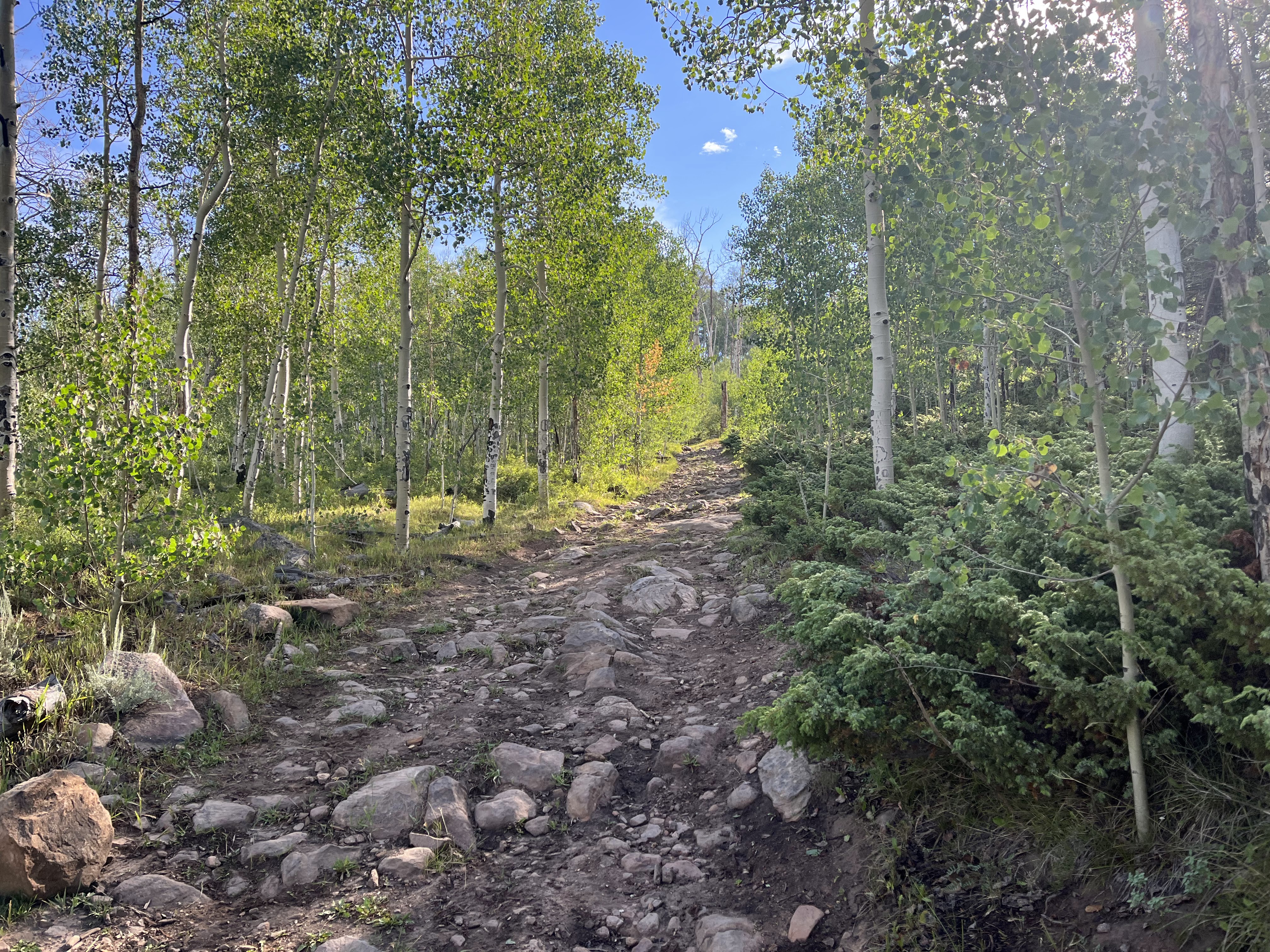
I hit the road immediately after work on a Thursday with my target set as the Phil's World TH right outside of Cortez, CO. I grabbed a couple of burritos and fuel in Flagstaff before continuing on. I made good time and hit the parking area around midnight after losing the hour due to time zone changes. There was one other vehicle there, but other than that all was quiet. Crushed one burrito and crashed out in the passenger seat of the truck.
This was just going to be a quick ride, I was just trying to burn off the Friday since my brother was working the full day. I still had a decent drive to Montrose after I was done here.
 |
| Good morning - view from the Phil's World TH. |
 |
| Fun right off the bat. |
 |
| Early morning sunlight in the high desert. |
 |
| Interesting things to see trailside. |
 |
| Super fun rollercoaster type stuff here. |
 |
| And the cherry on top of this ride - a rip down Rib Cage. |
I wanted to get on the road, so I packed up and headed out to go get fuel in Cortez. I got there and my heart sank. Where the hell was my wallet? I had pulled it out of my pack at the TH, but it was nowhere to be found. Instead of dicking around tearing apart the truck at the gas station, I decided to high tail it back to the TH - traffic was starting to ramp up and I didn't want it to get picked up.
I got there and was scouring the bumpy road that leads to the parking area... nothing. I parked in the spot where I was earlier, and there was a new car that was parked. I asked them if they saw a wallet and suddenly I had a handful of people scouring the lot while I searched the bed of the truck. Nothing. I opened up the rear door and boom, there it is... gently nestled on top of my sleeping bag.
I went from a sense of dread to my spirits being through the roof. Elated, I went back to the gas station and happily paid for goods and began my drive through the beautiful mountains to Montrose.
It was getting warm, but I still had some time to burn, so I stopped at Buzzard Gulch.
 |
| This tree was full of hanging rusted cans and other desert debris. |
 |
| Trail started out pretty smooth with mild climbing grades |
 |
| Starting to find a bit of chunkiness |
 |
| Really cool view into the wide gulch. I would be dropping down there. RAPIDLY. |
 |
| Toasty and the sun was intense... |
 |
| Really cool geology here. Super steep... |
The part above had some sections of downhill HAB just due to super steep/rubbly conditions in spots. I rode what I felt safe doing, but it was blazing. So fast in fact, that I blew a turn and ended up going the wrong direction as this was a figure 8 type route. In essence, I ended up riding up what was a trail much better suited to the downhill direction. I was just going to stick it out, but I was in the bottom of this gulch and the temps were getting out of my comfort zone. I looked at my gps and it said 113. It was still 4 miles of uphill so I cut my losses when I realized that I had no idea what was coming up and it wouldn't be smart to continue. I turned around knowing I was going to cut the loop short, but I had had enough. There was still some cool stuff to see as I made my way back.
 |
| A touch of water flowing here so I dunked the shirt to provide some cooling. |
 |
| Smooth trail starts to dominate before spitting out to a ranch road that had me going through 5-6 gates in just a couple hundred yards. |
 |
| Colorado Beef - I can confirm it is delish. |
 |
| Quick spin up to the truck. |
I wrapped up and had to drive up the road a bit to get service. I did and my brother said he was done for the day so I headed to his place. I had created quite an appetite, so we went to an early dinner. Good to see this dude.
Over the weekend we spent some quality time just doing dumb BS that brothers do. We did make the drive to Telluride and walked around, grabbed some food and took a ride up the mountain in the gondola.
 |
| Telluride far below. |
The beginning of the work week meant I was gonna be doing some riding east of the US-50 construction. The original plans were for an overnight ride Mon/Tues, a couple of day rides on Wed, and another overnighter Thurs/Fri. I got most of it in, but made some changes mainly weather related (either actual or nervous about).
The first ride I got off of bikepacking.com and the ride is called the Wuanita Overnighter. I chose it as my first adventure for a couple of reasons. First it seemed fairly easy from a logistic and effort standpoint. Another thing to note: I wasn't really out for a suffering type of week. Plenty of time for that kind of stuff, but this was more of a vacation thing for me. That said, let's go!
Day 1
After a quick stop for last minute supplies in Sargents, I drove the quick mile or so up the road to Daley Gulch where there was non-descript parking area. Rain looked possible but stayed away most of the day.
 |
| Just what the sign says. |
You can't really tell, but there is often flowing water right next to the road - or it meanders close by. I ended up finding easy access to water that flowed under the road I was on. Loaded up enough to get me through the evening and into the next day.
With the major loss of elevation and the clouds departing for now, it was starting to warm up.
 |
| Now off pavement and onto public ranch roads. |
 |
| Starting to see changes in terrain. Cool rock formations similar to Brown's Ranch, etc. |
I turned off this big road onto more of a single lane jeep road that provided access to Wood's Gulch. The route description mentioned that the ranchers in the area note the mountain lion presence in the area. Noting the terrain, I could understand why.
 |
| Lots of remnants scattered around. |
I started to scout for camp sites. I wasn't tired, just was ready to relax and I needed to keep some miles in the tank for tomorrow. I was approaching 40 miles and the total route was around 62 or so.
 |
| Starting to see some good possibilities. |
 |
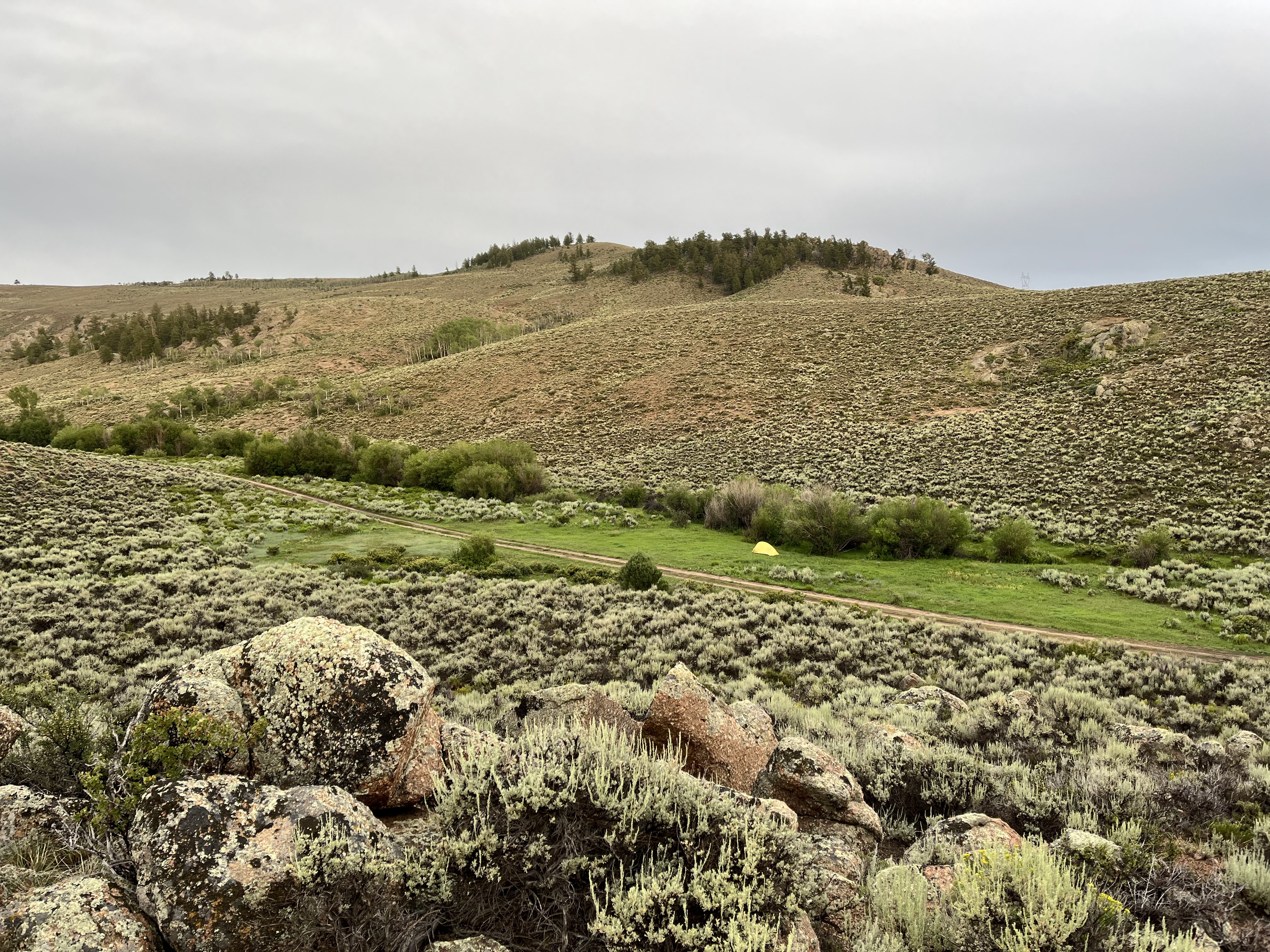
| Got a good one just in time. Storm was blowing in. Mosquitos were really eating me as I set up camp. Stupid move of the trip was I didn't have bug spray. #arizonakid |
The thunder started rumbling and before I knew it, the rain had started. Got settled in my tent and started to listen to podcasts with a background sound of rain and thunder. Might have eaten some peanut M&M's. Maybe.
 |
| My view for a couple hours. Nice and dry inside my new Big Agnes tent. This is way better than my previous bivy bag and not a whole lot heavier. |
Eventually the rain moved off and it was plenty light out. I decided to do some exploring of the rock formations and hills around my camp. The mosquitos were really out now, but I was kinda committed and really didn't want to lay in my tent for another 12 hours straight. I usually don't get to bit up but the Colorado mosquitos must have liked my desert blood. Ugh. I would be paying for this for the next week.
 |
| Looking down on camp |
 |
| On top of the big rock pile I found this at the very top - it was sheltered by boulders on all sides. Pretty spooky, but cool at the same time. |
 |
| I climbed up the opposite side of the road hoping for a sunset pic but wasn't sure due to the clouds. I got lucky enough to catch a bit. |
OK, enough sightseeing. I was getting wrecked by the bloodsuckers so I hightailed it to the tent, got in and then focused on killing the 10 mosquitoes that followed me in. Then settled in to more podcasts. I dozed off and woke up a few times in the night when other storms rolled through. Maybe one of my best nights of sleeping outside ever!
Day 2
 |
| Sunrise. Time to get up, get the tent mostly dry and avoid mosquitos. |
I got on the road and continued my way through Wood's Gulch. The jeep road started to deteriorate as the grade started to pitch up. It was a beautiful morning to be on the bike.
After lunch, some weather started to roll in, but I had some time to burn so I ended up driving up and past Monarch Pass to go to Salida and poke around for a bit and just do some driving. I stopped to get some snacks/dinner and then ultimately figure out where I was gonna crash for the night.
The following day I had two potential rides on the agenda if weather held out the whole day. My first priority was riding the Monarch Crest trail. Armed with snacks and dinner, I drove back up the pass to the large parking area. I parked away from all the other vehicles... it was already winding down late on a Tuesday. I was stoked to have LTE, so I settled once again into the passenger seat of the truck, listening to comedy on the XM radio in the truck and then migrating to some podcasts. I think I passed out around 9:30 once the sun finally was gone. I only woke up a couple times - when rain showers opened up overnight.
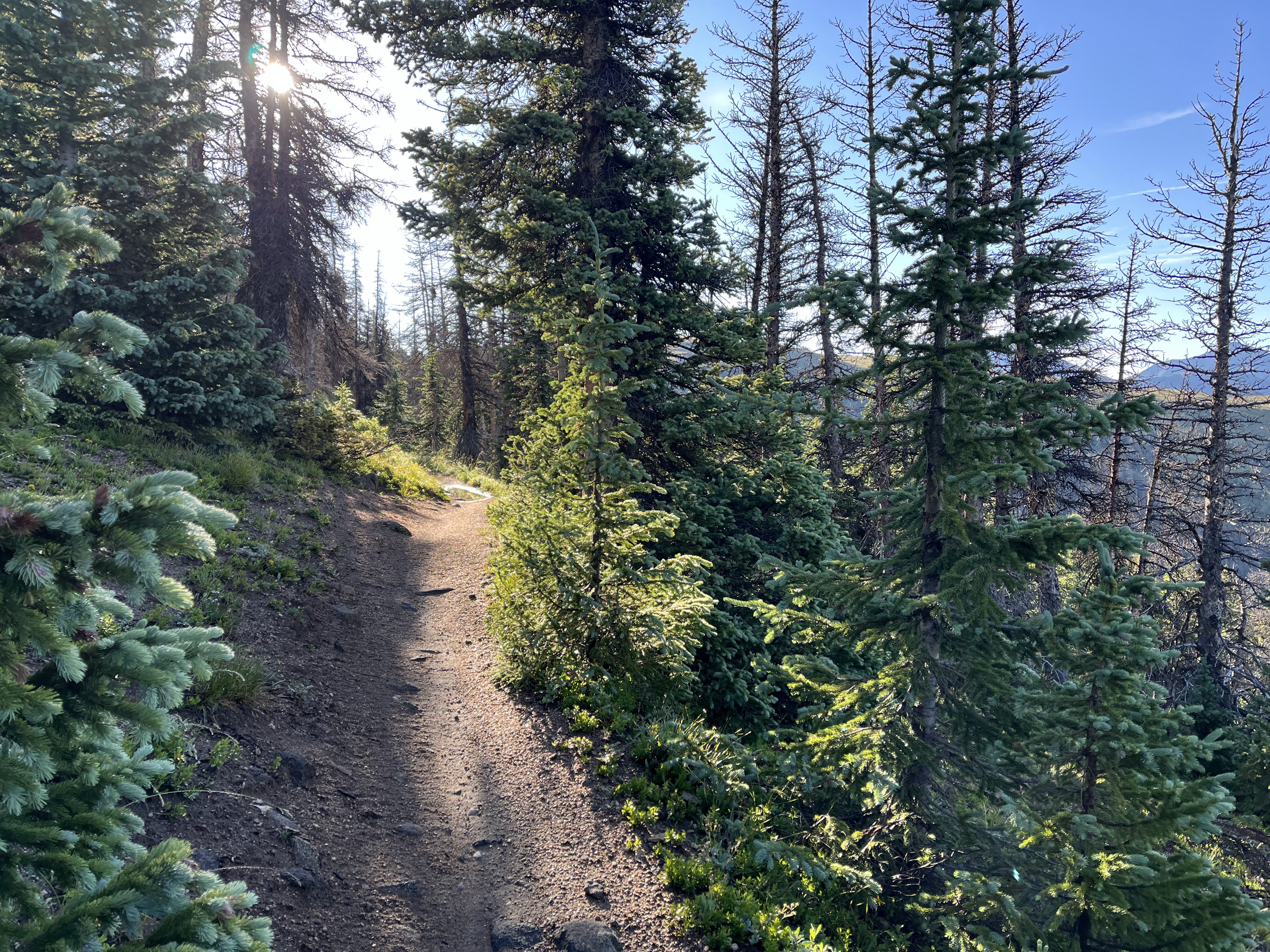
Wednesday - Monarch Crest OAB
 |
| Not a bad view to wake up to... |
 |
| Glad to not have my sleep kit harness with me today. |
The trail starts off on a jeep road briefly but then splits off maybe 100 yards up the road. Suddenly, I'm on some of the most glorious singletrack ever!
 |
| Couldn't ask for a more perfect bluebird sky morning. |
 |
| Not sure what this split was, but I stayed right on since that what my track told me to do. |
 |
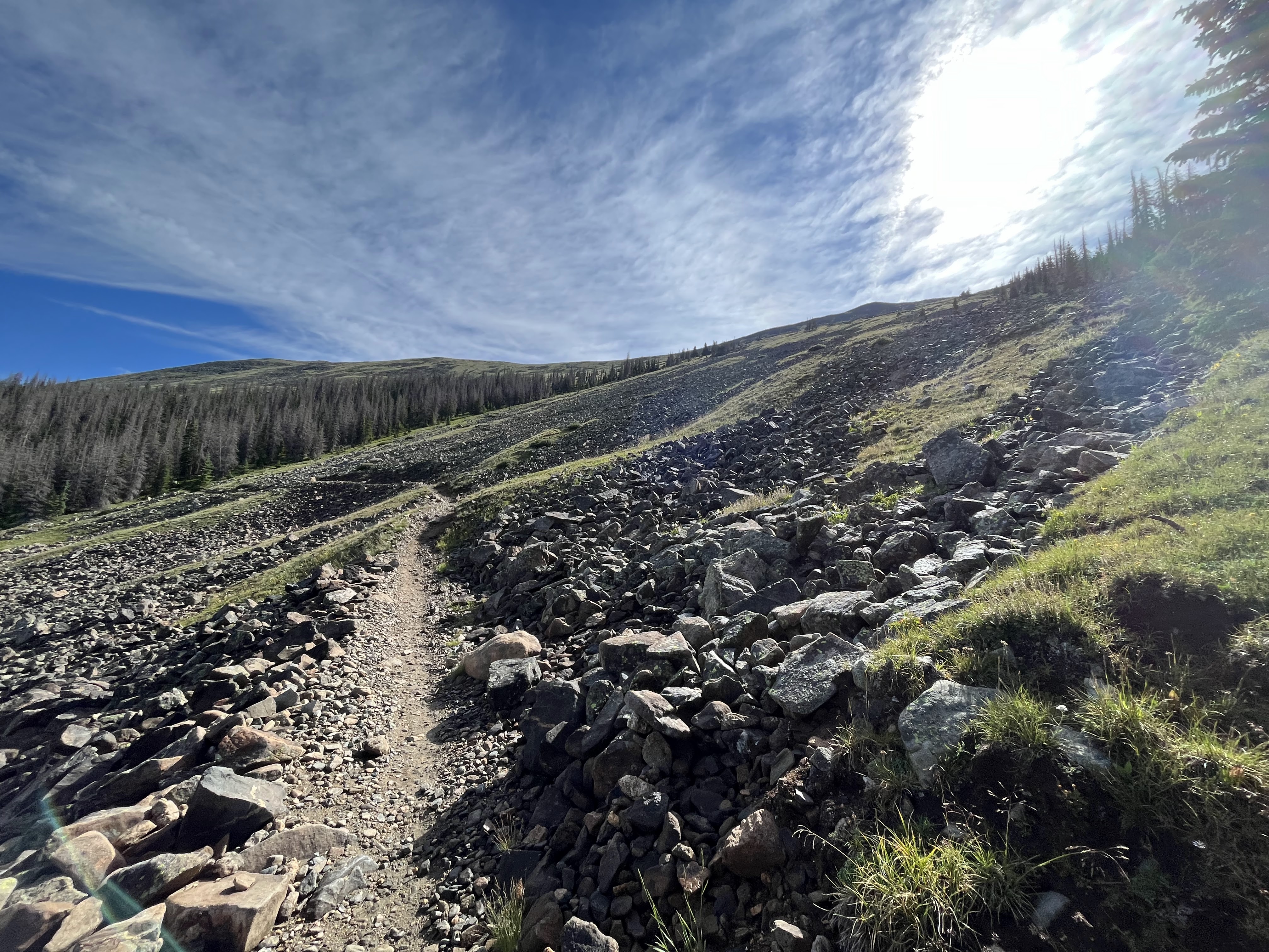
| Gigantic view and smooth tread |
 |
| Looking southish-ish |
 |
| And north-ish |
 |
| Hey, my lungs are working OK here at almost 12k feet! |
 |
| I mean, it's just amazing up here. Ride, turn a corner, more views - repeat. |
 |
| This was a pretty quick descent down into the trees. |
 |
| Conditions getting a bit rougher. Weird being up so high and still getting dwarfed by mountains to the east. I think that is Mt Ouray. |
 |
| I talked a bit with this rider and he tried to convince me to go with him down Green's Creek. Told him no dice haha and off he went. |
 |
| Hey little fella |
 |
| Time for a bit more climbing. |
 |
| Hmm, should I eat a snack? |
 |
| The answer is almost always yes. Snickers bars were the theme of this trip for some reason. |
 |
| Snack break over. Riding through this rock slide area. Massive. I made sure to not be in the direct path before taking pictures. |
After this, the trail dove back into the trees and before I knew it, I had come to the part where John Schilling had turned around in the track I poached from him. I didn't scope it out, but I think it was just a rubbly jeep road descent down to Marshall Pass Rd. In any case, I was hoping to check out another ride today so I turned around and made the return trip back to the truck. It was at this point that I saw about 20-30 total trail users who all got a later start than me. A couple of CT thru hikers, lots of bikes, and a couple of motos - one of which who gave me a high five since I pulled over to let them pass. Good times.
 |
| Fooses creek turn off. |
Damn, what a trail! There was a bit of a HAB on the return trip after the Greens Creek turn off. Pretty short. Could have maybe ridden it but it was a little bit loose in spots.
I was stoked to ride this, if you haven't ridden it and are there it is a must do, no doubt.
I was now ready for lunch and figuring out how the weather was going to cooperate for a second ride of the day. I enjoyed the burger at Tomichi Creek Trading Post so much that I went back lol. Sue me.
While I was eating lunch, afternoon thunderstorms started firing up, so I bailed on my second ride idea and just decided to chill out for a bit at the restaurant and then make the drive back to Gunnison.
Back in Gunnison, I stopped for supplies for my next ride which was going to be another overnighter, this time on the "Fossil Ultimate" route which is a 60 mile 10k climbing route created by
Jefe B.
All supplied up, I headed to the western area of Hartman Rocks, which has dispersed/free camping so I could crash out for the night. It ended up dumping rain and I watched the radar as the area covered by the route - especially the furthest/most wild portions of it - saw tons of rain.
Based on this, and the weather forecast for the next two days, I ended up bailing on the idea of an overnighter. I think I could have handled the weather I suppose, but I also got intimidated by the route description itself. It was touted as ultra tough and I just didn't know if I was up to unknown backcountry trail plus potential weather issues. Something about CO makes me nervous - not really sure why.
Anyway, I ended up deciding that I would do the easiest 30 miles of the route. Basically cutting off one half of the figure 8 route leaving the first and last 15 miles of the route. I kinda regret my decision in retrospect but I still really enjoyed the riding on this beautiful Thursday morning. Let's go!
 |
| Route starts off on CR-10 and the gradual climb to the trees begins. |
 |
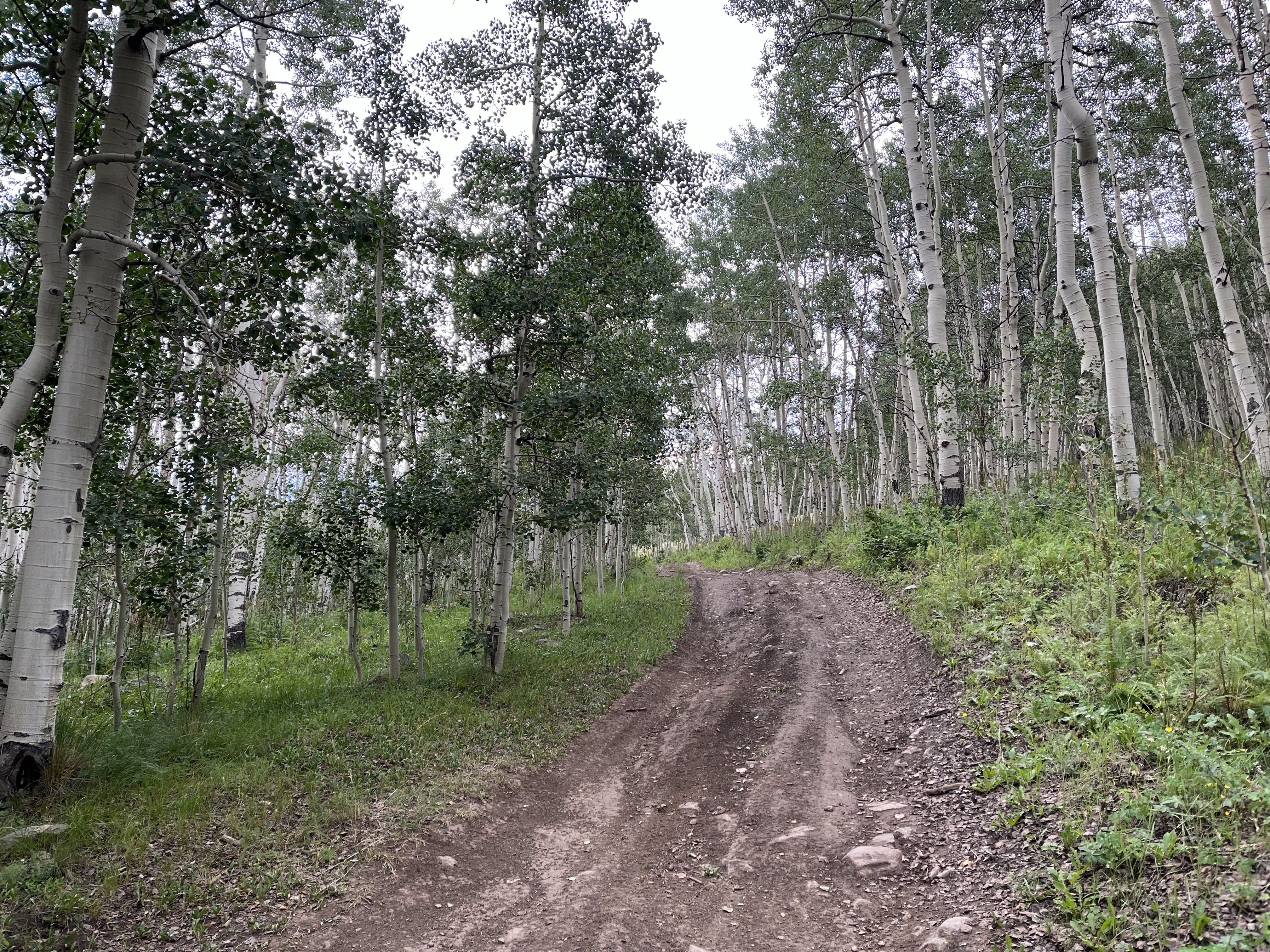
| Pavement stops and the dirt begins |
 |
| The route flirted with me going in and out of aspen stands. |
 |
| Weather not really sure what to do. |
 |
| Mean clouds are staying north for now |
 |
| Scared this guy pretty good. Had its face buried in the water trough and when I said hi it clearly surprised him. |
 |
| Endless and serene. |
 |
| Rugged little bits to keep things interesting. |
 |
| The route turns off on this faint singletrack to head into those trees and beyond |
The following bit of trail blew me away, fun to ride, and a flower show I was not expecting.
 |
| Faint trail through the aspens |
 |
| Picture doesn't capture it great but the flowers were popping. |
 |
| They were grading the dirt road above the trail, breaking up the silence. |
 |
| The elusive "gummy bear brick" flower lol. This had been in my pack since last week, and I think it probably all melted together during my blazing hot ride in Buzzard Gulch last Friday. |
 |
| Still a bit more up to go to the big trees. |
 |
| A quick blast down through some aspens got me to my end point for today. Time to loop back towards town. |
 |
| Nice place for a snack break. |
 |
| The descent out of the trees and to the flat ranch lands above Gunnison was fast and swift. Looks like I am riding towards the rain though... |
 |
| There was quite a bit of doubletrack, but as I got closer to town, singletrack started to dominate. And it was glorious! |
 |
| This trail is called shoelace - because it twists and turns like one. So fun! |
 |
| Color matches my bike! |
I got down to town and rain started in earnest - I was just a couple minutes away from the truck so didn't get too wet. Time for some lunch and then figure out what to do with the rest of the day...
The rain stuck around for a majority of the afternoon, so I had my doubts about getting anything else in today. I drove to the regular parking lot at Hartman to see if the rain would let up. It was still raining when I got there so I decided to catch up on personal emails and also facetime my kids to see how they were doing.
After an hour or so of rain, it stopped and the weather window looked clear for a while. I decided to sit around for a bit to let the rain soak in, and then took off for a quick spin around the entrance areas...
 |
| Up on the ridge. Dirt was just about perfect, though the rocks were just a little slick in places. |
Ended with a rip down to the trailhead back to the truck. Then to drive back to the dispersed camping on the other side since the main parking lot has signs saying "no camping"
All in all, a really good and satisfying day.
Made it to Friday. I was ready for a low-key exploratory ride, so I decided to start from my truck on the west side of Hartman Rocks. I targeted the "aberdeen loop" that I saw but had no idea what it was going to look like other than it looked like a steady climb to the area south of the main Hartman Rocks area. I wanted to burn off half the day or so, and then get ready to meet with my brother. It turns out he wasn't working in the canyon on the highway today, rather he was actually working at a rock quarry about a mile away from where I camped.
The ride started with a mellow jeep road climb - I was consulting trailforks often and would take little side loops where they presented themselves if it seemed on the "easy" side of things. One such example was a side loop called the Enchanted Forest. This is a quick jaunt through private land but it is a stark contrast to the rest of Hartman.
 |
| Aspens - WHAT?!?! |
 |
| Dense tree cover had me thinking I was somewhere else entirely. |
That bit was fairly short lived and I had to continue to make my way south.
 |
| Look closely and you can see how the trail is routed along the sides of the hills. |
 |
| The boulders at Hartman not even visible anymore - I am deep in the hills south of it. |
 |
| The bulk of the climbing ended and I dumped to a jeep road to connect to the western bit of singletrack that would take me back to the area next to the running water I found earlier. |
 |
| The jeep road was a different flavor of dirt than the singletrack... |
 |
| Shit! Death mud. |
 |
| Me worried that this was going to suck. |
Luckily, the jeep road was short enough and just when the mud almost stopped me, the singletrack connector appeared and dirt was back to normal.
 |
| What a view. Time to descend. |
This section of singletrack was just a touch more rowdy as far as rocks, but still it was one of the most fun descents I have had in a long time. Perfect grade and turns. I was having so much fun that I actually had to remind myself to dial it back just a bit considering I had seen nobody all day up here. Safety is always paramount when I am out solo.
 |
| Boulders of Hartman coming back into view. |
 |
| Betty White definitely approves of snack choice and location choice. |
 |
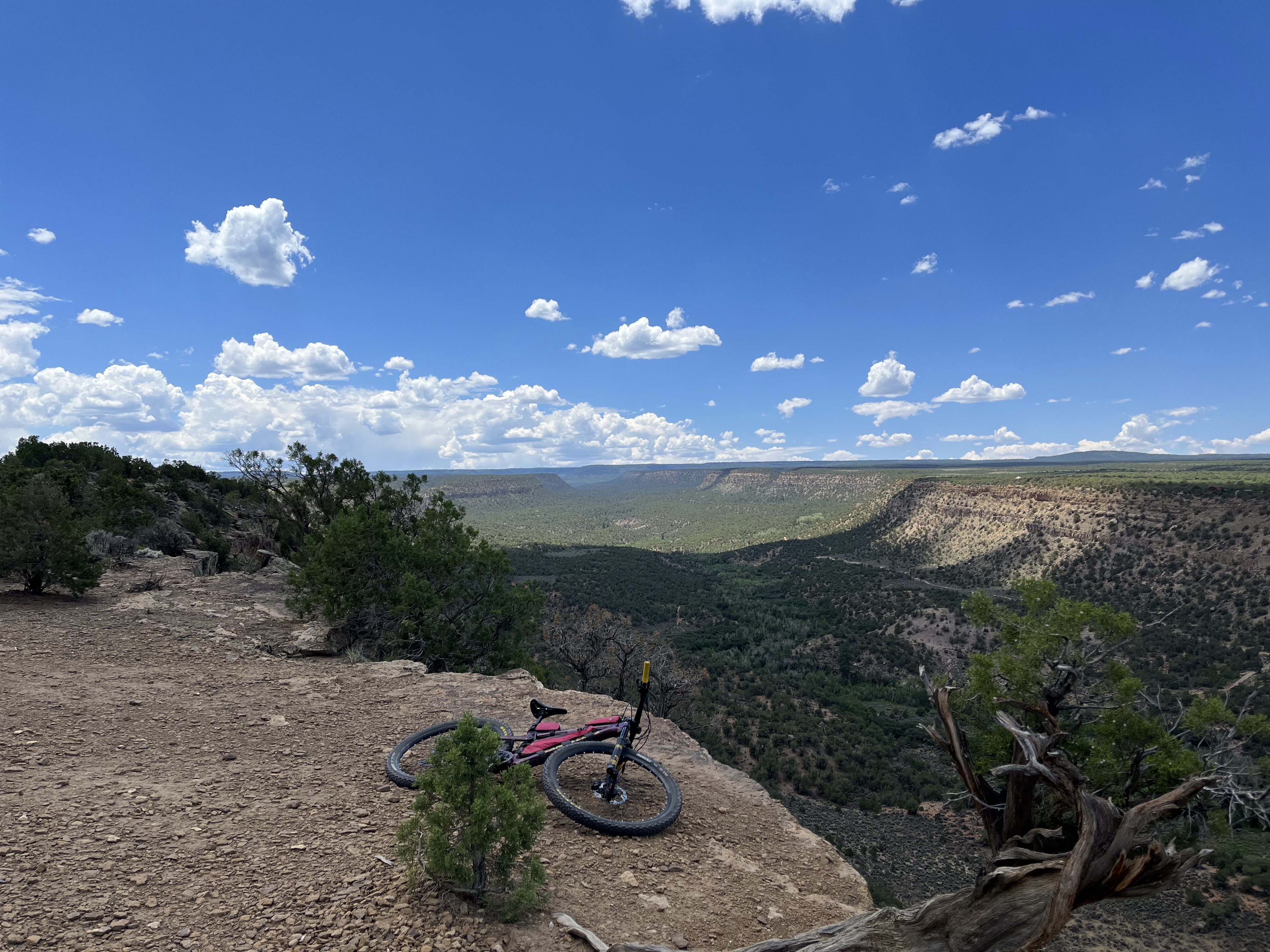
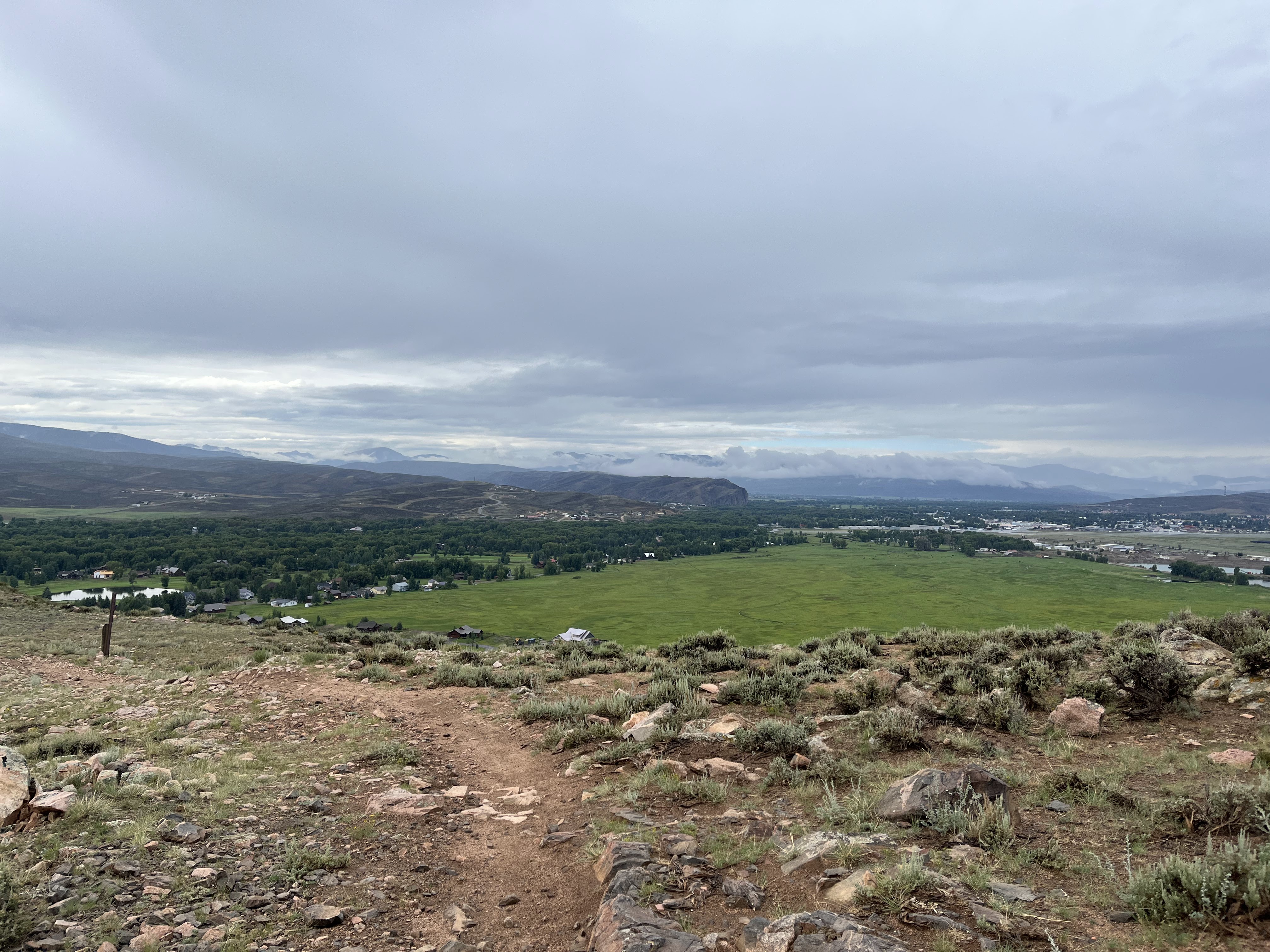
| Took a roundabout way back to where I was parked. Just gotta get down there and a bit to the left. Took the opportunity up on this ledge to turn the phone back on and check for messages. Had one from my brother who let me know he was working close by and would be off in an hour or so. Sweet. Took me about that long to get back to the truck and get cleaned up. |
We ended up driving into Gunnison for some pizza to wait out the traffic heading back to Montrose. Got some crazy rain while we were there and also when we got on the road.
And that wraps up my CO US50 tour. Had more quality time with my brother over the weekend and then made the trek home on Monday. It was so good visiting my brother and also getting more tastes of Colorado dirt. I have other objectives first, but maybe a future running of CTR has been planted...


No comments:
Post a Comment