There is something about being outside on my bike that has oddly enough become a defining trait of my life since my first bikepacking trip back in March of 2012. I say oddly enough because prior to that, cardio was not in my vocabulary. I was more a fat kid who dabbled with weightlifting but had lost some weight.
At one point in the mid 2000's I was over 250 pounds and ruining my health. I had become a father and knew that life wasn't just about me, and I had to take care of my kids for a long time to come. So gradually I got a lot of the weight off, and I had some friends who were into mountain biking... they were way stronger than me but we had a good time riding bikes.
It was addicting seeing the improvement. When we rode more, we started to run into people on the trail. Phoenix Sonoran Preserve was the new trail system on the block and we were running into people who were doing full loops of the south side - the north wasn't even on the map. We half way didn't believe them when they told us these distances of 15 miles lol. That seemed impossible. Or that they did the climbs in their middle chain ring (remember when most of us had 3x up front???). Again, impossible.
But those things became possible, and then we discovered some forums, and then blogs... these crazy people were doing 30 - 50 mile rides. WHAT?!?! These guys were legends to us, we talked about them when we were having post ride beers after riding 10+ miles. Whatever, those guys are cyborgs. Haha.
Life continued to go on, and we did more stuff. There is a lot of my riding history here on this blog, so I don't want to revisit too much of it here. So I digress.
Truth be told, the 750 (now 800) route has been on my mind since I completed the AZTR 300 in 2017. It's a fairly large time commitment for one thing - and fitness has to be huge too. Having completed the 300, attempting the northern 500 miles of the route was a compromise for me. After a pretty traumatic time in my life over the last couple of years including a divorce, cancer diagnosis and the death of my dad all in the span of six months, I decided that I was going to NOT wait to "get out there" on the route because if I have learned anything - life isn't guaranteed and there's much sweet AZT north of Picketpost that I want to ride and hike the hell out of and suffer IN.
And trust me, all three of those things happened.
It's a pretty audacious thought, really - to travel under your own power for 500 miles through some of the most rugged territory in the southwest. Carrying all of your supplies from the start and only replenishing by visiting commercial establishments that the route passes through or next to. Not to mention knowing water sources on the route. There aren't water spigots just in the middle of the desert. But there are springs and streams in a surprising amount of locations. Know of them or potentially get yourself in a life threatening situation.
No assistance. Do it yourself.
Picketpost to Utah.
Pre-start.
Right while I was doing my final checks of gear and my packing list, my fifteen year old sends me a text...
 |
| This is "tuffy". I've taken him on business trips - daughters will have you doing silly things sometimes... |
Anyway, I was able to secure tuffy in a side pocket of my Osprey Stratos pack. What's a few extra ounces at this point?.
My partner in crime, Marcus, who I had ridden tightly with in 2017 when he also finished the 300, picked me up from my house - he came from Chandler to get me in the NW valley, then drove me all the way to Picketpost. That's not an easy ask and a lot of driving. But he did it without hesitation. Thanks, Marcus! I owe you one.
We got to Picketpost around 11PM, and I was scheduled to start at 3AM. I was really hoping to get some good miles in during what I had hoped to be cool temperatures. My goal for the day was to get to the top of 4 peaks near El Oso Rd. It was going to mean an 18 hour day at least, but it would set me up well for the rest of the ride...
 |
| Ready to ride, note the sparkly new Arizona Trail Association shirt. |
I wanted to crash out for a few hours, but didn't want to pull out my sleep kit just to have to pack it away in a few hours. I just wanted to wake up and start riding. So I did what most bikepackers have done... you crash out in the pit toilet building. Luckily, most of these facilities are so remote that they are usually in good shape and clean. Picketpost is no exception. There is a host who takes care of the area and they do a fantastic job. No smell, clean floors. Good enough for me.
 |
| Just enough room to wedge my bike in and lay down. |
Day 1
Important term: HAB = Hike a Bike. This is when you push your bike because you are either too weak, too tired or the terrain just otherwise dictates you do it. Everyone does it to some extent. I did it a lot.
 |
| Alarm went of at 2:45am. Here I am bright eyed and bushy tailed haha! |
I pulled all my stuff out of the bathroom, powered up the SPOT tracker and my eTrex. It's taking forever to load. What the heck. Finally it comes up. I clumsily went over to the AZT sign at the trailhead, took a terrible selfie, and off I went
 |
| 3AM Picketpost selfie. |
I started to head out and promptly missed the turn onto the AZT. Oh boy.
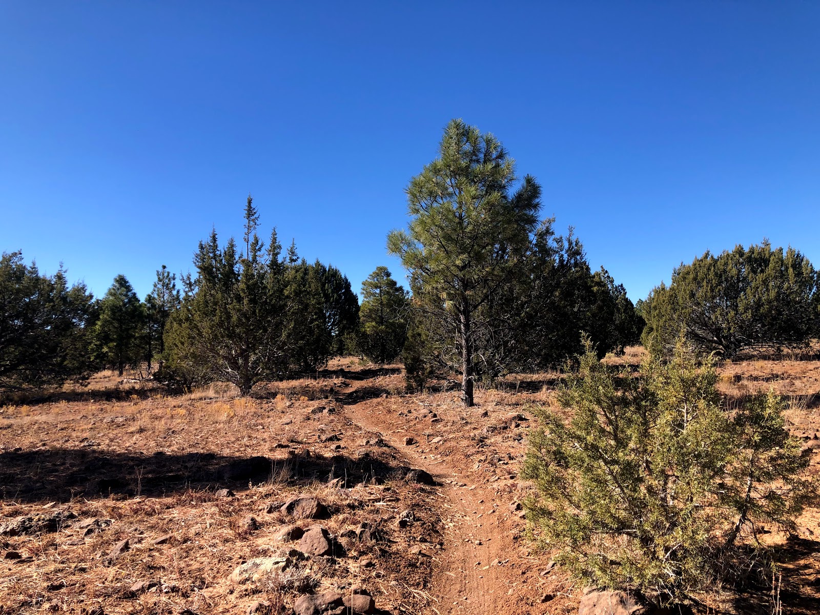
It was definitely an adjustment riding fully loaded, but it didn't feel terrible. I adjusted to it fairly quickly. I did notice something right away that gave me a bit of concern. There wasn't any chill in the air. Like zero. I knew it was supposed to be warm this day and the next. Nothing I can do about it now, but what I had hoped to be a cool push to Gold Canyon for resupply was not going to happen.
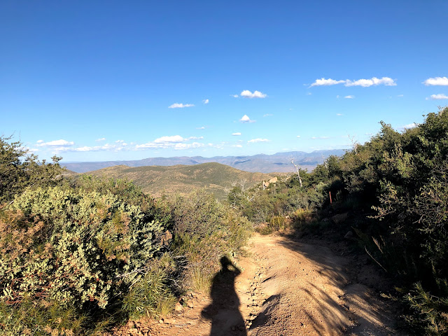
That said, it really was a beautiful morning to be on the mountain bike.
 |
| Word! |
 |
| First glimpses of light on what is going to be a warm day... |
 |
| Jeep roads |
 |
| The Superstitions rise up majestically. |
 |
| Orange brilliance |
 |
| More jeep roads, but good tread and easy riding. Oh, and the views! |
 |
| I took this knowing it was going to be hot later. I ended up feeling like this later on today. |
 |
| First touches of sunlight on the supes... |
 |
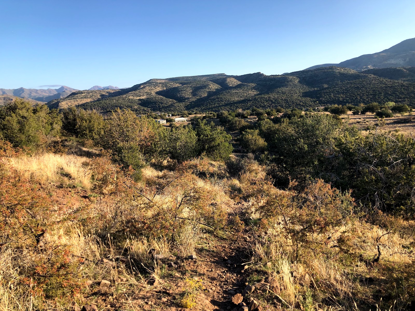
| Cool stuff in Gold Canyon. Would love to check this area out more! |
 |
| Stunning. |
 |
| Begin easy pavement spin to resupply in Gold Canyon. |
It was a bit after 9am when I pulled up to the subway off of superstition mountain drive. I didn't need food, just needed to top off the drinks. It was already getting warm now. I was feeling good though, and had gotten here within 15 minutes of my estimate. Totally acceptable. I should have stayed longer and hydrated more. I had already been riding six hours but I really wanted to get to the marina at Saguaro lake. I still had a lot of riding to do to make my goal for the day. Not fully hydrating back up here was a major tactical error that almost forced me to quit later this day.
After a bit of meh dirt and a touch of pavement riding, I approached Jacob's Crosscut Trail. I was curious about how this was going to ride, it has a mixed reputation but appears to be getting better all the time.
 |
| How was this going to ride? |
 |
| Answer: Pretty great, at least while it worked its way up the flanks of the mountain heading N/NE |
The trail was riding pretty well even though it was fairly rocky. It reminded me of terrain near some of my "home" trails, so all was good.
 |
| Oh, views! |
 |
| The bulldog canyon section there in the distance. |
Jacob's crosscut was good until it turned to the west and started to parallel the contours of the mountain. There has to have been some fairly significant water events in here because the trail was just decimated in four or five spots. Water is a powerful thing, and there was lots of evidence of water going right over the trail and blowing it out.
 |
| Exiting Lost Dutchman area and crossing over apache trail road. This is where the new route departs from the old 750 route. Does it look hot? It was hot. |
 |
| Abandoned structure here. Two owls were sitting up in the rafters when I arrived. One took off, the other is still in there if you zoom in. |
 |
| One last look at the Lost Dutchman area. |
It was starting to get pretty hot, but there wasn't a lot of relief from the sun. It was around noon I think and I turned on my backup navigation device because it can read temps. It said 92. Not good.
 |
| Begin hike a bike (HAB) up anything requiring a decent effort. |
I knew from my time through here last fall that there were some punchy jeep road climbs but that I remembered it being mostly rideable and good trail surface. Some little HAB bits, but nothing big.
My memory was either way off, or the landscape here had changed a lot. I was suffering big time in here, going shade spot to shade spot. I checked the temp on my wahoo and it said 98 while I was sitting in the shade.
 |
| Shade spot to shade spot. Beautiful views didn't cool me off one bit. |
 |
| I was baking and needed to get the hell out of here. Still OK on fluids but that only gets you so far. Water and shade is coming up, either at the marina or the lake itself. Keep moving. |
 |
| Oh, but the sand. Demoralizing |
 |
| So much sand. So hot. Ready to pull the plug, but never quit before sleeping on it, right? |
I mercifully got spit out onto the pavement of the bush highway. I desperately needed shade and cold drinks. This was the longest 4-ish miles of the day. At one point, there is a final little climb with a yellow "right curve" in the road ahead sign. I knew the marina and restaurant were right beyond that sign. I couldn't keep pedaling. I spied a shady spot on the other side of the road. I pushed my bike across and sat in the shade and sucked the remaining water out of my hydration bladder dry. Just had to get to the marina...
I managed to pull myself together - I was on the verge of calling someone to get me. I knew if I could just get some cold drinks and a good meal in me it would be a good start to recovery.
 |
| Made it! |
I got seated outside, it was plenty nice in the shade here. I asked for cokes and lots of waters. I looked at the menu and it had two sides, a lunch side and dinner side. The dinner side was mostly salads, seafood and some sides plus a "fish fry" special. The lunch side was burgers and sandwiches and such. I had it flipped over to the lunch side and I had picked out the burger I was going to have. The waitress came over to take my order and she flipped the menu back over to the dinner side stating they were only serving items off of the dinner side. So I clarified that I couldn't get burgers or anything like that. She was like, "that's right, I'm so sorry". That seemed odd, but whatever it is what it is. I ordered a cobb salad which was OK but not really what I was hoping for after almost 14 hours on the bike.
She brought out my food and asked if I needed anything else and I just politely asked to keep the drinks topped off. I said, it might be easier if you could just bring out a pitcher of water. She said she would do that but there was a limit of one pitcher of water for a table. Um OK???
I kinda picked at the salad and sucked down water and cokes. I shot out some messages to family/friends and let
John Schilling know that I was just trying to save my ride at this point, so don't worry if my spot stops moving earlier than expected.
Note: I was wearing a SPOT tracker which allowed family and friends to keep tabs on my location at all times. It has an SOS feature as well. The great thing is it doesn't really on cell signal and is a very passive device. Just turn it on and start tracking. That said, it can be concerning to some if your "dot" stops moving. Especially early in the day. If I was stopping before 8PM, I would try my best to let loved ones know that it was planned.
While this was going on, a family who had sat next to me was curiously discussing between them about the weird menu setup (they wanted burgers/sandwiches also). Right around then, the waitress came out and apologized to them, and stated she had only been working there for five days. She didn't know that the lunch and dinner menu were available at the time. So they proceeded to order burgers and here I was with a half eaten cobb salad and now I feel like the universe has conspired against me today. Wow.
I finally started to come back to life a bit. I used the rest of the pitcher to start to fill up my hydration bladder and bottles, but it wasn't enough. I had paid my tab (and tipped well despite the burger thing which she never apologized to me for lol). I got her attention and asked if I could have another pitcher of water so I could finish topping off my capacity. She doubled down on her "one pitcher per table" statement and I insisted that I could pay for it.. She said no you don't have to pay and brought out another pitcher. Seriously, what on earth? I get that maybe they have some customers who could abuse this and sit on the patio all day overlooking the water. But it was a Wednesday evening, and they weren't busy at all. I just wanted to load up and get out. Why would you give a paying customer a hard time over a pitcher of water, especially after you denied him a burger???
Dinner issues aside, my plan to get up four peaks was up in smoke - I knew I wasn't going to make it up to El Oso, or even close. I actually was thinking of crashing out as soon as possible once I left the marina. Heck I was looking for good looking spots as soon as I left. But starting the spin on the pavement and to butcher jones recreation area I was feeling way better. The heat had relented and I was fully shaded. It's a super fast downhill to the area once you turn off the road, and I flew down. There is no camping at the recreation site, and the hours are sunrise to sunset, though there were plenty of people who were just getting there clearly close to dark.
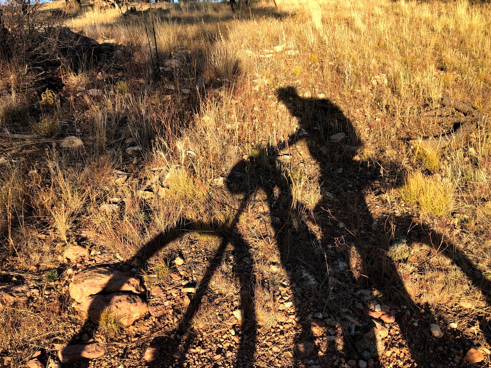
I knew I was going to have fair amount of non rideable sand I had to navigate. I thought this was perfect as I could just be put into "forced recovery" mode while I pushed my bike through the sand. There was also a hideously steep HAB coming up that I figured I could make it to the top of. I was hoping I would have cell service at the top of that. so I could check in with loved ones and let them know I was good and stopping for the night. I pushed for about an hour and fifteen minutes and topped out on the HAB. I had recovered and saved my ride for now. I set up camp at the top and it was absolutely serene.
 |
| Pushing through sand in the shade is "mo betta" when the sun isn't crushing you. |
 |
| Great colors. I was feeling a million times better. Still crushed, but not going to quit. Fight on. |
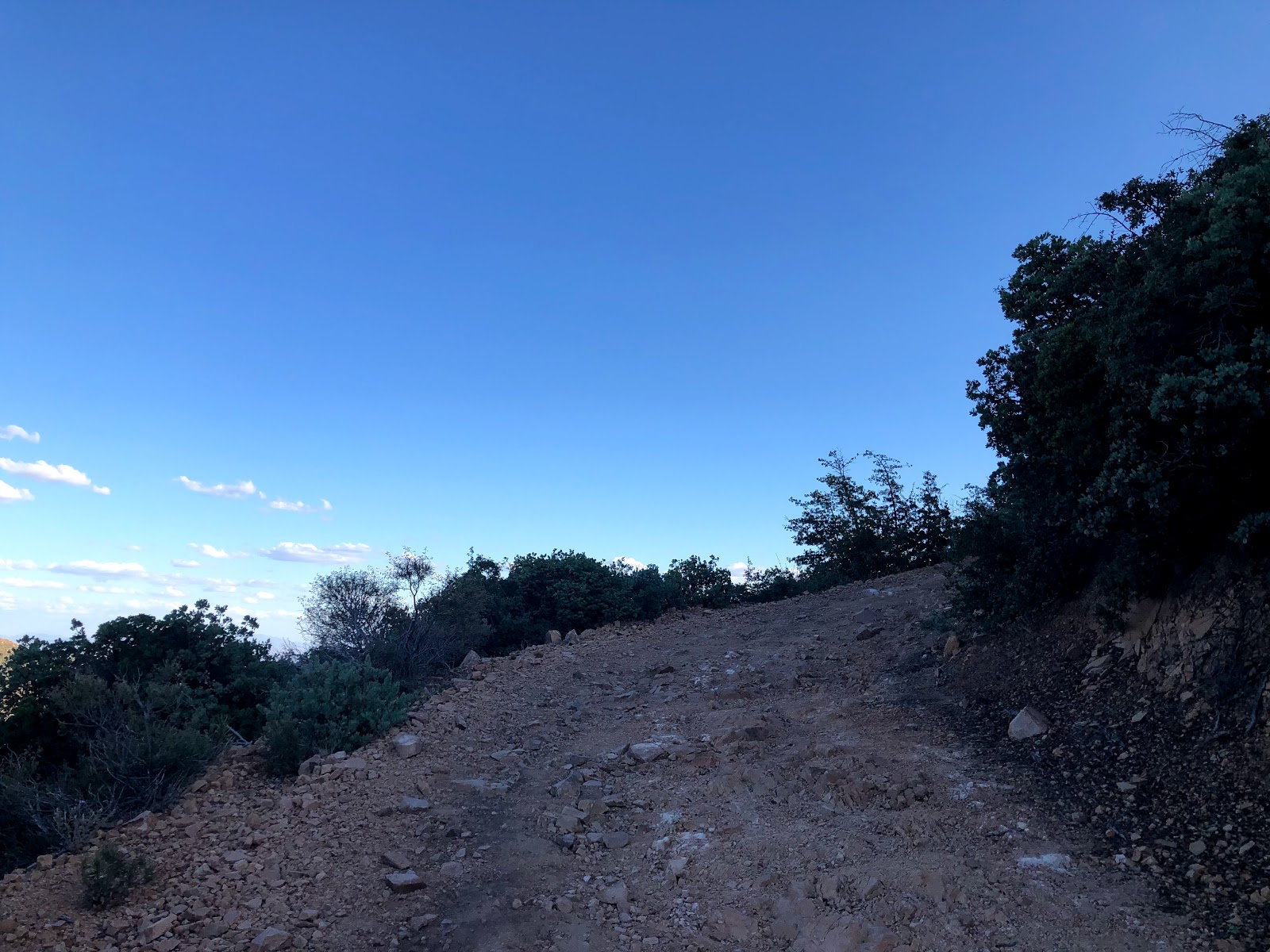
 |
| Last rays illuminating the skies. |
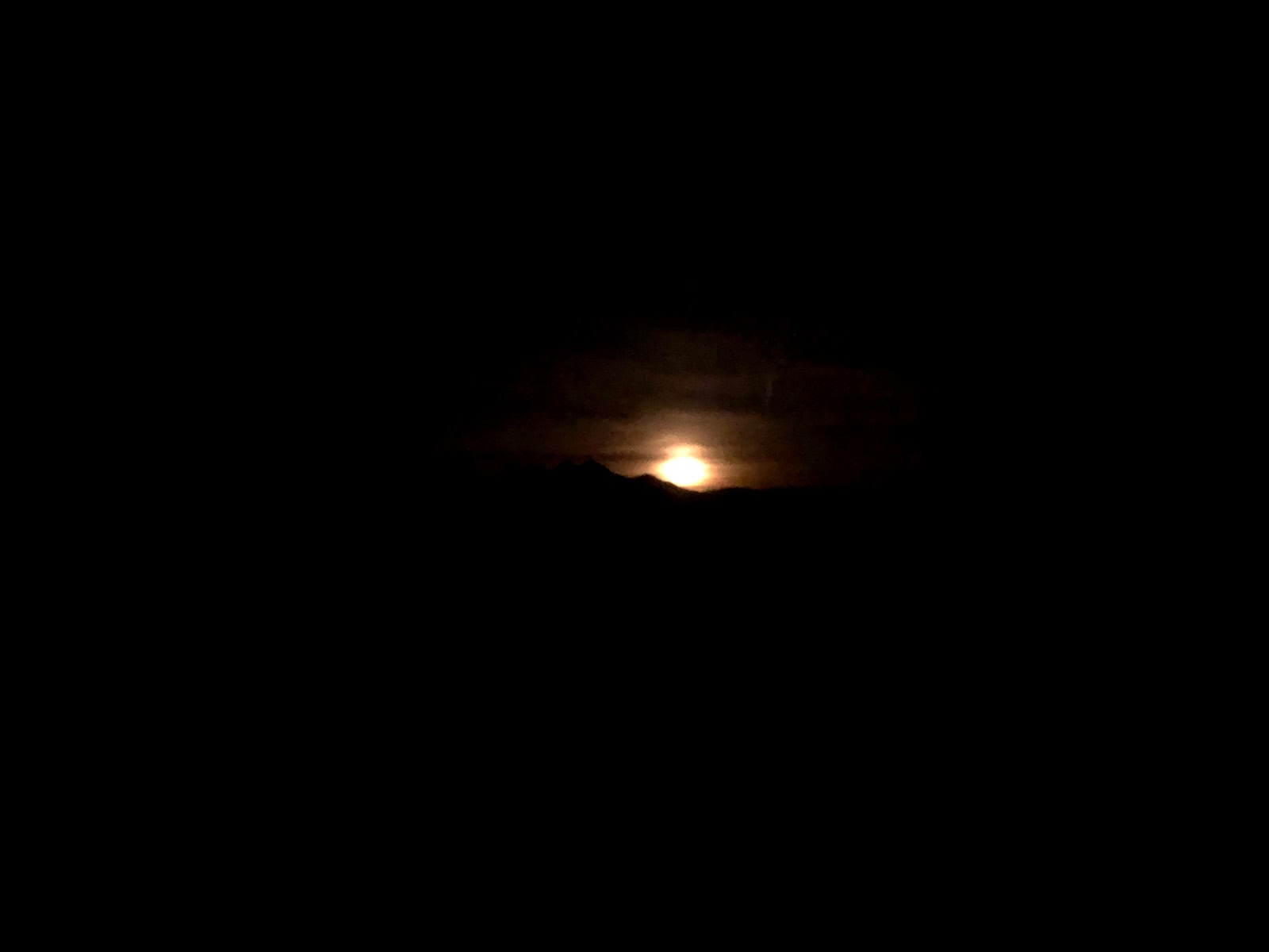
 |
| Just as I got camp set up, this spectacular moon rise occurred. |
 |
| Cowboy camping with a full moon in the background. |
 |
| Hey, there's tuffy! |
 |
| Howling at the moon haha!! |
I fell asleep almost instantly. The only thing that woke me up were a couple of jeeps that were negotiating the road below around 11PM. I was hoping they weren't heading up my way. They weren't.
Oh and the wind. Around midnight the wind started gusting in a major way all the way until dawn. I had a couple items start to blow away so I had to collect those and secure them. When the big gusts would wake me up, I would drink more water still knowing I was still likely behind on hydration. You can't fix that in a few hours...
Day 2
 |
| Sunrise over the superstitions. Weaver's needle almost dead center. |
 |
| Gotta make it up to that shoulder just left of the distinctive four peaks |
 |
| A little more light makes Saguaro Lake below start to be more visible. |
I had really wanted to start earlier, but honestly I was just so wrecked the previous day that the 8+ hours of sleep was needed. And even though I had been trying to get better hydrated, my urine was still darker than I would have liked. Not a great start to the day.
My plan was to make the epic climb up to the top and then drop down El Oso road where there was a spring that I knew had good and plentiful water as I had scouted it just ten days prior. I also knew that the day prior had taken a large toll on me physically and it was going to be a struggle with quite a bit of pushing my bike on the steeper pitches. Gotta move forward!
 |
| Riding along this ridge in the early morning. Beautiful. Oh and it still wasn't cool. It was gonna be warm and exposed again today, but at least I would gain some reprieve as I gained elevation. |
 |
| A bit more sand to negotiate. Not worth the effort to try to ride through. I walked. |
 |
| Cool rock formations start to develop. This one reminded me of a mini "Tom's Thumb" from the McDowell's |
 |
| Starting to gain some elevation and views are expanding. |
 |
| Getting warm. Time for a shade and snack break. |
 |
| I've recently discovered Swedish Fish as riding fuel. |
 |
| I had a little conversation with him before he disappeared into my mouth. |
 |
| Finally feel like I am getting somewhere. |
 |
| Bear scat all over the place You can see the telltale berries that are plentiful in the area. |
 |
| Four peaks wilderness. This begins the final push up to the "summit" |
 |
| Tuffy ain't afraid of no bears! |
I walked quite a bit prior and the next section was no different. I came up with a way to continue forward progress while minimizing stopped time. Take 50 steps, rest for 5 breaths. I would end up using the pattern for much of the rest of my time out on the trail when I was in HAB mode.
 |
| Final look down right before the cattle guard. Huge views!! |
 |
| So happy to be here. El Oso Road just a few minutes away and time for a large hydration effort. |
 |
| Communication tower right on El Oso |
It's a burning fast descent down to Middle Water Spring on El Oso. I figured I'd be hiking it back out since I'd be fully packed down with water.
 |
| Different perspective of four peaks here. |
I arrived at Middle Water knowing I was going to really work on hydration here for an hour or so. I pulled some of my water into an extra container and started my cold soak ramen for a snack. Mixed up some gatorade powder and water and slammed that. Then I began the process of filtering water.
 |
| I prefer my water with hints of Michelin, but this no name brand will have to do. |
 |
| Stuffed animals don't need water thankfully. |
My plan was to stick around until I urinated a couple of times. Did some other body maintenance and soaked my shirt in one of the larger ground puddles. It was noticeably cooler up here so that was good. I was looking forward to making good time down to Sycamore Creek and highway 87 below. I didn't realize how much up and down there would be on the way to the boulder creek turn off. It was in here that I started to realize that I had zero climbing legs. I definitely started hiking more than I would have liked, and this would start a trend that would continue for much of the rest of the ride. I think that I dug such a hole on day 1 that I was just never going to get back to normal, and the effort to get to El Oso didn't help at all.
 |
| HAB on El Oso to get back on route. I was thankful this cloud blocked the sun for a few minutes. |
 |
| This is the little spot I wanted to make it to last night. Plans change. Keep moving. |
 |
| Views of the lake on the eastern side of the four peaks area... Roosevelt Lake. |
 |
| Woah! Legit pine trees out of nowhere. |
 |
| Steeper than it looks. HAB. |
 |
| More walking. |
 |
| Views opening up to the west. Almost time to start heading down to boulder creek |
 |
| But first, let's hike up another hill |
I actually missed the turnoff by 50 feet or so because it wasn't super obvious.
 |
| Yes this is the trail. Those aren't soft plants either. |
 |
| Yes, this is the trail. |
 |
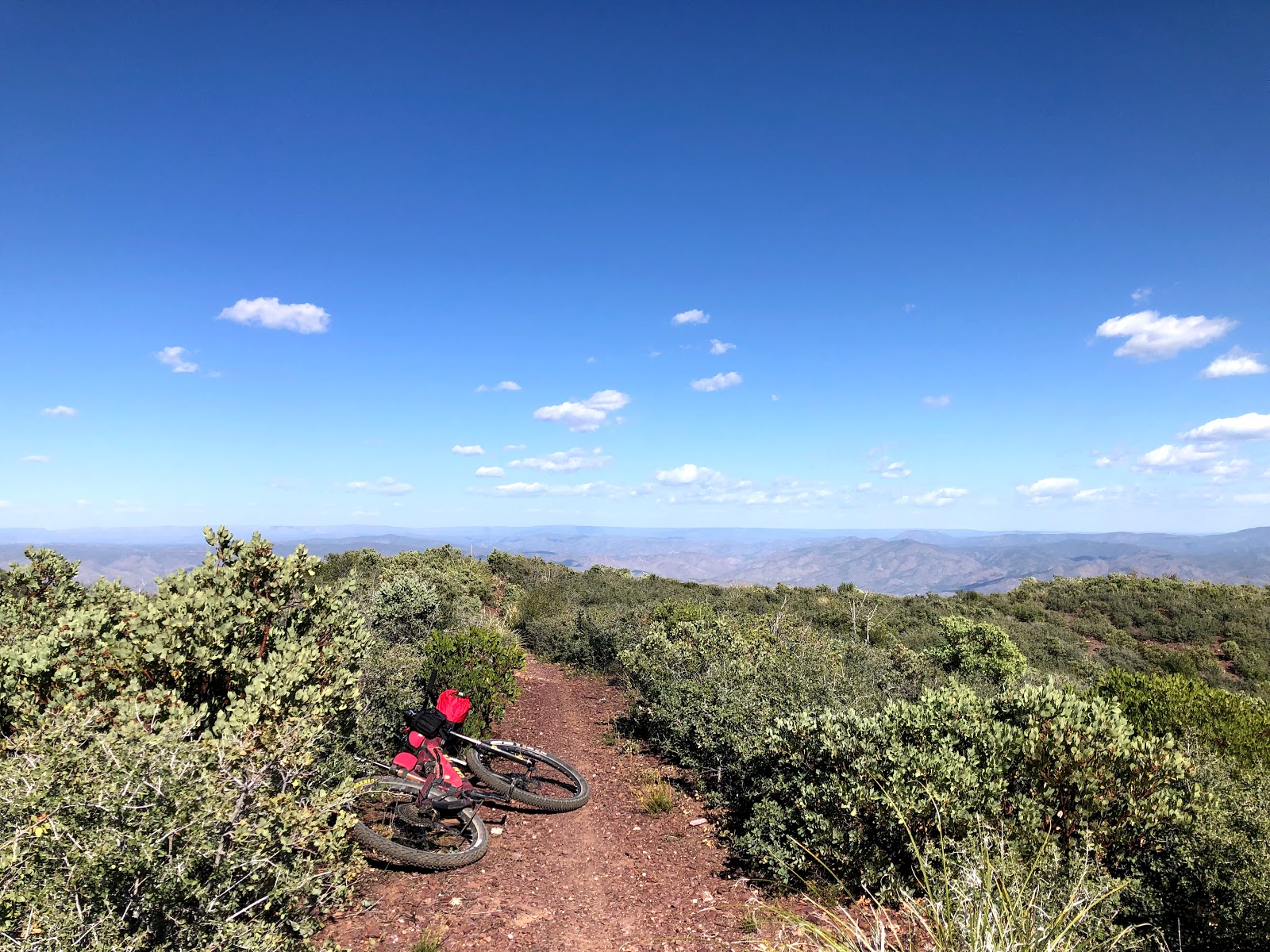
| If you aren't hiking, the views probably suck. Ancient bikepacking proverb... |
 |
| I think this was an ironic thumb's up... Want to get out of the sun, but not looking forward to dusk near a creek in bear country either... |
The passage down and through boulder creek was certainly rugged. I would compare it to if Oracle Ridge on Mt. Lemmon had an angry little cousin. The exposure to falls was less, footing was the same. Encroachment of vegetation was similar, but way more pokey stuff in boulder creek. Manzanita and the like are tough to push through, but generally won't scratch you up too bad. There was plenty of manzanita and catclaw in boulder creek. And tons of bear scat.
It was getting about that time of evening and I got really tired of yelling out "big bear" or "hey bear" so I started yelling out "El Oso". This would stick the rest of the ride as well when I was in likely bear areas. Did you know the four peaks area has the densest population of black bear in the state? Neither did I till I started to research the area. Tons of good eating, including prickly pear cactus and tons of manzanita bushes with plentiful berries (at least this year).
 |
| Pictures never really capture it - not really rideable here. or anywhere for me until I got to the very lower flanks. |
 |
| Plenty of water down here though... but I didn't need it yet. |
 |
| Things start to get more challenging now even with my gpx track, it's really easy to lose the trail and I found myself 30-50 feet off track at times. |
 |
| This is the track. |
 |
| So is this. |
Finally the trail became a bit more rideable but I was tired and clumsy. Eventually I heard the flowing water of sycamore creek and I stopped to filter water. I haven't really had to filter larger quantities of water before this trip, so I didn't realize how annoying and time consuming it was using my sawyer squeeze system. It works great, but it takes a while. Next time I would likely just use the filter on more questionable and non moving water and I would chemically treat flowing water out of streams. Would save time this way.
 |
| A literal sign that things are getting better. |
I continued moving forward, and the moon put on another show:
Right around this time, my heart skipped a beat when I saw some eyes glow at me... as my eyes focused on it with the large amount of light from the moon, I realized it was just a deer. Re-start breathing...
I crossed underneath highway 87 using the culvert there, and it was clear of sand and whatnot. It was also less noisy than I imagined even when cars passed overhead. I was considering just setting up camp in there, but also didn't want to be in a place where larger animals like deer might be wanting to cross. I don't know, but I was imaging some huge deer just stepping on me in the night. Weird thoughts.
I knew there was a gate coming up with flat ground next to it. Soon enough I was there, and I set up camp. It was cooler, but still not as cool as I would have hoped for more comfortable sleep temps.
 |
| Another cowboy camp setup right next to an AZT gate. |
Day 3
 |
| Waking up again with the sun. |
I knew today was going to be another hard day. The AZT here I had seen before so this was my first set of AZT miles I was familiar with since I started. Nothing overly steep but it is fairly rocky so more HAB to be had.
 |
| Rubble on the trail surface. Was worse than it looks. |
 |
| Mt. Ord. |
My first crash in quite a while happened on this spot below. It doesn't look like much, but while I was descending I didn't like the look of the drop off of the area without the rocks. Tried to stop but it didn't happen. Bike shot out from under me and I landed on my right side and smacked my right hand and hip hard trying to break the fall.
 |
| Steeper than it looks and slippery - as I was coming down I didn't like the look of it and tried to stop.The bike slid out from under me. |
Everything checked out ok, my hand was hurting a bit but I didn't feel like I had broken anything.
 |
| Too much effort to pedal up the loose surface - HAB |
 |
| HAB |
 |
| I did say the AZT was good in here right?!!? HAB |
 |
| Cool views at least. |
I filtered water at a stream that typically flows, but now was just holding water in pools. I knew I was going to have another hot, exposed afternoon climb.
 |
| Sometimes the trail almost disappears. |
The trail got a bit better and there was a pretty fun section that finally spit me out to some seldom used pavement of the old highway 87. As I pedaled, I thought I was in deep, deep trouble. I had to stop once because I just had nothing going in my legs. I was exhausted and had zero power. OK. Get through to the dirt road turnoff of FR 201 and re-evaluate.
 |
| Why did the tarantula cross the road? |
I got to the turnoff and immediately grabbed some shade. Had a snack and applied sunscreen. Thought again about pulling the plug if the pavement push to get here was any indication. Thought I was screwed as the upcoming grind is no picnic.
I told myself I could do this, even if I had to walk the whole thing. Then the thoughts of resupply at Jake's Corner on hwy 188 started to motivate me and I decided to get my ass moving. That and some people who were just on the other side of the rise who decided to start target shooting.
The first bits of dirt were very rideable and it boosted my confidence a bit. The views didn't hurt either as they kept expanding and I was still pedaling!
 |
| Highway 87 below. Already high above that! |
 |
| Pleasant road surface and easy enough grades for now. |
 |
| Oof. Start the push. 50 steps. 5 breaths. Repeat. Should have been able to ride this. |
 |
| Getting higher rapidly |
 |
| You can see the ribbon of dirt I've been traveling on |
 |
| This is why it hurt so much to get up here. Big time elevation gain. |
Right around this time before the final switchback to the top, two guys in an ATV who had passed me heading up a bit earlier, were heading back down. They stopped and asked if I was good on water and everything. I said yeah I was good. They insisted I take some water so I obliged them. Drank the first bottle right there and then packed another in my feedbag. They took the trash that had collected in there. They handed me a beer for later too haha. We talked for 15-20 minutes. They tried to give me some food but I really didn't need it or want to carry it up or down the rest of the way. Really good dudes (father and son). Thanks guys!
 |
| Final bit as the goldridge trail gets closer. Real trees for a bit!! |
 |
| Final look back before losing this view. |
 |
| Tuffy wanted to check out the cool red rock! |
 |
| So glad the rock wasn't pretty enough that "Sam" had to deface it. What a joke. This wasn't here the last time I was. There was trash littering the ground too. Wow. One of the most beautiful places and people treat it like their personal dumpster. |
 |
| GOLDRIDGE!! |
 |
| Really fun through the first 2-3 miles. Though trickier than I remember due to grass hiding the trail at times. |
After the first bit, the trail drops off the face of the earth with a vengeance. Pure, demoralizing, downhill and uphill HAB until the very lowest flanks. I can't imagine people being able to ride this - penalty for failure is very high. If you stuff a wheel, you are going down for a long time.
At one point, as I was pushing, I heard something and I was like "who the hell has a drone out here???" Then it clicked. Not a drone. Bee swarm. If I had disturbed them and I was a target, I was in big time trouble. I stayed calm for a second and noticed they were swarming and heading uphill to my left about 10-20 feet away. I continued to stay still as they passed me and flew up to their next destination.
Wow, that could have been bad.
The trail routing here is quite an interesting choice. There is no contouring, it's just straight high point to high point routing. Push up, push down. Well, try not to fall down. There are times where if you let the bike go it would take a long trip down. This area would be be difficult to travel in even without a bike. It could be so much better. Maybe someday...
 |
| Grades mellow out a bit and you can ride carefully. Watch out for large rocks right on the edge of the singletrack hidden by vegetation. |
 |
| Flat and approaching deer creek trailhead. |
 |
| The upper bits really alter your perspective. This seemed flat but it was very easy to get going really fast on here without pedaling. |
 |
| Hell yes! I survived. Deer creek trailhead at intersection of the 87 and 188 highways. Time for smooth and downhill rocketship ride to Jake's Corner! |
I got to the bar and sat down at the bar and ordered cokes/water and a big bacon burger with double fries. I ended up talking to the bartender about Chris Kuzdas (who completed his journey to Utah, congrats!!) who had been there the Sunday prior. I also talked to a "typical" motorcycle guy with a huge beard but was also into mountain biking. We talked about all the trails we have ridden. Cool dude.
After getting a really good meal, I headed over to the general store and stocked up on supplies. Also still focused on hydration. Still never really fixed the damage from day one. Doing my best to manage. The people watching here is top notch by they way =)
 |
| Sitting. Resting. Little dog in the blue truck was cute af. |
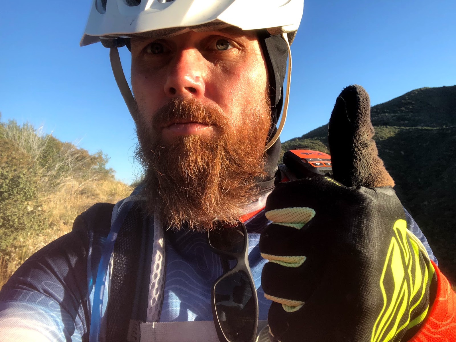
 |
| Best I've looked since the start in my humble opinion. |
 |
| I was waiting for this guy to injure himself the way he was using that grinder to cut into the electric port on the pole. |
The next couple hours were probably the best I felt the entire ride. Temps were good, roads were good and the scenery was pretty.
 |
| I can ride!!! |
 |
| Bridge over Rye Creek. Plenty of water in there. |
 |
| Cows with a side of sunset. |
Eventually, I got spit out onto the real highway 87 which was a kick in the nuts. Very odd feeling to be on this road after virtual isolation for a few days. The shoulder is the size of a full lane, but it still never feels good for vehicles to be passing at 65MPH.
I actually missed the crossing by a hundred yards or so because the track on my eTrex and the color code of the highway on the map were basically the same color. And since it was dark I didn't see the opening in the division where I was supposed to cross.
I got across and I heard a dog running toward me barking but luckily there was a fence there. I couldn't tell because it was dark. Eventually the overwhelming noises of the dog and highway faded as I began the climb to Payson. Lots of this continued to be rideable, but I started to hike after the sun went down. I knew I wanted to get as close as possible to Payson, without ending up in a scenario where I needed to backtrack to comfortably camp. I didn't really research this. But it ended up being OK.
 |
| Night time and steep = HAB |
The trail was getting fairly rocky, and I was getting closer to Payson. I started to look for a suitable place to pull off, but there wasn't much, so I just had to keep going. Since this was a Friday night, I didn't feel comfortable laying down close to the 4x4 road because I wasn't sure what this area was like on a Saturday morning.
Eventually, it opened up and I was able to find a spot that looks like it gets used for target shooting but it was good enough for me and off the road. And I had LTE service. Nice.
 |
| Cowboy camp once again. |
Day 4
 |
| Not the most beautiful of wake up views, but it was secluded |
 |
| Again, not the most beautiful of wake up views, but it is what it is. Was finally cooler last night! |
 |
| Tuffy's last escape before he was put on permanent lock down. |
It was a quick spin out to the 87 again for some quick miles, then back on to some easy dirt. If I would have known, I would have pushed to here last night. For two reasons.
The first being, it was much prettier. The second being there was a legit queen size air mattress fully inflated under a tree with nothing else around. Really? What the heck? I was so blown away I didn't take a picture. I don't know what the story is with that, but I'd love to know.
 |
| Just on the outskirts of civilization. |
And just like that, I get spit into a Sonic parking lot. I was gathering my bearings when I see another bikepacker heading toward me. That must be Colin Schindler whom was heading southbound on the route. He turned east and was heading away - I called out but he didn't hear me. Finally he turned around and I waited for him. Cool dude. We talked for a bit and then I pointed him to where the trail began.
 |
| Colin pedaling away. |
 |
| I let out a big YAHOO!!! when I saw this sign. It felt like a major victory after my first couple of days. |
 |
| Definitely happier than this pic demonstrates. |
I was making a beeline to Alfonso's for burritos. A breakfast burrito for now, and a bean and cheese burrito for portable fuel.
 |
| So, so good. |
I finished up at Alfonso's and headed over to the Circle K to replenish drinks and snacks. Then began the push towards Pine. I knew this was going to be tough, but I didn't realize how tough. It starts actually really great - fast roads and plenty of pedaling.
 |
| Oh, I can do this! |
 |
| Can ride under this one! |
 |
| Fall colors! |
 |
| Crossing the East Verde River. |
I think the entire section to the river crossing was maybe my favorite of the entire ride. Easy riding, fall colors and just beautiful terrain. Then the climbing started in earnest.
 |
| Wear your sunscreen kids!!! Melanoma kills. |
 |
| Still riding a lot, but tying not to burn a ton of matches. |
 |
| Gaining elevation quickly again. |
 |
| This sign has seen better days. |
 |
| Steep. |
 |
| But steep gets you views. |
 |
| Topped out for a bit, time for more riding on easier terrain. |
 |
| Another sunscreen break and a snack break |
It was getting warm, and I'd like to tell you about something amazing. It's called the "no pants" break. I hadn't seen anyone for hours; felt like I was in the middle of nowhere. There was a nice little breeze here in the shade. Pulled my bibs down and just enjoyed the breeze while eating nacho cheese doritos haha! Absolutely magical, just don't try it in a public area or by a school =)
As I was leaving, I turned around the corner and saw this:
 |
| Sometimes, people are just like the things they leave behind. |
This little bit of dirt remaining spit me out onto a quick jaunt on some pavement and then down FAST into a private gated community that has generously allowed its use by through bikers, who are really the only people who would need to use it. It had an odd vibe to it to be honest. There were deer at the bottom standing in people's yards. It felt like I was being watched - like once the residents knew of my presence they retreated into their homes and were waiting for me to leave. I'm sure I'm totally wrong, but that's what it felt like at the time.
 |
| Interesting - no trespassing signs but also a trail register. I entered my name and added a thank you for use of this area. |
 |
| Added a message of thanks |
 |
| Can you spot the deer? It's right there and blends in effortlessly. |
The exit out of here was tough. Real tough. Vegetation encroaching on the trail and very rocky. I didn't ride much. Story of my trip!
 |
| Good water here. Didn't filter a lot. Just a couple bottles worth. |
 |
| Back onto AZT for good! (Well that would depend on detour status) |
 |
| If I knew the vicious switchbacks that were coming up, I would have looked different. |
 |
| Some of the most amazing colors I have seen. |
 |
| Right before a demoralizing push |
 |
| Finally escaped and the trail was fast and flowy to the pine trailhead. |
 |
| Oh yeah! Super gate! |
 |
| THAT BREWERY. |
 |
| Mogollon monster burger with all the fixin's and double fries. |
If you are in Pine, please support this establishment. They support the AZT, and cater to AZT users. They are the best. I did turn in my 2 for 1 coupon for Arizona Trail Ale. Awesome people.
I was good on supplies, got my water topped off. Time to get across the road and begin to tackle highline. Just one problem. I was freaking beat. I knew I had such a big effort in front of me. But I was just DONE. I started the climb up from the parking lot, and basically resigned to the fact that I would get up a touch away from the trailhead but once I found a good looking spot I was going to crash out. I felt defeated as I really planned to make it so much further today. I think the first couple of days were catching up to me. I never really felt good after day one. I was always chasing just feeling "OK". All in all, the amount of hiking I was doing had slowed me to a crawl and for the first time the thought of not making it to stateline crept into my head. I pushed that thought out of my mind for now. That's a dangerous path to go down.
 |
| Highline on tap... |
 |
| Beautiful evening, but I was smoked. |
 |
| I gotta crash. |
I fell asleep so fast. Another night under the stars. I was woken up a few times by something that sounded large creeping around. I yelled out "El Oso" and listened... just my heart pounding in my ears. Next thing I knew it was light out. Gotta go!
Day 5
 |
| Absolutely toast. Felt like a lazy turd for it being so light out. |
Woke up hoping to be energized, but again still just felt "meh". I had to get moving, this was going to be an epic push to the rim.
 |
| Some of this was really nice and rideable much to my surprise. |
 |
| Progress. Slow, but progress |
 |
| More good stuff. |
 |
| Really wanted to get to Geronimo last night. Was never going to happen. |
 |
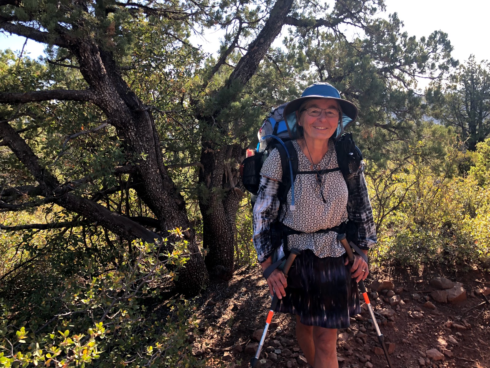
| This was the third thru hiker I ran into on the trip. I had run into a pair right before boulder creek. |
Claire (above) and I talked for about 20 minutes. She was from Montreal and had heard that her 99 year old mother had some health stuff pop up a couple days ago. Surgery was discussed but she had been out of cell service for a couple of days now. She wasn't sure, but her mom may have passed. I told her she would likely have service shortly once she was over a ridge or two and had line of sight to the south. She was meeting someone in Pine and she would figure out her plans after getting additional information on her mother. Very nice lady. The size of her pack was intimidating. She's tough as nails for sure.
 |
| Every once in a while you catch a glimpse of where you need to get to. |
 |
| More colors! |
 |
| This spot was heaven. So beautiful with the ferns and then a running stream at the bottom. |
 |
| Filtered a bottle or two worth here. Would have been the nicest place on earth other than the person on the road above who did donuts in his vehicle. Twice. What in the actual hell???? |
 |
| Still have to get up there somehow! |
 |
| This must be a portal gate to Sedona! |
 |
| Wait how did I get here? |
 |
| Let's hike a bit |
 |
| Let's push through dense brush. |
 |
| Hard to see trail due to high vegetation. |
 |
| Running stream, but don't need water yet. |
 |
| Snack break. |
 |
| Brutal, long stretch from Pine. |
 |
| Washington Park. Filtered water here and grabbed a snack. I was so ready to be up on the rim. The hardest and steepest part still to come. |
 |
| Highly recommended place to visit. Maybe without a bike even though the lower bits can be ridden. |
 |
| A little humor on the sign. |
 |
| Water everywhere. |
 |
| Riding! |
 |
| Ingenuity and hard work on display. |
 |
| OK it's steep. |
 |
| John mentioned extra credit for taking this detour. That's a strong no from me dog. Get me out of here. |
 |
| If you haven't been here. You have no idea. So. Steep. |
 |
| That's a lot of elevation gain in a short distance. |
 |
| Oh yes!!!! I'm on the rim! Indescribable push to achieve this. |
Unfortunately, the detour information for the prescribed burn near blue ridge was still in play. I had a decision here, I could follow the signed detour or the detour created by John Schilling that would maximize AZT miles. I was here to ride max AZT miles, so the decision wasn't too hard. Also, since I had people watching my spot track superimposed over the route (and the detour route was also shown), I didn't want to stray off of the "official race" detour track - didn't want people to think I was lost or whatever.
I crushed half of my bean burrito from Alfonso's and was able to send out some texts from the edge of the rim. I put on some warmer clothing because it was noticeably cooler up here. Time to get going!
 |
| General springs cabin |
The AZT in here is fantastic, but unfortunately my time on it came to an end at the start of the detour track. Time to basically backtrack toward the rim road.
 |
| It's kinda spooky griding away in the middle of the forest when it's pitch black. |
Temps were hovering between 37-39. Not terrible. There was a breeze which I wanted to get out of. It had been a long day, and at some point today, I made the decision that stateline wasn't going to happen. My energy levels weren't getting better and I was at least two days behind my planned schedule. I had wanted to be in Flagstaff by now. My butt was in bad shape also. I wasn't going to quit here, but Flagstaff was going to be the end of the line. It hurt to admit that I was so much slower than I had planned. My back was also starting to "tell me" weird things too. I get a weird patch of numbness that happens when it's about to go out or give me problems. That had started the day prior. Beyond my shit energy levels, I wasn't sure if my body would hold up to the canyon hike. I certainly did not think trying it would be wise.
Basically, excuses.
Anyway, I figured I would ride gravel roads until I got out of the wind. It turns out that ended up being at Kehl campground. It was completely deserted - there were signs stating it was closing the next day for renovations. I should have crashed out in the bathroom, but didn't for some reason. This ended up being the coldest night so far. My gear which was rated to handle these temps wasn't keeping me warm enough. I wasn't in danger, just wasn't as warm as I would have liked.
Day 6
Since I had mentally checked out on making it to stateline, I was definitely in a more relaxed mood. With that and the cold temps, I wasn't highly motivated to get out of the bag this morning.
 |
| Another night cowboy camping. |
 |
| Turkeys in the campground. |
 |
| It was cold in the morning. Nothing froze though. |
 |
| Easy morning grind. |
 |
| Fantastic views off the rim. |
 |
| Happy to be in the sun. It was chilly. |
 |
| Hard to see here, but I had been breathing smoke from the prescribed fire east of here. |
Going back to the night before, I was really looking forward to a meal at the diner in Clint's Well. I knew the hours (or so I thought), but it is actually closed on Monday and Tuesday. They also recently had their cook pass away so they are looking to replace. Hopefully they can make things work out.
 |
| CLOSED! Dreams crushed. |
 |
| Refuel the best I can here. Not a bad selection really, and nice people. |
 |
| The Philly Cheesesteak wasn't the diner breakfast I wanted, but it was warm. |
I was feeling fat and happy, time to knock out the rest of the detour and get back to AZT.
 |
| Right after leaving, there is a brief climb... it was sunny and I decided to strip off layers and put on sunscreen. |
 |
| Gates, gates, gates. So many in the open lands of AZ |
The detour was good, no real issues. The track wasn't always as precise as expected on the rest of the route, but nothing that was hard to figure out. Sometimes the road was actually 100-200 feet off the track but it always merged again. No fence issues or anything. At some point, the detour signage indicated I could go east to rejoin the AZT, but remember, max AZT miles were the goal. So I continued on south to get back to the 87 so I could start the happy jack segment from the beginning. I then got a good view of the smoke plume from the prescribed burn that caused my detour.
 |
| Pretty large operation going on. I'm glad I wasn't in there. |
 |
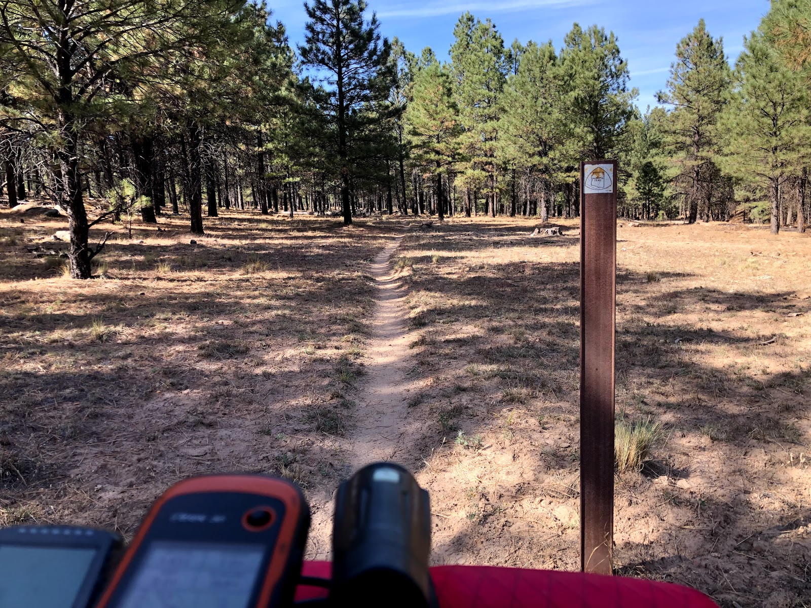
| AZT! Let's go! |
I've never had the "pleasure" of riding the old route through here, but let me say the new stuff is sooo good. It's still rocky but man if I had any kind of legs it would have been amazing. Unfortunately, I did end up walking some very mild grades at times - so frustrating. I ate the rest of my burrito at some point in here too.
 |
| New Happy Jack singletrack. Go get some!!! |
 |
| Almost went down the old trail alignment. I can tell you the new stuff is much better! |
 |
| The thoughtfulness that goes into the routing isn't unnoticed by me. Right through this beautiful stand of trees. |
 |
| Water hasn't been the best since acquiring the rim. Didn't need any though. |
 |
| Night started to fall and I really started to suffer. |
My front brake started making some hideous noise at some point - I was so fried I didn't even bother to look at it. I found that if I stopped and rotated my front wheel backwards and hit the brake, it would stop for a while. Just wanted to keep moving. It was getting chilly again and my ass was killing me! Was walking quite a bit. Towards the end of the new segment, the track ceased to exist on the ground. Meaning the gpx track I was following had no corresponding trail on the actual ground. Uhhhh what the hell? Looked around for 5-10 minutes in the dark with all of my available light. Then I remembered I had seen a small discussion point in a facebook message from Chris and John. Turns out, that segment is getting worked on soon. I ended up validating my route with the guthooks app (
highly recommended resource) and met up with Schuff tank and then continued on.
I was ready to be done and was approaching Lake Mary Rd which is where I really wanted to get to. But I was ready to pull over if a nice spot presented itself. Until I saw a sign on one of the final road crossings prior to Lake Mary Rd. They were going to be starting prescribed burns on the east side of Lake Mary Rd and AZT would potentially be impacted. OK I guess my decision is made for me. Push to Lake Mary Rd.
 |
| Notice of prescribed burn starting the next day. |
Finally made it to Lake Mary Rd and crossed over to the west side of it. Tonight I really wanted to stay warmer so I used my bivy. It's funny, because it's a white bivy which lead to a humorous moment in a few hours. I crashed out so fast, but then was jolted awake when what had to be thru hikers walking by saying LOOK AT THE PILE OF SNOW. Except it wasn't snow it was my white bivy. Then they laughed about it. I remember being so mad because I thought it was time to get up. But it was midnight. So I was annoyed to wake up but happy to have so much sleep time left. It ended up getting super windy tonight. Using the bivy was a really good call.
Day 7
I was in no hurry today. I knew this would be my last day on the bike. I was ready to be done, but was also wanted to savor it. It's like the universe knew that today was they last day for me. I was presented with so many cool moments and encounters.
 |
| Seven nights of sleeping on the ground. This would be my final wake up in the cold. |
 |
| Good AZT right off the bat. |
 |
| Funny how you can only see a location once but instantly remember it more than a year later. I backpacked in this area with Nina in July of 2018. |
 |
| We sat on this log and talked about how stupid we were for trying to backpack so far. I think we were 19 miles in for the day and needed to get to Mormon Lake for food - another 5 miles away. Oof |
The riding was good in here. Still hints of rockiness. My rear was really bothering me, and I started trying to stand and mash (like a real mountain biker lol) which was actually way more effective than I imagined. Things to improve on...
 |
| These cross country ski markers made me smile. |
 |
| Fall colors and rocky trails. |
I happened to notice right when I hit the 300 mile barrier. I've really been trying to reconcile the difference between the 300 miles between Parker Canyon Lake and Picketpost, and Picketpost to here. So many things have changed for me. I'm clearly not the same rider, but I also don't think it would take me this long (six plus days for this vs a touch over four days for the south) to ride the southern 300 again. I believe there are bigger chunks of more rideable sections in the south, and potentially the average gradient of climbs is less in the south. I would love to see some kind of analysis on that. Who knows. I also know that carrying more gear (to handle cold weather) obviously had an impact. Weight is weight.
 |
| 300 on the odometer. |
I was ready for a break and needed water to make it the rest of the way to Flagstaff. I had enough food to make it. I didn't really want to go to the store in mormon lake, but I also knew that Navajo Spring was dry. Luckily there is good water at double springs campground. It was also closed for the season so not a soul around. The bathrooms were boarded up which was a bummer. Would have been a luxury.
Funny how perspectives change...
 |
| A quiet place to filter water and have a snack. |
After a brief little HAB out of the campground, the trail got so sweet all the way to anderson mesa. It slalomed between pine trees and I was really able to just flow through here. So fun.
 |
| Oh, except right after it pointed downhill... lets stop immediately to pick up the bike over this. |
I ran into two bikers who had started at the south rim and were going to head to Sedona and then connect to the BCT and beyond. Cool people, and the first cyclists I had seen since Colin in Payson.
Shortly after that, I ran into Joe from Ohio (I think). We had a great talk for 15-20 minutes. He has hiked almost the entirety of the AZT in different stints. We talked about his big cat encounter in southern Arizona and border patrol tracking him down there too and how all AZT users in the very southern reaches have not escaped their gaze. He was looking to get to Pine and then head back home for work. Super cool dude. I gave him and the other hikers I ran into water source info. I had noticed that there were hardly any caches (unless I didn't see them) other than a gallon at the beginning of the Happy Jack segment.
 |
| Rad dude, good talk. |
 |
| Joe took a pic of me too. He said he wanted to show his friends back home that don't believe that people do this kind of stuff. |
 |
| More twisty stuff through the pines. |
Then Anderson Mesa. I knew it was flat and rocky. How would it ride? Not bad at all. I was able to stand and mash pretty much the whole thing. The wind was non-existent and it hadn't rained recently so no death mud!
 |
| Not bad. |
 |
| First time Humphreys seems within reach. |
 |
| Don't be fooled. There is some sweet singletrack in here too. It's not all terrible rutted out jeep road. |
Ran into a thru hiker I'll call San Diego girl because I didn't ask her name. She looked like a bad ass with a shaved head and tats. We discussed the normal things and I told her it gets prettier in a bit. She noted that this was beautiful in its own way. Hmm. Indeed.
Shortly after, I ran into three thru hikers. They commented on my
Rogue Panda bags. Cool. Two of them were Arizonans and the other was from Sweden. Nice dudes. They wanted to drop down a bit cause temps were going to be chilly up on the mesa with no cover from the wind really.
 |
| Keep grinding away - Lake Mary here. |
 |
| More fabulous singletrack. Starting to drag though. |
 |
| Humphrey's is RIGHT THERE. GOOOOO |
There were some reroutes around Marshal lake that weren't reflected on the track. Couldn't even see the old stuff on the ground. Good work was done in there. I ran into one final thru hiker here - she was like are you on the AZT and I said I was. She was like "Oh, good, my gps says I'm off". I said me too, don't worry you are good. I asked about her journey and she asked about mine. I told her, "I just want to be in Flagstaff". She responded oh you're gonna be there in a second. I knew it wasn't quite that short, but I was ready.
Right after our encounter there was a super steep decent down towards fisher point. That's when I heard a nasty noise coming from my front brake. Metal on metal. oops. Pulled my front wheel off, and put on my spare (used) pads. I'd be able to limp the rest of the way with these. It's mostly flat anyway.
It really was mostly flat and good riding all they way till right before the water retention area under the freeway. In fitting form, I pushed that freaking bike up the hill. The view on the other side was less than beautiful, but pretty in that it represented release from my journey. It was palpable as soon as I reached the top.
 |
| Why not finish with a little push uphill? |
Here's the view you get. I40 and a nasty reclaimed water site.
 |
| I think the Teenage Mutant Ninja Turtles were born here. |
I was so thankful to be done. It was time. Almost seven full days on the trail. I slept on the ground each night.
A great thing happened right at the end. Some "questionable looking" dudes were hanging out underneath the bridge. I passed them, and one of the yelled out if I had seen any gloves out towards fisher point. I wish I could remember his name. His buddy's name was Chris.
Anyway, the guy owns the bicycle below. It was rad. He said he has ridden it all over the country, and to Florida a couple of times. It is well thought out and obviously this guy lives off of his bike. I told him I hadn't seen any gloves. BUT!!! I was like "dude I have these gloves in my bag that I've been wearing at night. They are basically brand new and super warm". I told him if they fit him, they were his.
He looked at me like I was crazy. I wasn't. I was just grateful. I was going to go to a cheap hotel in Flagstaff and stuff myself with an expensive meal. I didn't know what his journey was, but I'm sure it wasn't nearly as comfortable as mine.
 |
| Be safe, adventurer. |
We shook hands, and I headed up into town a bit. I got on my phone, let John know I was quitting here and let loved ones know I was good and safe in Flagstaff.
I went and got what has to be the worst room in Flagstaff. I GUARANTEE you have passed within 20 feet of where my head rested the next two nights in your vehicle. I'm not exaggerating.
It might as well have been the Hilton.
I went out and had a fantastic meal and beers and conversed with another guy who's name is Mike. And he's in IT also. Haha.
I woke up in the morning and looked at my bike. I had zero desire to ride or push it.
So even though I didn't reach my planned destination, I know in my heart that I reached the correct one. I'm one thankful guy.
Thanks for reading. Go get your adventure. Stretch your imagination and your boundaries. You might not end up as far as you think or desire, but you will end up where you are supposed to.