Big ride season in the deserts proper is getting real close, but for big rides more than 3-4 hours it is still more comfortable to get up in elevation a bit. I woke up on a Saturday and I decided to hit up a route I had missed out on earlier this year when
Schilling tossed out the invite. I was bummed I couldn't join at the time, but I saved it in my "future adventures" list.
I've been fortunate to have been able to get out on some proper day rides over the last month which is good because I'm planning on tackling
The Fool's Loop in early November. I'm modifying it slightly to start/end at my house, but no big deal as I'm just exchanging pavement for pavement for the most part.
I recently purchased a new bike just for insurance really, as the market is just crazy for parts/bikes and I have been without a "+1" since, well forever.
I ordered some proper bikepacking bags for it, and decided that I would ride it on the Fool's Loop. Guess I better make sure I can ride a big ride on a hardtail so I brought it on it's first proper ride, having only ridden a quick 10-ish mile loop near my house.
Got to the start quick enough and off we go. Crossed the street to get on dirt, but first... does the "magic gate" work? I waved my hand in front of the sensor every which way - but nothing. I wasn't expecting it to work as it was out of commission last October during my Coco 250 run. I didn't think much about it, I just hoisted my bike over and then crawled under some barbed wire. Weird because after the fact John told me that it worked for them on their ride. Oh well.
Back on the bike, there is some mild up and down but the dirt was in good shape. This part at least, gets regular vehicle traffic from the residents. Just about a mile in, I (just like last year) missed the turn off completely. I climbed up 50 yards or so and realized my mistake. There was a lot of vegetation hiding the less traveled path before it climbs to another gate that must be climbed.
After the second fence hop, the conditions got significantly more rugged. It wasn't smooth before, and all the rain this summer, while much needed, has certainly impacted trails and dirt roads all over the state. This was no exception. All rideable, but certainly slightly sketchy at times surfing babyhead littered descents.
Trail conditions improved on a long mellow downhill that lead to the approach to the big power transfer station.
 |
| Ahh, finally smoothing out a bit and yellow flowers popping everywhere. |
 |
| People are dumb and need instructions |
 |
| Beginning the section that contours around the north side of the Woodchute Wilderness. |
 |
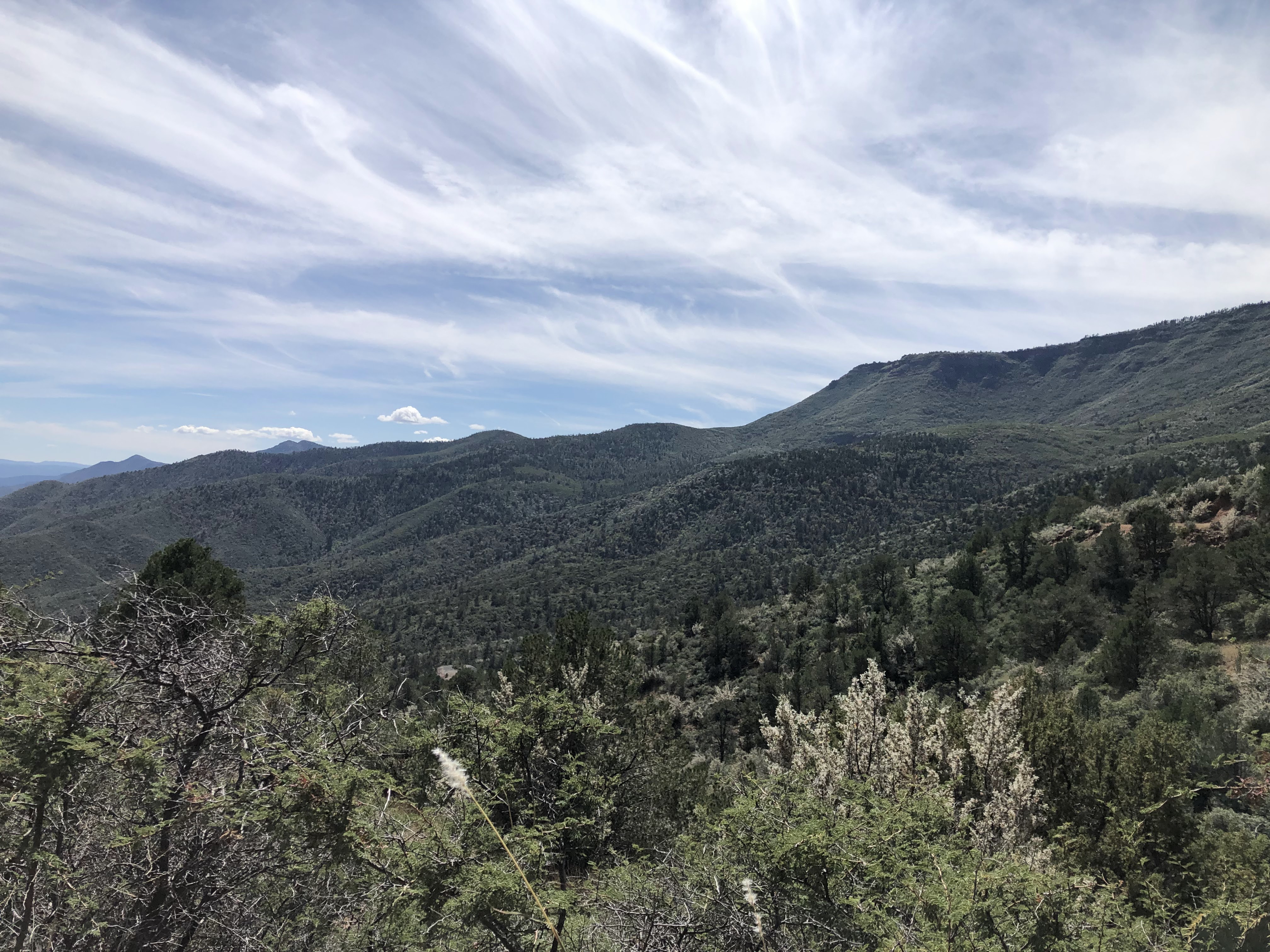
| Gaining elevation |
 |
| And gaining views. Bill Williams mtn on the left and Humphrey's on the right. |
 |
| Reached the much smoother Perkinsville Rd. |
 |
| Fantastic climbing through here and even bigger views. A couple of jeeps passed me; everyone kind. |
 |
| Descent to Jerome |
 |
| Arizona mining history... |
 |
| Let the quirkiness begin |
 |
| Made a quick stop at the Flatiron Cafe. Cool place. Bike friendly. |
 |
| After quickly losing a bit more elevation, you gain it right back getting out of town. |
 |
| Route turns rugged for a punchy climb away from Jerome. |
The climbing grade relented a bit, and I ran into flowing water on the trail. There ended up being quite a bit of puddles and water I had to avoid for the next ten miles or so.
In addition, I was having "on the bike" training on how to ride a hardtail down a couple of super fast and rocky descents. Definitely can't approach it like you can on full squish lol.
 |
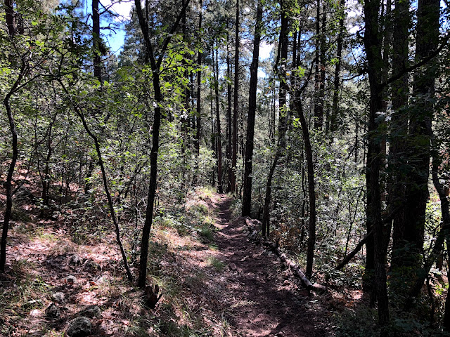
| Dense, lush and green. |
I finally topped out on the jeep roads and turned onto some legit MTB trails, although again pretty rubbly. There was actually a couple of women out doing some trail brushing - I think there is a race coming up of some sorts because there was pink ribbon tied to trees everywhere that I followed all the way to the end.
It was all mostly downhill with the exception of a more embedded rock/boulder section that I walked because I was tired. Then time for a burning descent back to the truck. I remember really liking the descent, and it was still good, although again, it was definitely showing the impacts of the rain.
Good times. I love this loop - it's perfect with a good resupply place basically right in the middle of the ride. Great views, and little traffic.