Thursday, November 24, 2016

Ride Report: Picketpost Punisher AKA Pulverizer

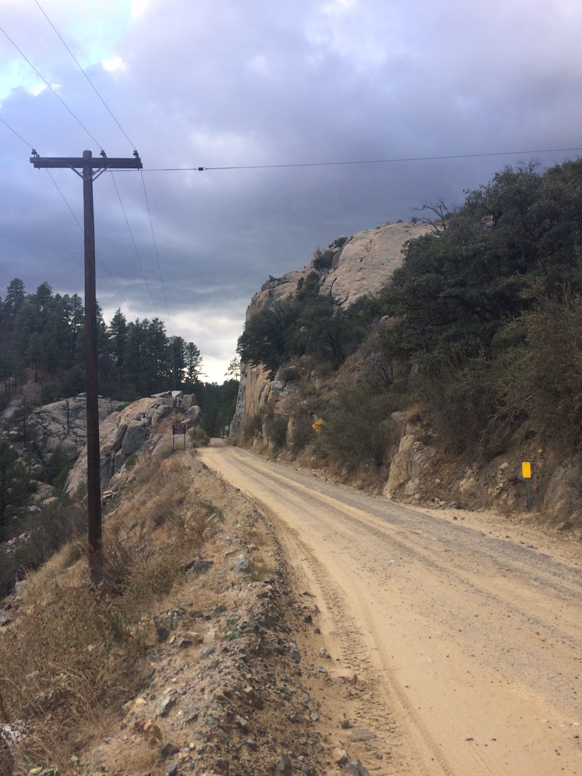
Fleeting sunlight...


I had already prepped my light system and gotten some warmer clothes on in anticipation of the final push to Picketpost. The sun was done painting the terrain gold, and darkness was starting to take a firm grasp on this beautiful autumn night - just a few more minutes until I would need to turn the lights on, but right now I was enjoying a fairly fast bit of downhill. 


Some might call them free miles. I won't. I earned these. Thirteen hours of effort and keen awareness of just how "out there" I really am - I was getting tired physically and mentally. I was well aware that a bad mechanical issue on the bike could quite easily mean I don't get out until dawn. 

I was kicking myself for not having a SPOT tracker. There is very limited cell reception out here, and I likely wouldn't find service until I was basically done. That is two hours from now. A SPOT would allow me to send brief status messages indicating I was fine and it doesn't rely on cell reception. It would also allow the wife to know I was moving or if I had to make a decision to stop either by choice or out of necessity. I shudder to think what I would have put my wife though if I had to stop. I was prepared to spend a night if needed, except for that little detail. Keep moving. No mistakes now!

I was worried about this section, both earlier this morning and right now. I was quite literally "in the lion's den". I read about this place, and others have either seen "something" or had that "something is watching me" feeling here. I saw plenty of cat scat earlier when I was riding up this part. If I had looked closer, I'm sure I could have seen prints as well. I didn't really want to though. No need to confirm what rules this domain. I already know. Just passing through kitty...


If I was "the king" I would live here too...


A flash of graceful, powerful movement bounded over the trail thirty feet in front of me as I turned a corner, still aided by gravity. The form I saw didn't seem to care about gravity at all - it went from my right to left uphill. I didn't look natural the way it moved. I was immediately in awe and terror - fully humbled to both see this creature and thankful at the same time that I DID see it. It's the ones behind you that will get you...

I stopped at the point where it had crossed. I didn't want to just burn by - I had to take a stand, albeit it briefly. Lights turned on high, I looked for glowing eyes on the mountain side. I yelled. Trying to convince myself that I could impose fear on this creature.

Nothing.

I started the descent slowly... yelling frequently. Taking quick glances behind me. 

Nothing.

A few minutes went by of the descent and I had placed a ridge between myself and the point where we intersected. I felt safer somehow now. Keep moving. I saw a sign for Picketpost trailhead. Teasing me into thinking it was so close. It wasn't. I ran into two female hikers after that. I let them know what I had seen a mile or so back and they asked what I had been up to today. I told them the route and they kinda glazed over. I think they must have been AZT through hikers, because there was no other cars at PP when I got there. Cool. As we departed, they said "good luck, you have about ten miles left"...

The soothing sounds of my iPhone alarm pierced the darkness at 3:40AM. I reached to my left and grabbed some chocolate donuts and a bottle of water. Breakfast of champions haha! The inside of my truck was foggy, but I had slept comfortably in the passenger seat of my truck. Not enough sleep though - I had gotten here at 11:30 the night before. I got dressed in the truck and made final prep with the bike and then got started at around 4:15AM. It was cold and this entire route would be completely new to me.

The start of this route had me a bit worried. I was fumbling a bit, the combination of being a bit chilled, in the dark and on new unfamiliar trail. I will need to come back to this place, I know it is beautiful, but both times today when I pass it it is shrouded in darkness.

The miles tick by, a steady climb to get to the high point before I can begin my "descent" down to the Gila. I think of the terrain I am crossing, and get into a rhythm. Feeling good, but slightly vulnerable in the dark here. The sound of cowbells makes me feel better - if they are out here, I should be good to pass through right?

I notice as the exposure increases - still I can't comprehend where I am - I shine my light off the edge and it returns void. Expansive. As the climbing continues, my pace slows a bit. I take in what I see, including lion scat. Keep pedaling. Where is the sun?


There is is! Salvation is coming and my anxiety wanes with the growing light. 

Terrain starting to reveal itself


Lights are extinguished, and I start to realize how special this place is. How much blood, sweat and tears it must have taken to construct this. All for the hardiest of adventurers.

First rays of light tickle the top of the terrain.


Completely immersed in this environment. 


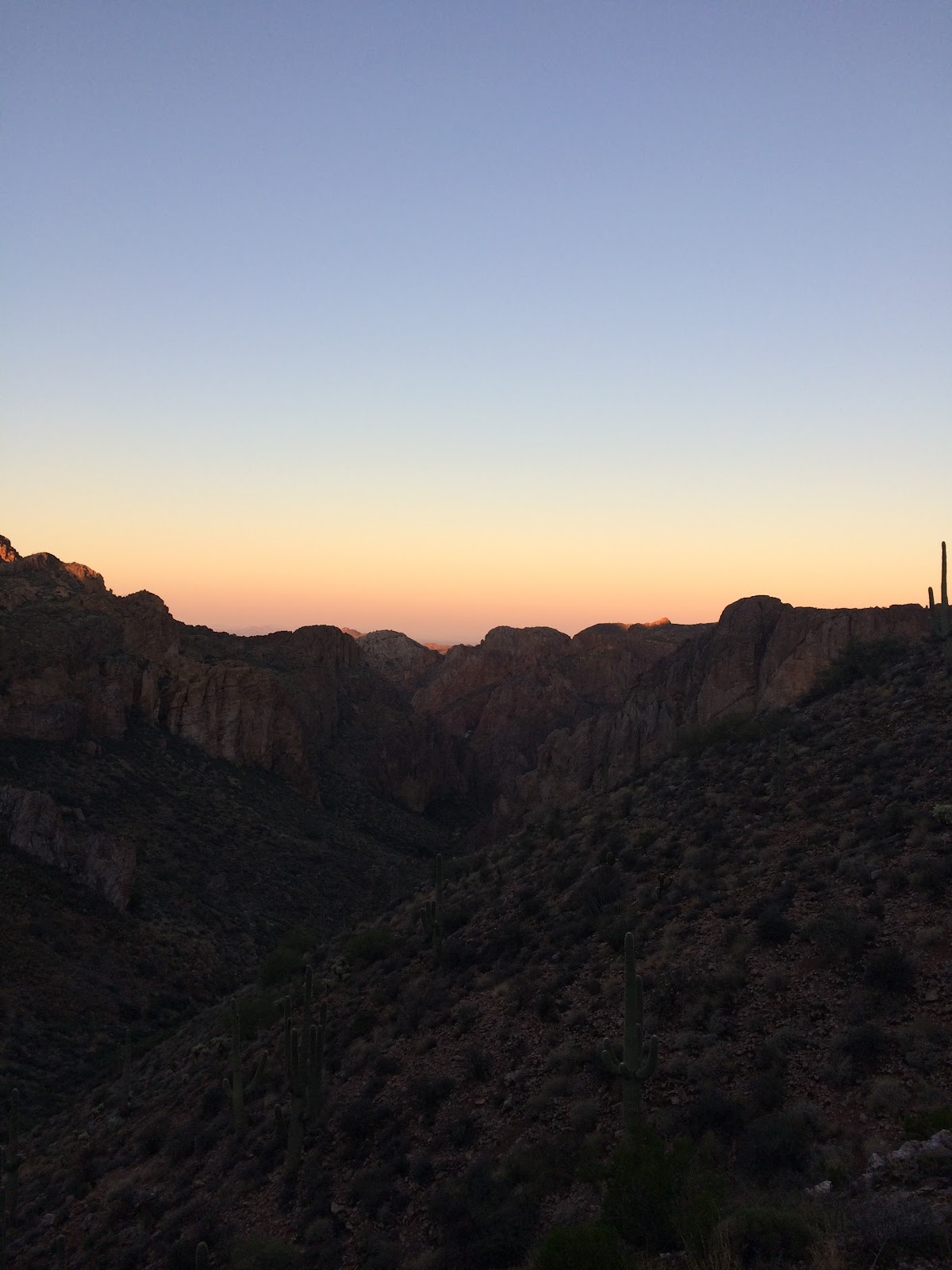
The sun starts to dominate - looking south where the Gila hides and visions of an adversary I'll tackle in April far in the distance...


After navigating indescribable canyons, I begin my descent to the Gila River. As I worked my way down, the power and life giving power of it began to reveal itself. Cactus turned into a dense canopy of trees and eventually the dense canopy could no longer shroud the sound of life giving water. Now to find the best place to cross.

I was a bit worried about water levels - it rained a decent amount the previous day, but the water levels according to the web resource still indicated levels right below 80 CFS, well below the 135 John S had talked about crossing this at. Still, it had gone up a bit higher than the folks who did the route on Saturday.

I took my shoes off as I wear five ten brand shoes AKA moon boots. If these got soaked, they would be wet all day. I didn't need that and the potential for blisters.

Stepped in at a location clearly used by motorized vehicles, up to just above my knees, but this is supposed to be the deepest part. I was shocked with how cold the water was. I made my way across the rocky bottom, wincing with the coldness of the water and the rocky bottom. 

I made it across and set the bike down and grabbed some food and a gatorade from my pack. I let my legs air dry a bit and then started to scrape the mud off of my feet so I could put my shoes back on. 


Easy crossing - but very cold. 


From here, you pass the ghost town of Cochran, and there is some dirt road riding all the way to Kelvin. As you get further south and away from the Gila, you realize what you just came though, and how far away from everything you really are. You better have some really good friends if you want to get rescued out here.


Yeah, just rode through all of that, and need to do it again much later today.


Right before the junction to the F - K highway.

There were some short grunts where I hiked a couple of times just to keep those matches in reserve, but it was some good riding, then a screaming descent down the dirt road towards Kelvin. Then boom a big climb??? What I didn't know this was here. But it is, so I walked a decent chunk of it. I got back on the bike when I saw a truck coming down haha and rode the rest. Mercifully it started to mellow out. Before I knew it was passing the AZT Kelvin trailhead and then a brief bit of steep pavement heading down and across the bridge into Kelvin.

I had originally intended to stop at Wilson trailer court, but I noticed signs at the ADOT yard indicating drinking water, so I followed the signs and got to the goods.


I sucked down my remaining water and had a snack and refilled my water bladder. I was able to get a text out to the wife saying I was OK and that I was still shooting for a 7PM finish, but that it was going to be tough. I had taken some time cues from John S. and was pretty much on his pace. This gave me some confidence moving forward. I knew that he had battled some tired legs during his running of this route last year, especially from here (Kelvin) to the end. I thought if I could avoid that in combination of my earlier start, 7PM just might be in reach.

As with most of my stops today, I wanted to keep it short. 10-15 minutes max. I rolled back towards the bridge and made the turn right before the bridge to hop onto the AZT for the remaining miles. 


Cool little gate right past some houses


I noticed immediately the distinct change in terrain makeup. It was more loose pea gravel over hard pack. There were also quite a few rutted areas - really want to watch how you are placing tires here it would be easy to get sucked into a rut and take a spill. 

I really enjoyed this section, though it seemed to keep going. It was like the trail version of the movie "Groundhog Day". Same thing over and over. Ride, approach the river, climb back away, marvel at the views, repeat. Here again the Gila and it's life giving ability is clearly visible time and again - and the Sonoran desert does its best to put on a "fall colors" show. Not bad... not bad at all.


You can see as the desert merges with the Gila... cactus turns to dense trees. Fall colors on display!

I was about half way through this section when I ran into the first people on the route all day. A couple of ranchers on horseback. They asked if I had seen any cows. I said yes, on the other side of the Gila about 5 hours ago haha. I don't think that is the answer they wanted to hear. They asked how many more bikers were behind me and I said nobody... just me. Onward.

I made it to the base of the climb. It's funny I was thinking I was going to sit by the river for a second while I ate and drank my last gatorade... but it was around the corner, and I wasn't going to move any further than I needed to. Probably better anyway. Keep moving. 

I finished my snack and gatorade and put some different socks on under the ones I was wearing. The ones I were wearing the majority of the day aren't my normal riding socks, and I noticed during a couple of the last brief HAB's that I had hot spots on the back of my heels. Not good based on how much hiking I had in front of me. I put my normal socks on and the the others on top of those. I knew it would be getting cool later. This seemed to do the trick as immediately I had a steep jeep road up to the AZT sign to HAB up. No more hot spots. It was right around 2PM and I knew that if all went well 7PM was now close to a reality. Awesome!

From here to the end is just a mighty struggle. Plenty of rideable stuff, plenty of HAB and plenty of views. Golden hour approaching again in this place. Marvelous.


Rogue Panda gear solid all day!


Shadows getting longer


One last look south. Crazy. Can't believe I'm doing this. I'm gonna finish this thing!


I get to the spot indicating the mostly downhill run back to Picketpost. This is where I started to struggle. It seems like soon as I can taste that finish line I get pre-occupied with where I am and how much further to go. I was feeling fine physically, but my mind started to mess with me a bit. I started to put timelines in my head. Ten "downhill" miles? I don't see how this should take me any more than an hour. I start a smooth contoured run downhill and I encounter the cat I was worried about this morning, and the one that has been on my mind ever since the sun started going down this afternoon. These guys are so elusive - to see one is a real treat, though I would have felt a hell of a lot better if I was with another rider. 

After this confrontation and subsequent finish of this downhill section, I ran into some hikers while HABing up a grunt of a hill. It felt nice to see other people for sure. My senses were shot and the adrenaline dump from the lion had me now feeling sloppy/tired.  

I couldn't believe how many climbs and turns there were. It's supposed to be downhill and basically straight according to the gpx. But the trail twists and turns and goes up and down. It gets a bit more technical in here as well. Nothing crazy, but stuff that would be easy to make a mistake and crash or break something on the bike. 

I kept riding and started to see glimpses of traffic on the 60 but dammit I'm not getting anywhere. I started to feel a bit of a bonk coming on - haven't eaten in a while. I pull over for a second and stop and eat some pop tarts. The ultimate riding fuel!!!

My sense of direction is all screwed up now, and I'm getting more and more frustrated. Again physically fine, just ready to be done. Time just seems stopped. I don't recognize any of this from this morning! Where is the end? I constantly stop and zoom in and out on my eTrex trying to estimate how much further. Why isn't the endpoint getting any closer? I probably burned 10 minutes with this BS. I should have just kept pedaling. 

Finally, I come across something I do recognize! The wash right after the start point! Hell yes! I drop down in and almost eat sand as I narrowly avoid a crash - the sand just swallowed my front tire as I was way too forward on the bike. I hop off and hike up several steps on the opposite side. How fitting. Hop back on my bike and ride up to the sign. 

7:20PM. Boom - PULVERIZED!


I'm super stoked to have finished this route. I think this ride and day 1 of the CK bikepack a few weeks ago were very similar effort wise. This one however was mentally much more taxing. Being solo out here and fully self reliant drains other parts of you beyond the physical.

The big benefit of course for me is a preview of the finish of the AZTR 300 in April. I'll feel much more confident if everything works out and I'm fortunate enough to make it to Kelvin. 


Monday, November 14, 2016

Picketpost Punisher Preview

This time of year in AZ is long ride season - and luckily the folks over at AES have some fantastic events set up that put together epic days and great people. The people who show up to these things are as different as the terrain we get to ride in this great state. From absolute speedy cyborgs to tortoise paced (but super determined) riders like myself it doesn't really matter. I've yet to meet a jerk yet when gathering with these folks.

If you have any interest at all in riding your bike (not to mention pushing it around on some non-descript trail for good measure) for a good portion of the day, you should check it out. Be prepared - GPS, food, water, tools, etc.

Anyway, I missed the Kentucky Camp event back on Nov 5th due to riding something a bit longer. Next up on the list is Picketpost Punisher. This event comes in three "levels" - A, B and C. The C course is 36 miles and 4500 feet of climbing. The B is 55 miles and the A course (AKA the Pulverizer) is 75 miles and according to the method of measure between 10-12k climbing. It is said to expect between a 10-15 hour time on course. 10 being for the speedy cyborgs. 15 (or likely more) for the slow guys like me.

I was originally planning on doing the group start, but I messed up some scheduling and family needs to take priority. So I'm doing it the Tuesday Nov 22 - a few days after the group start.

Ride report to come.


Monday, November 7, 2016

Bradshaw Bender! Backroad to Crown King to Mayer and (mostly) Full Black Canyon Trail.

Well, I told people that I would be blogging about this which surprisingly generated some interest, so I guess I better make this good. No pressure right? Haha.

A little background first...

I guess you can say that this trip started close to twenty years ago when I had my first trip to Crown King via the back road from Lake Pleasant. Friends that I worked with were into 4x4 trips and general shenanigans and this was one of the better "destination" type trips for that kind of thing. We would supply up, take the trip up the road and camp out near CK and head into town for supplies and food then head back to camp. Always a good time.

There are two really distinct odd memories of those many trips. The first is seeing a stock Subaru Outback that was deep between Fort Misery and Oro Belle mine. This was back before they used to do a lot of trail maintenance. No clue how he got back there. Second was seeing a mountain biker close to the same area. I couldn't even comprehend that. Cardio was not in my vocabulary, and even taking vehicles up was easily a half day commitment if everything went well. How the hell do you ride a bike back here?

Fast forward a bunch of years - I guess to around late 2011 and I started getting into mountain biking. Back then rides consisted of 5-10 miles. I had already been through a big part of my weight loss journey, but was still more into weight lifting than cardio. My friends started to get into MTB more so I decided to give it a shot and I liked it, so that started my journey out of the weight room and into the great outdoors.

Around 2012 we came across an Arizona specific MTB forum and read accounts of dudes doing things that didn't seem possible. Twenty plus mile rides were the norm for these guys and they extended to even bigger rides and even the concept of bikepacking.

Soon after that myself and a couple of buddies embarked on our first bikepack of our own. On the BCT from Table Mesa Rd to Bumble Bee. Two twenty five mile days and it freaking crushed us.

The progression continued and eventually I was one of the guys doing rides that were in the twenty plus mile range on the regular. Looking for more of a challenge lead me down the path of endurance "racing". Somehow in the tangled web of the internet I found blogs of these freaks doing huge rides in fantastic areas. It all led me to Arizona Endurance Series. This opened the door (rabbit hole?) that I am currently falling through.

Needless to say, this has led to me completing 5 AES routes over the last few years along with some other "big mile" days of my own design. Which has led me to really contemplating one of the best MTB ultras out there - the Arizona Trail Race (300).

This race has been on my radar for several years, but couldn't ever really comprehend what it would take to really take it on. Last year I was getting closer but knew in my heart that it wasn't the year. However, Arizona endurance freak John S. said something to me and one other guy in a discussion thread about the race. He said something along the lines of - "You guys have the fitness to do this right now"...

That really stuck with me and has been a motivator ever since. I gotta say, the AES community is full of the most amazing people. I have yet to meet someone who has any kind of negative vibe at all. Just a bunch of bad asses riding bikes and pushing the boundaries of body and mind. Everyone has been so helpful and giving. I hope to meet more of them in the future.

Anyways, all of that to say that the race is about five months out from now, and I really needed to get at least one big overnight trip in. I've always wanted to do a full trip of the BCT from north to south, but the shuttle aspect makes it a pain. I also have read a bit about some trips that have taken place higher up in the Bradshaw mountains. In a moment of clarity (or maybe insanity) my old world of 4x4ing and new world of mountain biking collided when I saw this route from John: Pleasantville

I thought to myself that it would be freaking epic to ride mountain bikes from home to CK via the back road, then drop down to intersect BCT and take it all they way home. But how possible is it anyway? That climb to CK is steep and nasty. But so are many sections of the AZTR. What better way to test myself?

Some Strava research indicated that yes several people have ridden bikes all the way up to CK, though usually from a staging area north of the lake. Starting from my house would mean that we would already be 30 miles in at that point. Also, we would be riding loaded bikes. Meaning food, water and sleeping gear.

It was on. I took several tracks and started doing some work in topofusion to piece everything together. The first iteration was simple. Home to CK via the backroad, drop down via the main road to intersect the BCT then head south all the way to its terminus at Carefree Highway then continue south on the 51st ave alignment which would lead through open desert/state trust land (and a loop 303 crossing) back to my neighborhood.

This looked all good, and we could have supplied up enough in CK and Cleator to get us to rock springs, but then we would be missing a big section of the black canyon trail. A revision was made to head north along the BCT to get to Mayer, AZ for a nice chunk of miles and a good resupply point in Mayer. And now the story starts...

We wanted to get an early start so Marcus showed up a bit before 4am. Some final adjustments and we were on our way right from my driveway!

Final prep

We had a short little jaunt through my neighborhood and crossed the bridge over the CAP canal and hopped the barrier - feeling the full weight of the bikes for the first time. This led us to the Pyramid Peak area. It's a fun little area that motos and MTB's like to play in. We were thankful for the decent rain the night before as it really made the sandy spots easier to ride. We made pretty quick work of this and came to the loop 303. There is a way to get underneath it, but I wasn't quite sure where it was at, so we rode to a spot where the fence usually has a break in it. The fence had been mended so again we lift bikes over and navigate the barbed wire. We crossed over the 303 and then another fence and more flat riding to access Carefree Highway. Two more fences to cross - at least these have gates you can open and don't have to lift bikes over. We are now briefly on the BCT and soon connect to the Maricopa Trail to head west and access Lake Pleasant.

The riding remains flat through this section, with a handful of short punchy washes you have to navigate through. Again we were mostly happy for the rain because it kept the sandy areas ride-able. There were a couple mud puddles that snuck up on us though because we were riding with our lights on low to conserve battery power. Running with minimal lights might have saved us much later the next day...

Some gates to deal with by road crossings

Right next to the entrance to the lake here - a little mud on the tires.

We got through that section and now the first bit of what felt like real mountain biking as we dropped down to the Agua Fria crossing just south of the lake. This was easier to navigate than the first time I was through. I think the people who run the prickly pedal bike race did some work in there - much appreciated! Soon we were entering the official trail system at Lake Pleasant, and the sun started to make its appearance...

Here comes the sun...


We made pretty quick work of the first half of the trails there, though the weight of the bikes was noticeable as we navigated some decent climbs for the first time. We stopped at the desert tortoise campground for a quick snack and to load up on water. This would need to get us to Crown King. We both loaded up with 100 ounces and I also was carrying two 32 ounce gatorades with me so my pack was quite heavy at this point. I was glad I had those extra fluids though and I would end up needing them. Marcus who is like a camel wasn't carrying anything other than the 100 ounces and he ran out a bit before the top of the climb to CK.

Refuel time
Yours truly...


Quiet campground

Lemme take a selfie... Stashed my helmet light right after this because I was feeling the weight of it
From here, we had to navigate the second half of the trail system and we had our first gpx challenge of the ride. I must have drawn in the track wrong or something else because we dead ended in another picnic area. No biggie, just take the road and connect back up to Castle Hot Springs. It's our ride, we will do what we want!

Saw several groups of wild burros and a group of eight javelina as well. In addition to some sweet views of the lake. The floating bridge was still out of commission. The lake is as low as I have ever seen it!

Burro walking away from us here. 

Sweet views!

Eventually we were in for the dirt grind on castle hot springs to the turn off at cow creek road. This was gradual climbing for the most part with a few steep ones to deal with. We were both being careful not to push to hard - reminding ourselves that we had a full day in front of us not to mention the next day!

Excellent views, hard to capture the scope in a picture.

Um, yeah. We are going up there eventually...

No services for 20 miles. Hope you are ready!

Already have gained a bit of elevation. Lots more to go.

We finally arrived at CK rock and took a break. I downed one of my gatorades and was happy to have that bit of weight off my back. A couple in a side by side rode up towards us and the driver asked if this was the way to Crown King. We confirmed and off he went. We thought it was weird because the big rock clearly points the way, but the rock was turned a bit so the "CK" was facing north. Usually it faces east so drivers see it. Anyway, the guy must have thought we were crazy, we would meet him again much later in the day near Oro Belle mine... All in all the traffic was minimal and we just saw a handful of vehicles heading towards CK this day. We intentionally picked Friday as our start day as this route can be a zoo on Saturday and Sunday.

The famous CK rock. It's been turned a bit.

From here, the elevation gain comes quickly. Marcus was riding really strong and churning out a lot of the climbs on the bike. I tend to be able to hike just about as fast as I can grind out the steeps in granny gear, and I feel like it's less taxing for me physically so lots of hike a bike (HAB) was had for me. You'll notice that as suffering goes up, the amount of pictures goes down!

Looking south towards Lake Pleasant.
And one at Fort Misery. Cool place for a break, despite the name. Thinking of burgers at this point.

We enjoyed the fairly easy riding after the break. It's sort of flat through here as it follows Humbug Creek. We passed a bunch of medium sized mining equipment in the area. First time I've seen that, or maybe the first time I was going slow enough to pay attention.

Fort Misery looking north-ish. We still need to go UP THERE. These clouds were very welcome as it was warm.
Eventually the flatter terrain of the creek had to end and the pain was about to get real as we made the approach to Oro Belle mine. It was about two miles of suck for me. I watched in amazement as Marcus was grinding it out on the bike. I rode short segments of it, but was fine with pushing. The views were out of this world. It was on this section that the 3-4 side by sides that had passed us heading north earlier in the day ran into us again as they went south back to the lake. They all gave us the "wtf" looks. I don't think they expected to see us so close to the final approach to the top.

The coolest thing about this route is the change in scenery that happens in this last push. Arizona is freaking awesome!


Terrain is changing. More trees!

Just beautiful. 

Rarely does a picture capture the steepness of a trail - I think this one actually does. Marcus is up there, in about the center...

We've come through all of that via the roads you see in the picture. 

Looking back down this section.

Side by side heading back down. 

Almost to the top. Being somewhere like this makes you feel small!

Thankful for the ability to do this.

Marcus being kind enough to wait for me. Just one final push...
One final push remained. Marcus and I both hiked this section. Marcus's knee was feeling a bit sore, and the shale would just kick out underneath your tires as you tried to ride. Better to push at this point...

Finally made it to the top of the climb. We are in the pines now and it's all downhill for about 2 miles to get to Crown King and real food!

This little guy is tired...

I'd say we earned this downhill.

We arrived in CK and a couple of ladies in a truck saw us and said "good job". We'd talk to them more in a few minutes once we got to the saloon.

We were both pretty crushed at this point, but we were so stoked to be here. We gave ourselves an hour to eat and resupply.

At this point the story goes, "so two bikers in spandex walk into the saloon in Crown King". What a sight we must have been. It's not totally unheard of to see people ride their bikes up to CK, but the vast majority do it from the access road off of I-17 towards bumblebee.

When the people in the saloon heard that we came up from the lake side they couldn't believe it. They freaked out a bit more when we told them our actual start point near 51st ave and Happy Valley. They said what time did you guys leave yesterday - and we said we left at 4AM today. One of them (who might have been slightly drunk lol) said that we were "world champions". Maybe world champions of smelling like ass, because Lord knows we certainly were a mess at this point. Everyone was really nice, but we had to get out of here soon so we put our food order in and ordered a beer. We then sat at a table far away from everyone because I think we were both worried that we were stinking up the joint. It was also at this point that we realized that it was fairly chilly so we stayed inside instead of eating on the patio.


So good. 

Sadly, neither of us got any pictures in CK except for our food haha. I think you can tell what was on our mind.

We said our goodbyes to the people in the saloon and headed next door to the general store to pick up water for the trip down to Cleator and beyond. I was kinda chilly so I through on another shirt on top of the two I had on and after we filled our packs with water it was all downhill to Cleator. Magnificent views as we went down. Minimal traffic as well. I would never want to do this on a weekend - traffic is just too much in my opinion. The temps warmed up as we lost a lot of the elevation that we worked so hard to gain. I wasn't shivering anymore, so I was happy.


Just after leaving CK and the views start opening up.

Looking back towards CK.

Expansive. Views to the east forever...

Marcus stoked to be here. When looking up from Sunset Point he always wondered what was up here. Now he knows.

We made quick easy miles to Cleator which is a mandatory stop in my opinion. Crazy cool place.


Basically this.

And after this stop the suffering really started. The original intent was to head north on BCT, get to Mayer, resupply and then make some return miles south on BCT to get a head start on day two.

Fat freaking chance.

Both nights really brought on the challenges - more mentally than anything. The section heading north to Mayer neither of us had seen, but it looked reasonable on the elevation profile. Only about a thousand feet elevation gain when it would "flatten out" and give us access to Mayer and resupply haha. That sounds funny now. Those 17 miles to the chevron took us 3.5 hours. We couldn't really figure it out at the time. The climbing seemed endless and exposed since night was fully upon us. We were hiking and pedaling and seeming getting nowhere. And Mayer lives on the other side of a mountain/hill so you can't see the freeway or anything until the very end. Super frustrating. We kept passing spots that looked like they would make good camp locations, thinking we might at least make it back to one of them.

That never happened.

Mercifully, the trailhead came but we made a dumb decision out of tiredness and ended up bushwhacking to access  HWY 69 instead of the gravel road out of the trailhead. Luckily, the highway has a full sized lane as a shoulder, so we felt fine making the short trek to the store down the road. There we topped off water in our bladders again, and I bought another two gatorades. Also on the list:

King size snickers.
Package of chocolate frosted donuts.
And this:

It's a party at 9:30 PM in Mayer. Pure awesomeness in a cone. 

We made our way back to the trailhead resigned to the fact that we would not be making any miles south today. We looked around the trailhead area for a spot to lay out sleeping bags and I told Marcus that it was going to get no better than the outhouse right in front of our faces. This is the absolutely cleanest outhouse I have ever seen. No smell. No bugs. Flat concrete with walls on three sides and a roof? Done. We hung our kits and gear on the fence, and cleaned up a bit. We laid our bags out and I slammed down the snickers, shared the donuts with Marcus, and we also shared some pop tarts. I drank one of my gatorades and that was it.

I was out within a few minutes. The thoughts of the next day were in my mind. We were in Mayer, and had to get all the way home the next day. What have we gotten ourselves into? I was feeling pretty stiff and woke up a couple of times at night due to some weird cramping and in my feet and my calves a couple of times. Also thought I heard someone walking around at one point, but it was just the wind.

Marcus woke up once and yelled "Get me outta here". He was all tangled up in his bag. I laughed so hard at that. I was also happy to need to get up and pee a few times. Good to be hydrated with a long day coming up and at warmer temps. While the lower elevations were still to have nice temps, the canyons of BCT and the exposure to the sun make it seem warmer than it is. Also there was a wind out of the north which might seem nice, but it makes the air feel still when you are moving with it. You don't get the cooling benefits until you are stopped.

Super deluxe accommodations...
Day two broke and it was chilly with a breeze out of the north. I felt surprisingly good - no pain or super stiffness like I was expecting. The rear was a bit sore, but no big deal.

We both slept longer than we wanted, but we ate a bit and got on the trail fairly quickly. There were some trail volunteers who showed up right before we left and we talked to them for a few minutes. We told them of our previous day and how we crashed out right there at the outhouse haha. The guy mentioned the names of the volunteers who maintain this facility after we said it was the cleanest outhouse we had ever seen. They didn't mention or give us a hard time about "camping" there - as it technically isn't allowed. Though I don't think what we did can be classified as camping... I'm sure they are happy to see trail users up here. They talked about the trail work they are doing on the other side of the freeway. That is BCT up there and we didn't do it, thus the "mostly full" BCT in the title. I think most people consider this the northern end of BCT at this point until they finish up more work on the northern segment from here anyway.

We had to make our way over the ridge that was hiding our view of Mayer the night before and then we had some pretty easy and beautiful miles for most of the morning.

My view most of the trip. Marcus always pulling strong. 

Cattle standoff. This was a theme all the way to the bumble bee trail head.


Cattle like the trail too! 

We were up in there yesterday. Hard to believe. 

We got through the jeep/ranch roads and then figured out why this next singletrack section was so tough the night before. It was a nice downhill grade going this direction. The exposure wasn't as bad as what it seemed the night before, though there were still some sections where a mistake could have some consequences. All in all, I really enjoyed going down this section and it redeemed itself for sure here. In a couple of places the views to the south were just enormous. Wow, are we really riding this?

Start of the goodness. 


Now we are seeing why were so slow up this section the night before. Much better going this direction!

Held back for a bit here so Marcus wouldn't feel like I was on top of him going down. 


The trail started to flatten out a bit, but was still fairly easy riding. Had a couple more cattle encounters...

Mooooove over steak!

And then our first mechanical. Sliced sidewall.
Good times. Got out of here fairly quickly though. 

We finally made it to the bumble bee trailhead and it was later than what we were hoping. It was just about noon. Took us about 4 hours to get here from the start. It's going to be a long day...

The reality of a long day ahead starting to be realized.


At this point the pictures pretty much stop. We were really wanting to not waste a lot of time, so we kept moving pretty well. The BCT from bumble bee to Rock Springs is pretty nice. Not my favorite section, but it has its great moments.

We did have one WTF moment when we came to the Agua Fria crossing just north of Rock Springs. We approached and there was a 30-40 foot body of water blocking our way. I don't remember this at all from my previous time through here. Not really wanting to get wet we scrambled over some big rock formations to the east and it didn't look promising. We scrambled to the west and there was potential so we crossed the little stream there but were worried that the "pond" was going to be there on the other side of this high ground. It was so overgrown we couldn't tell what we would find.

Mercifully, the ground remained dry and we pushed onward toward some nice climbing and well constructed trail. Food awaits in Rock Springs!

Delicious. 

At this point it was 4PM and we were feeling fine, but the efforts of the ride were starting to drag us down. Gotta keep moving. After the refuel of burger, fries and pepsi in RS, we headed down some sweet track back down to the Agua Fria and then the big climb up to one of the best views on the BCT. This climb and following decent is just a treat and to do it at this time of day is really special.

Get a picture here every time!

Golden hour creeping in. Never been here this time of day before. Magnificent. 

From here the pictures stop. We wanted to get as much of the trail out of the way before pulling out our lights. Let it rip! I ended up getting my third best ever time on the RS to LPL segment. Not bad for being on a loaded bike and the big efforts of the trip so far.

It was getting dark now and decided to get lights set up. Put my big light on the bars and the blue light indicator came on - decided though to wait for a bit because there was still some light to work with. The reality of a longer night ride than we anticipated was apparent so saving as much light capacity as possible was the name of the game. This also meant riding slower...

Finally, it became too dark to ride without lights, so I went to flip it on and nothing. No battery indicator or anything. Ugh. I still had two sources of light, my main helmet light (which I barely ran in the early morning of day one and not at all on night one) and also a headlamp which had 5 hours capacity on high and 50 or so on low. It would be workable especially once we got on the flats closer to our destination. I really hoped that my main helmet light would work all the way home though.

The ride through to Table Mesa Road was OK. We were just fatigued and mentally drained. We knew we had a decent effort to get back and again, the night hours just puts a weird vibe for me. Plus the finish line was getting closer. In the back of our minds, families came into play. They knew we would be finishing in the dark, but the estimating game is one that I am not good with (sorry hun). The original plan was to get home right around dark. The reality was much different. It was a combo of the late start to day and without the benefit of making miles south the night before.

Live and learn.

I guess the biggest thing about this was letting the wife know that yes I am out here in the back country but I also am with a person that I absolutely trust and we promised to look out for each other. I told my wife that she needs to trust that process and that I will be in contact when I am able (which isn't often in this section of trail).

I understand the concern she has (and Marcus's wife as well). That said, I told her that when I do have contact with her, it would be much appreciated to save the subtle lectures for another time. I probably took her texts to me stronger than what she intended, but at that point, anything other than "great job" or "you are awesome" or "you can do it" is just going to be another negative thought in a mind that is already fighting all kinds of negativity. Love you babe! Thanks for dealing with me and these adventures!

Anyway...

We were still amazed that it was dark and people were still firing their guns off at table mesa road. I'm all for guns, but c'mon it's freaking dark people!

The next section to get to emery henderson is where things got really rough. The trail has seen some better days and is very rocky. No big climbs really, but again just like Mayer, you keep going hoping to see see city lights but they never appear. There is always another ridge. Always!

This part of the ride is pretty blurry for me. It was around 8PM I think and another big day was already in the books. The finish like was so close but here are the obstacles that we encountered on the way to the EH trailhead.

1. Birds flying right at Marcus's face
2. A skunk right on the trail that didn't want to move.
3. Marcus finally punctured the tube we put in earlier in the day. We pulled the valve core out and I gave him some sealant to hopefully keep us from having to put in another tube.
4. Had to stop a time or two to add air.
5. Below average trail conditions and diminishing bike handling coordination due to fatigue.

The diminishing coordination should be no shock. Both Marcus and I have clocked in previous big days in the nine hour range. Day one clocked in at a seventeen hour day and now on day two we were right around twelve hours. Something for us to keep in mind - you're gonna slow down as the days and hours go by.

We finally got to EH trailhead and Marcus had to fuss with the tire a bit more. This time it lasted till the end of the ride.

Outhouse at EH trailhead. This one was not clean and could learn from the caretakers of the big bug TH in Mayer...

Fighting with the tube again. It held this time.


So the part from here is supposed to be flat, sandy and boring. It's flat, not sandy and rocky and in general a piece of crap "trail". It was hard to follow at night. We ran into one spot and we were dumbfounded. I stole a pic from John S showing what it looks like in the day. It looks even worse at night.

Piece of crap trail. Pic courtesy of John Schilling.

We finally attained the other side and it still was below average, but not as bad. Lost the trail a few times and in trying to find the route I ran right over some kind of death cactus. It put the largest spines in my back tire I have ever gotten. Yelled out a couple of choice words and Marcus said "Dude you ran over a cactus". I never even saw it. Ugh.

I pulled out the small pieces without consequence but knew I had to keep the big chunk in there to act as a plug of sorts. There was no repairing that one in the field and I didn't want to tube it.

We kept riding and it was holding air. We were approaching Carefree Highway again and merged onto the track where we headed west earlier in the morning the day before. This time we stay south! Almost home! Honey keep the light on!!!

We cross CF highway and got close to the 303 crossing when I felt my rear tire going soft. No!!!!! Didn't want to deal with this so close to home. I decided to pull the valve core and put in more orange seal in my tire and pump it up hoping I could limp home on it. It holds for now.

Crossed the 303 and dealt with the same fence B.S. as day one. Getting so close now! Unfortunately, the easy riding due to damp sand on day one from the rain was a distant memory and now there was sections of super dry and deep sand that were hard to ride through. I couldn't really ride up on the stiffer berms because the sideways flex of the tire was something I was weary of with my rear tire being close to giving out. In fact after doing that I lost air in my tire and had to pump up again. This time it lasted the rest of the way!

Approaching my neighborhood, it looks eerily similar to the section north of EH where the ridge blocks all city lights. Marcus was like, "I don't remember riding through those hills". I let him sit on that thought for a minute or so and then told him that we didn't have to and that my hood was nestled in between what he was seeing. Another five minutes or so and we saw my neighborhood lights and we were freaking STOKED! Came up to the concrete barrier separating pyramid peak and my hood... lifted the bikes over (awkwardly for me) and rode the streets a mile or so back to my house. 11:15PM finish wow what a freaking adventure.

Helped Marcus get his bags off of his bike and said our goodbyes. He had a long drive home. He headed out and I had to collect myself a bit before heading inside. Needed a shower so freaking bad. Walked in said hi to the wifey and my daughter who was home and headed straight to the bathroom to wash up. Finished that and then went out to talk to the wife. I was still kinda wired yet tired at the same time. Had some food that she picked up earlier for me. Uploaded to Strava of course (or the ride never happened) and then finally got to bed around 1AM.

Woke up at 7AM what on earth is happening WHY AM I AWAKE? Got a couple short naps including one right before "The Walking Dead". What a time to be alive!

So thankful to have the "fitness" and equipment to be able to attempt something like this. Glad to have a friend silly enough to take the bait and do it with. Also thanks and much respect to guys who demonstrate what it looks like to push limits. John S, Ray H, Jeff Z, Bart L, Joe P etc. The AZ endurance MTB community is amazing.

Till next time...