Short backstory: I had planned and trained to get out and do the full 800 AZTR route. Arizona had an absolutely bonkers winter from a precipitation standpoint. Biggest snowfall on record or close to it and snow levels not seen since the inception of the AZTR as we know it. Not really believing what was happening, I went out for an overnighter with the full gear I was going to take, including hiking poles, full ultralight tent, different pack, etc. It was a success. Right after that, we got another blasting of winter weather. I had been obsessing over the conditions up north; watching multiple webcam feeds, AZT thru hiker FB pages, etc. I was going crazy and eventually I had to make the call to just give up on the 800 run this spring. Immediately I felt a sense of mental relief.
This ended up starting a whole new phase of planning. Weather on the 300 looked damn near primo. The hiking poles were obviously no longer needed and the tent was ditched along with some additional warmer clothing. As the forecast looked perfectly clean for my planned duration, even my ultralight bivy ended up getting ditched. Cowboy camping was the name of the game.
The biggest impact of this was originally I was planning on starting around noon due to not wanting to get to the border and just sit there and sleep over night. I didn't really want to wait around. Not out of fear or anything, just seems like a waste of time to hang out there in the context of an ITT. With that timeframe, my thinking was to just take the canelos nice and easy. No rush or stress - then camp out before the private ranch boundary which is closed sunset to sunrise. This would set me up nicely for one of my goals - to see the molino basin area in the daylight. Funny, turns out I ended up seeing it in the daylight anyway haha.
Anyway, with just doing the 300, I really didn't want to lose out on that time, so I checked with my ride to the border if we could get started earlier. Liz said no problem. I didn't want to be absurd about it, but I thought if I got started at 8:30am and had no issues and pushed fairly hard, I could make it through to HWY 82 before sunset. It was going to be close as I am NOT a speedster by any stretch. My saving grace is that I can plod along relatively consistently.
Getting there/rules/Day 1.
I have a group of ex coworkers and we still get together every few months or so - one of them is a recent retiree but also has a lot of adventure/ultra endurance blood. We all had talked about my plans for the 800 and she offered assistance in any way while I was out on route. That was the opportunity I had to explain the rules of self supported bikepacking - in essence - do it yourself. I did say "well I could use a ride to Mexico" lol. She didn't hesitate and said she was game. OK that was easy!
Speaking of rules, I like to think there is a unwritten rule, in no way enforceable, but something that I believe the vast majority of participants already adhere by. That is: "don't be a dick". The fact is, as cyclists, we are (rightfully) on the bottom of trail user hierarchy from a right of way perspective. In some cases we aren't liked. This is unfortunate, but lots of times it is our own fault. On this ride, I wanted to make it a point to do the following - knowing I can't fix those issues, but I can do my best to have a positive interaction with everyone on trail. If enough of us do that, it's good for everyone!
1. Try to see hikers before they saw me and stop before they did if we were approaching each other.
2. Call out early and often until I was noticed if I was approaching from behind. Didn't want to startle anyone.
3. If a hiker initiated any kind of conversation outside of normal pleasantries... actually engage them in that conversation. I had one guy start talking to me right after I passed and since it was flat and he was hustling, I just rode slowly in front of him for a bit while we discussed our last few days.
4. On a more unseen note, this route is 100 percent doable without using the hiker water boxes. There are enough reliable sources you can filter from. For clarity, I have taken water from the freeman cache (the one "kinda acceptable" cache to use) before (1 liter each time). I resolved not to do that on this ride. I drank plenty at beehive well and took enough to get me to the ADOT yard in Kelvin even though there is a reliable option near Ripsey to pull from.
But I digress...
We agreed on a 4am pickup from my house in Peoria, and Liz was there ready to go at 3:50am and I loaded up and we were on the road with the quickness. I thought if everything went smooth, I could be on trail at 8:30.
The ride down was uneventful, we did do the approach from the west rather than going through Sierra Vista. I just like that drive a little better and it shows off the area better imo. This was Liz's first time down there - also - Montezuma Pass Rd is in really bad shape right now so didn't want to add any adventure.
 |
| Final approach - stoke is high! |
 |
| Good pup Bo was a good travelling companion. |
 |
| Border Monument 103 and the last time I will be this clean for a few days! |
 |
| I told Liz to go ahead and take off, I needed a couple minutes to absorb the moment. |
I looked at my phone at it was a minute or two past 8:30 so I started. Felt weird and I was AMPED. My heart rate was sky high and I was like "dude calm the fuck down it's just a bike ride" it doesn't help that the first bit has a mild climb, but whatever. I just focused on calming my breathing and relaxing. It was right around this time that I realized I didn't start my Garmin at the border - insert facepalm here - so I called myself a dumbass and that kinda broke the ice to help me calm down.
 |
| Smooth dirt roads and a view into Mexico |
 |
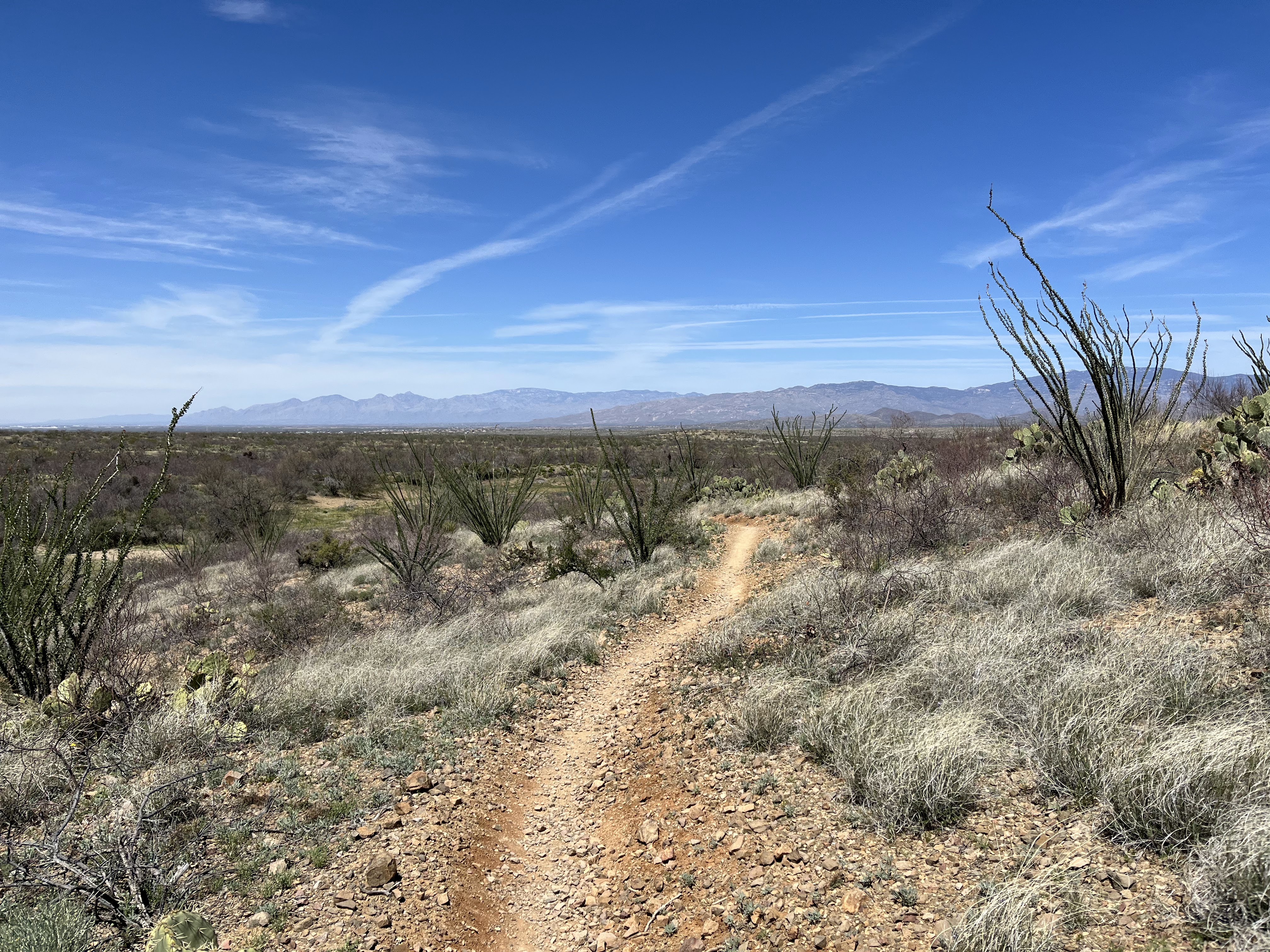
| Long, gradual climb to get to Sunnyside Canyon to nab the first bike legal AZT that makes sense. |
 |
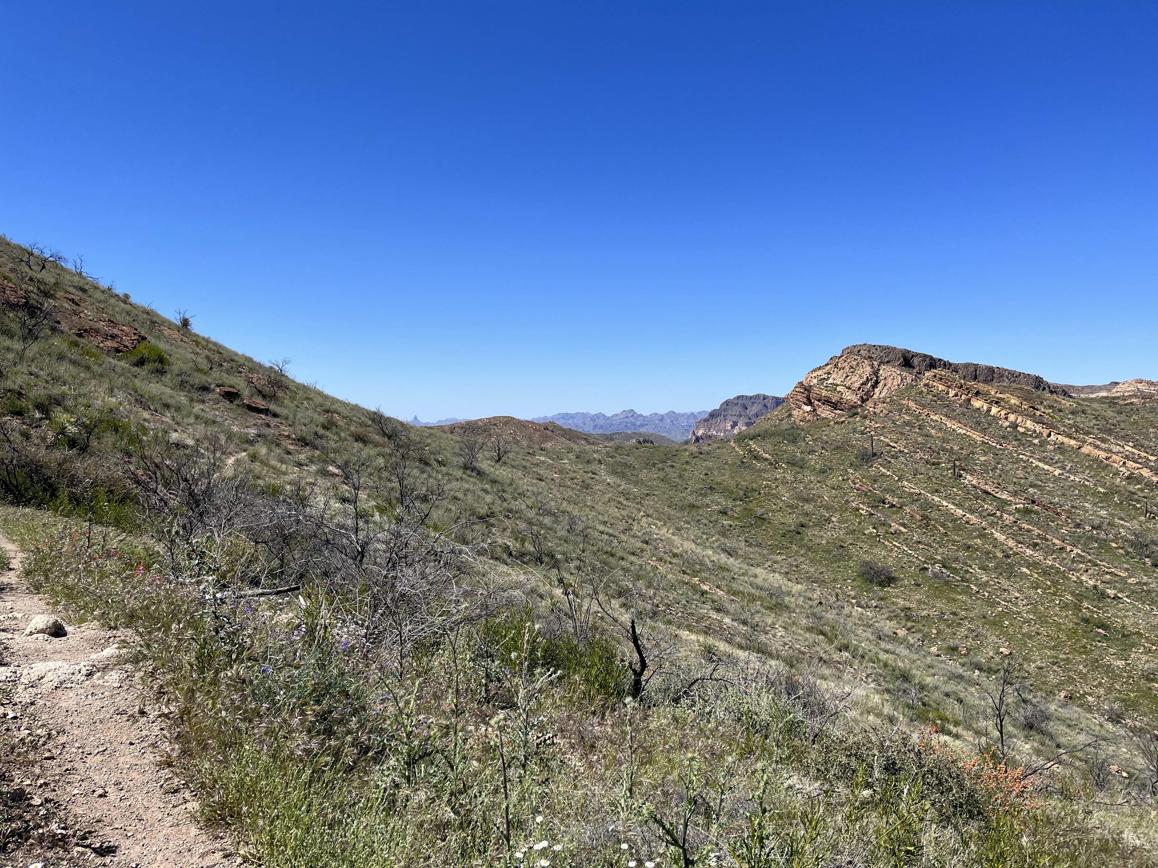
| The landscape changes drastically. |
 |
| The first of many AZT super gates on route. |
 |
| Officially on the AZT |
 |
| Nice bit of trail here right next to flowing water. Very peaceful. |
 |
| As soon as I hit this gate I knew where I was. This is the gate we watched riders come through last fall during the Grand Depart. That means Parker Canyon Lake is right up the hill! |
Note: while the first 21ish miles are fairly fast, the next 30ish are not. The kicker: I had a time constraint to adhere to. The route has a published closure from sunset to sunrise between miles 52 and 54 as the AZT has an agreement with the private ranch owner. Before the ride, I must have looked up the official sunset time 10 or 20 times: 6:46PM.
Important: sunset doesn't mean absence of sunlight in the sky. I knew based on other riders who I ride similar pace to that I needed to be to the trail junction to the legacy AZT by 5:15 at the absolute latest. Will I make it? I was going to have to push and hope for no stupid BS.
 |
| Begin the meaner, canelo hills east section, but it treats you nice for a couple miles before the whoopin' begins. |
 |
| Parker Canyon Lake looking stunning |
 |
| Let the hills commence! |
 |
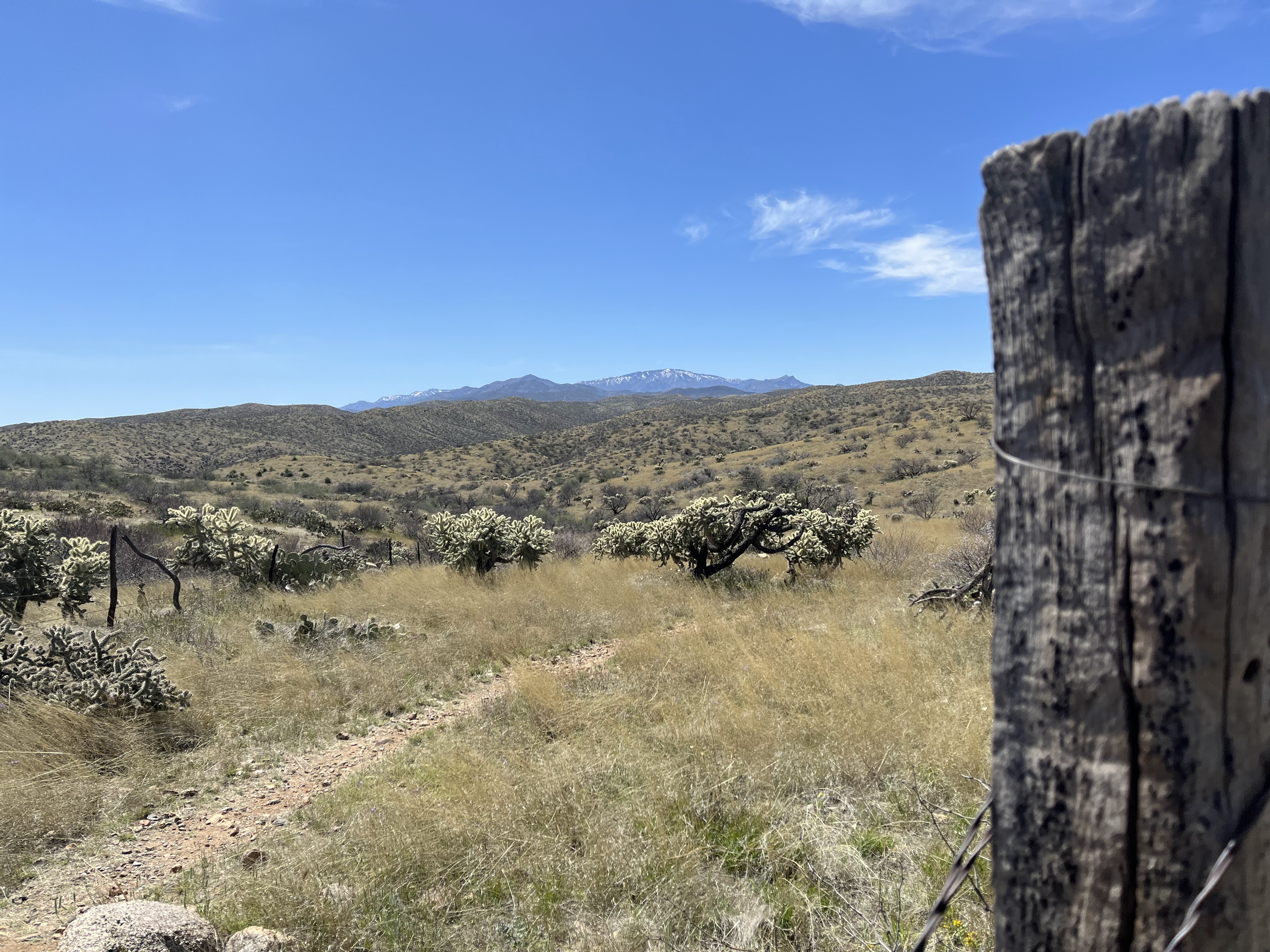
| I think I took a picture here last time I was here. This is what the canelos offer you. |
I stopped to top off my water at the creek in Parker Canyon and met two section hikers and a couple of thru hikers who were taking advantage of this reliable water source.
 |
| The cute Christmas colored cactus - well guarded by some deliberately placed stones. |
Right after this, I was doing more HAB when suddenly I get the dreaded sputtering and hissing sound from my rear tire. No!!!! How the hell am I gonna get a flat while HABing? This I did not have time for. Bad news. I rotated the tire so the very small puncture was on the bottom so the sealant could pool up and seal it. Hmm seems like it worked. Onward.
 |
| Big hikes lead to big views! |
The canelos begin to relent on the western side of them and the riding becomes a bit easier. I ran into a young woman out here on a gravel bike right around redrock canyon. Here she was in the dead center of the section between Patagonia and Canelo Pass Rd. She was like "this is harder than I thought" I told her it was gonna be work no matter how she tried to get out of her predicament. It was getting later in the day and she was trying to get to the pass rd to make a loop. She looked fit and mentioned she was from Colorado, so I got a bit less worried about the dropping temps even though she was barely wearing anything and had minimal gear. I had passed various other thru hikers who were all heading up from the pass so I felt a little bit better about letting her continue knowing there were others in the area.
 |
| I enjoyed watching the rest of daylight fade away from the Casa Blanca TH. Finally had a chance to relax, stretch a bit and eat my first slice of pizza. Also threw on some layers as it was getting chilly now that the sun was gone. Got my lights mounted and fired up and hit the road. |
 |
| This part of the route is temporary to join up with in progress AZT build. Should be done soon! |
 |
| Night falls |
 |
| And the full moon rises. |
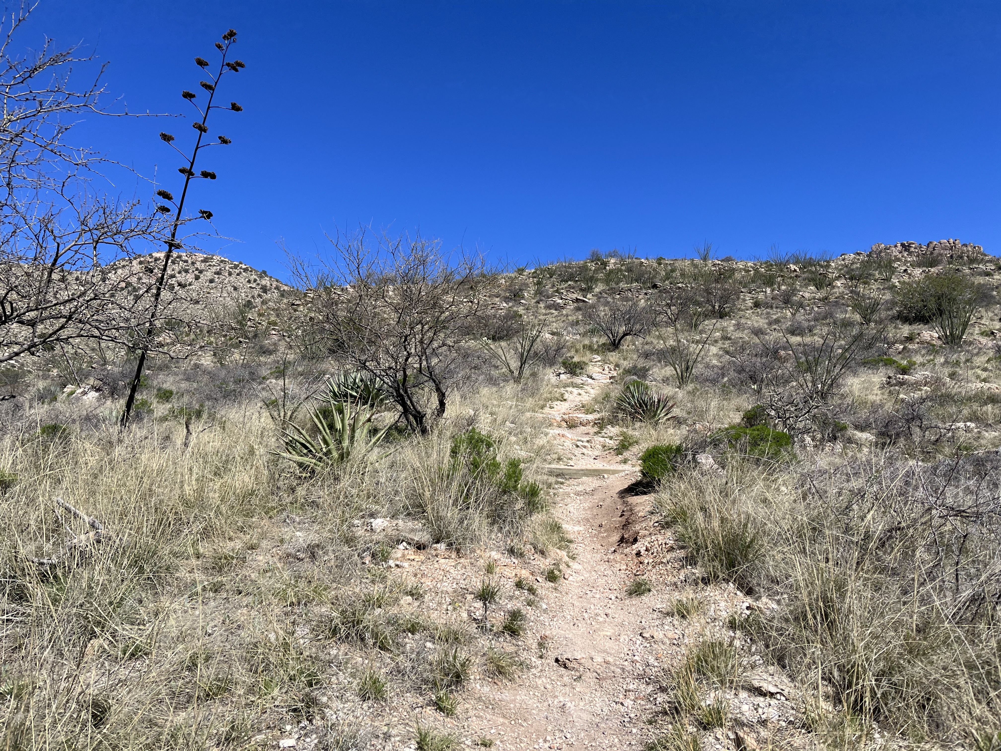
There are a couple of HAB's tucked in here but they aren't bad. I have ridden this section of actual AZT before, and it's good. Real good. But it does have a totally different character at night. The trail is off camber is some places (for water shedding purposes) so just be patient and work through it.
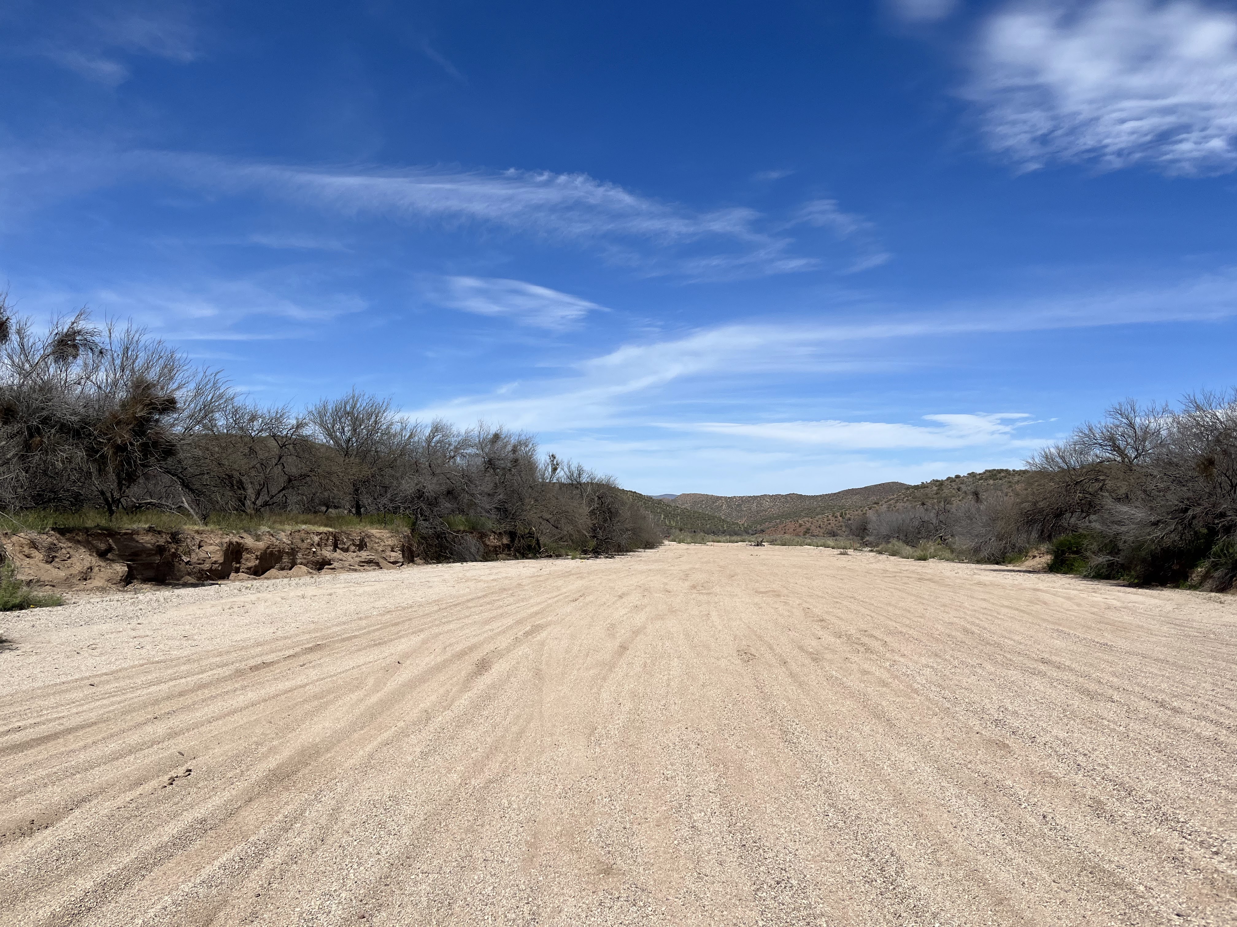
I crossed over Gardner Canyon which had tons of flowing water but I was good and waiting to fill up at Kentucky Camp. Gotta get there first.
It was starting to get pretty dang cold - could see my breath and my Garmin was registering mid 30's. Needed to make my stop at Kentucky Camp brief and efficient. I got there and worked my way around the main building where there is a sink, power outlet and restroom. I took off my main light and got it charging on the outlet while I slammed some water and then topped off my water stores. Ate another slice of pizza but I was freezing my tail off down there as it's kinda in a low spot in the terrain so it acts as a cold sink. I had been there for about 20 minutes but the day was catching up to me and I was ready to crash out as it was around midnight and I had woken up at 3am. I knew I had some uphill in front of me so I thought I would be able to find something that would work as I pedaled up. Hopefully I would get above this sinking cold air too. Sure enough, right before the cattle guard at the top of the jeep road something presented itself. I wasn't expecting any traffic being now so late and mid-week. Set up my sleep kit, drank a recovery drink and passed out almost immediately. This still ended up being my coldest night of sleep, but nothing terrible.
Day 1 Garmin Totals:
74 miles
9,327 ft climbing
Day 2:
My plan was to sleep a bit less than I have in the past. I thought I could get away with 6 or so hours a night which is actually quite a lot by a lot of standards. I wanted to observe how I felt and honestly that seemed like a really good sweet spot for me. I was never flat out exhausted really (well night three was kinda weird), but I always crashed out while still feeling relatively fresh.
Anyway, I did set an alarm but woke up before them every day due to the sky starting to light up.
 |
| Poked my head out of the sleeping bag to this view. |
I felt really good, no stiffness or anything which I was pretty happy about. I knew I had to get going though, some tough miles are coming up, but not before some quicker jeep roads and singletrack.
 |
| Just a random tank on the side of the road. |
 |
| Let the singletrack sweetness begin |
 |
| Gigantic views on a perfect morning |
 |
| This lone century stalk caught my attention. |
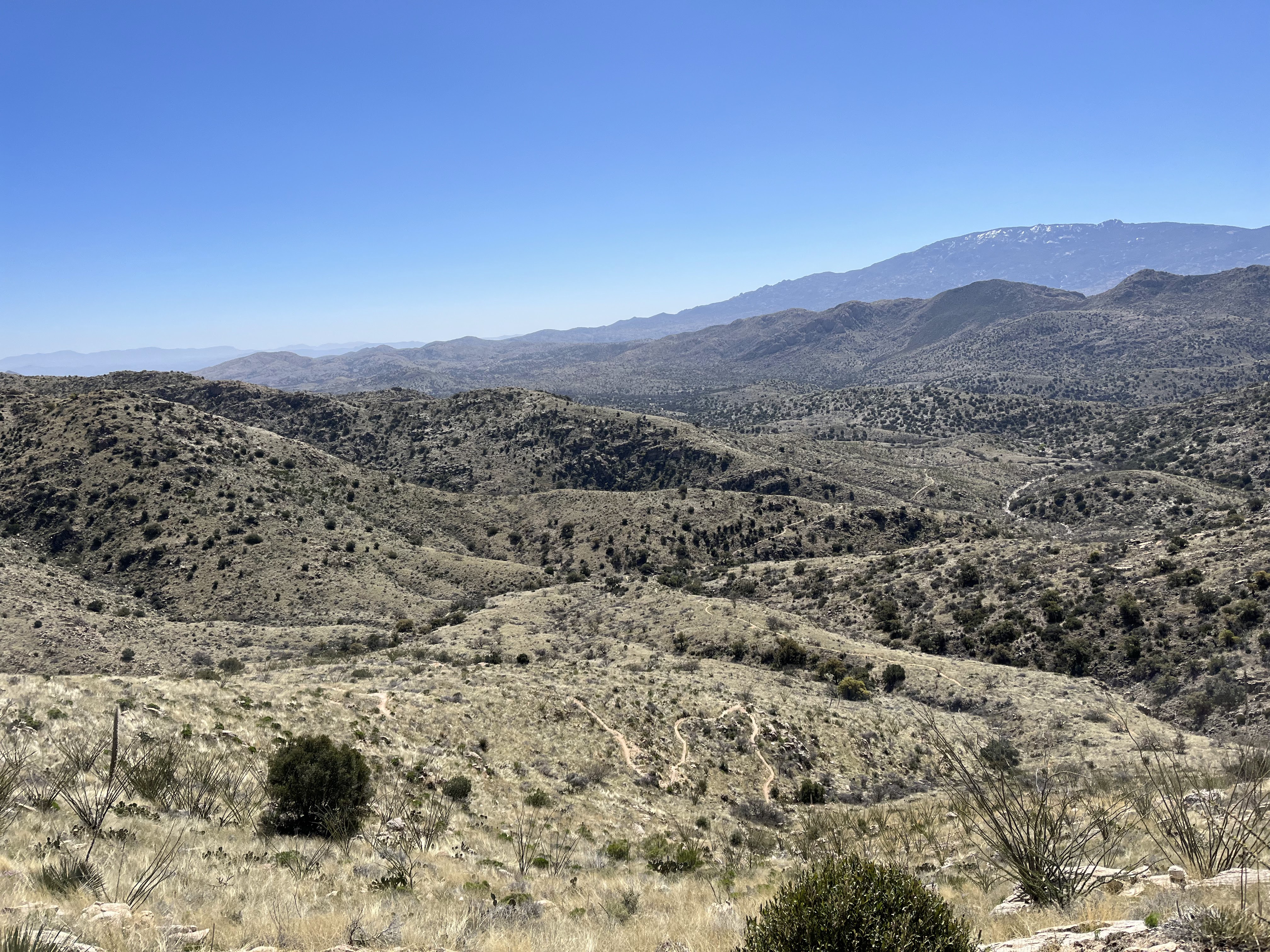
Not much else to say about the Las Colinas segment other than it is work. There were so many cows out there too, so at least I had company. My goal was to get to the magic green gate, which really just indicates the forest boundary - but it also indicates that the riding is about to get easier for quite a while as it trends ever so slightly downhill and also is a much smoother trail surface. It's a nice nice reward for the on again/off again nature of the terrain leading up to that.
 |
| Look around. Cows are everywhere - they are like the spiderman of these hills. If you think they can't get somewhere, you are wrong. |
 |
| Cows just love the AZT |
There was one actual bull who just did not want to yield the trail. I yelled and whatnot, but he just looked at me. I walked a few steps forward and he squared up to face me so I backed off real quick haha. I ended up hiking down into a small ravine to get around him. Didn't really feel like getting gored today.
 |
| Getting closer to the green gate - not much further but a good grunt to finish. |
 |
| I noticed smoke behind me to the south, there had been some target shooters out that way, but the shooting had stopped a while ago. I wonder if those activities started this? |
Finally, the green gate revealed itself and I took a quick snack break, looking forward to some easier riding. My rear tire had been hissing on brief occasions during all the HAB (so weird), but it kept sealing so I just ignored it. Dumb. I'd have to address it in a few minutes.
Near twin tanks which was super full, there was a very small reroute of the AZT which wasn't reflected on the track I had. The was small effort put into blocking it off, but the new singletrack on the ground looked legit and fairly new.
 |
| Rocks in this entry and another row of rocks about 20 feet down trail |
 |
| The right turn to the section above is "blocked" here too. |
 |
| New singletrack continuing straight instead of the hard right turn. |
 |
| Which leads to this and rejoins the track. It's a very small reroute. |
Of course, just as I was really get in the groove, my tire forced my hand. Of course in an area with no shade to be found. I pulled out my tire repair kit, shoved a quick plug in, trimmed the excess and put some super glue on it for good measure. Hope it holds, the hole was very small so I was confident it wouldn't be a problem.
The next miles leading to the Colossal Cave area as mentioned are a nice reprieve from the work of "Las Cowlinas" - again I found myself pushing a bit because I wanted to make the resupply option that is on route - Rocking K Market. It closed at 8 so I wasn't too stressed, but if something went wrong between now and then it would mean I would have to go to another spot to resupply and that would mean extra miles.
 |
| The day was warm, not hot and the wind was blowing. Honestly it was pretty damn perfect. |
 |
| Massive saguaros on this hillside. The picnic area within reach. Cold potable water awaits! |
I always forget the amount of work it takes to get to La Selvilla picnic area once rounding the corner. It's funny how time gets distorted when you are getting within reach of an objective.
 |
| This giant is just a mess of arms going every direction |
I finally made the picnic area and took advantage of nice cold water to rehydrate a bit and top off my containers. Used the restrooms and in general cleaned up a bit. Felt great to do that. It was just about 4PM and I knew I had about 2 hours of easy riding to get to the market. My first hot meal was on tap!
 |
Basically this for a little over an hour before reaching pavement to get resupplied and detour around Saguaro National Park where bikes are prohibited.
|
I made it to Rocking K, I was hoping for something like quesadillas, but they didn't have it on their menu. I started to grab enough calories to get me up to the top of Mt Lemmon the next afternoon and inquired about if they could make quesadillas. The cashier said sure thing, so I ordered up two of them to go because I wanted to get going. I went back outside to stretch and rest for a bit while I waited for my food. I reorganized my pack a bit to accommodate my new food items and also threw away trash I had generated over the last two days.
I had been out there for about 30 minutes when I went in to inquire about my food. Did they forget? lol. The cashier said they only had one cook that night and that it was getting worked on now. OK. Not much I can do about it. I just took the forced rest and used the time to throw my bike light on the charger. Finally, after an hour I got my food. Holy hell it was heavy haha they hooked me up. It was basically dark now, and I really wanted to get back onto dirt before I ate - I needed to get out of town haha.
I put on a layer and got to work on the Freeman Rd grind. Seemed to take forever but eventually I turned off onto Broadway and got to the dead end there. There were a couple cars parked there, so I headed north on dirt to get away from them before I pulled over and took my first bite of hot food in two days. Delicious.
This day is a trip. Started out very hard, then a nice recovery section in the middle, and now another beast on tap: Beginning the ascent up Mt Lemmon. It starts with a pretty massive climb up Redington Rd. But wait, there was a last minute addition of a new 1 mile section of singletrack that gets you off the dirt road. It was rad.
It was over pretty quickly then back on the dirt road. I had a few people pass me along with a 4Runner full of girls who hooted at me. I'm kinda a big deal lol.
 |
| Lights of Tucson now far below. |
After getting up Redington, the Chiva Falls 4x4 segment begins. This place is crazy and I can only imagine the types of vehicles that come out here to navigate this stuff. It is wild. It felt more difficult than years past, maybe because more erosion after all the storms this year? No idea but at any rate I did a massive amount of hiking both uphill and downhill. I wasn't tired, but just didn't have any juice left for laying down power. My goal was to get as close to the AZT as possible and also get up out of this valley I was in because it was quite chilly and I figured if I could get up close to the AZT I would get above the cold, moist air.
As I climbed, I was scoping the trailside for possible spots to crash out at. There really wasn't much so I pushed onward. Right as I was about to top out, an option presented itself and I quickly threw the bike down, pulled out my sleep kit and crashed.
Day 2 Garmin Totals:
78 miles
7,448 ft climbing
Day 3:
 |
| Roadside sleep location. |
 |
| Just a quick bit of jeep road riding before rejoining the AZT. |
 |
| Rule of thumb: gates when you aren't on the AZT are of poor quality. |
 |
| Memories of my dad - these were the treat of choice when I was a kid. |
Funny enough, one of my goals for this ride was to see this section in the daylight. But I wanted that to be the day before. I felt far behind where I wanted to be, but I really wasn't doing too bad in retrospect.
 |
| AZT attained. Next objective is the Molino HAB. |
 |
| Beautiful bits of trail in here. Tough work, but just a warm-up the rest of the efforts of the day. |
 |
| This tank is essentially at the bottom of the HAB. |
So this next section is pretty infamous on the route. It's a pretty tough hike with a bike. For those who are familiar with Piestewa Peak in Phoenix, imagine pushing/lifting your bike up that for about 45-60 minutes. Not exaggerating.
There was flowing water at the bottom before crossing the road so I took stock of my water levels. I had enough to get to the top so bypassed filtering.
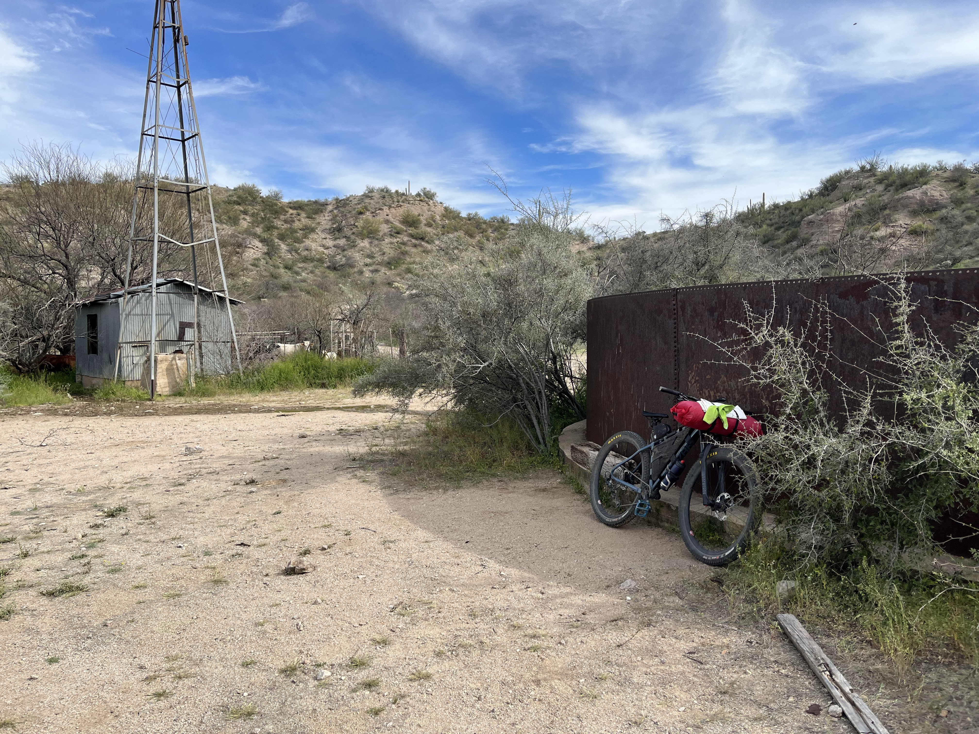
Up next is the Mt Lemmon HWY climb. It's a 14ish mile climb up a consistent 5-6 percent grade. On a loaded bike it is work. Before that though, you gotta get a bit more dirt in on the AZT between Molino and Prison Camp (Gordon Hirabayashi Campground). I hiked the vast majority of this. It was hot in there. About 10 MTBers passed me here, going in the much desired downhill direction. They all kept the stoke high with positive comments for me as I did more pushing. Finally reaching the campground, I found some shade, pounded some water and electrolytes and applied more sunscreen.
Time to grind away to the trees!
This was pretty hard work, but eventually I found myself at the Bigelow TH where I forced myself to finish off the rest of my water and then got just a liter or so to get me to Summerhaven. Also, in a PRO move, I ate some of my quesadillas. I was close to Summerhaven, but the challenging Sunset trail was close. It isn't long, but it is fairly rugged/slow going. I remember getting mad in there last time, because all I could think about was food in town, but I was frustrated by the trail. By eating a bit before getting in there, it went much smoother and was a much more positive experience.
That's not to say there wasn't some BS in there though haha.
 |
| Starts off innocent enough. |
 |
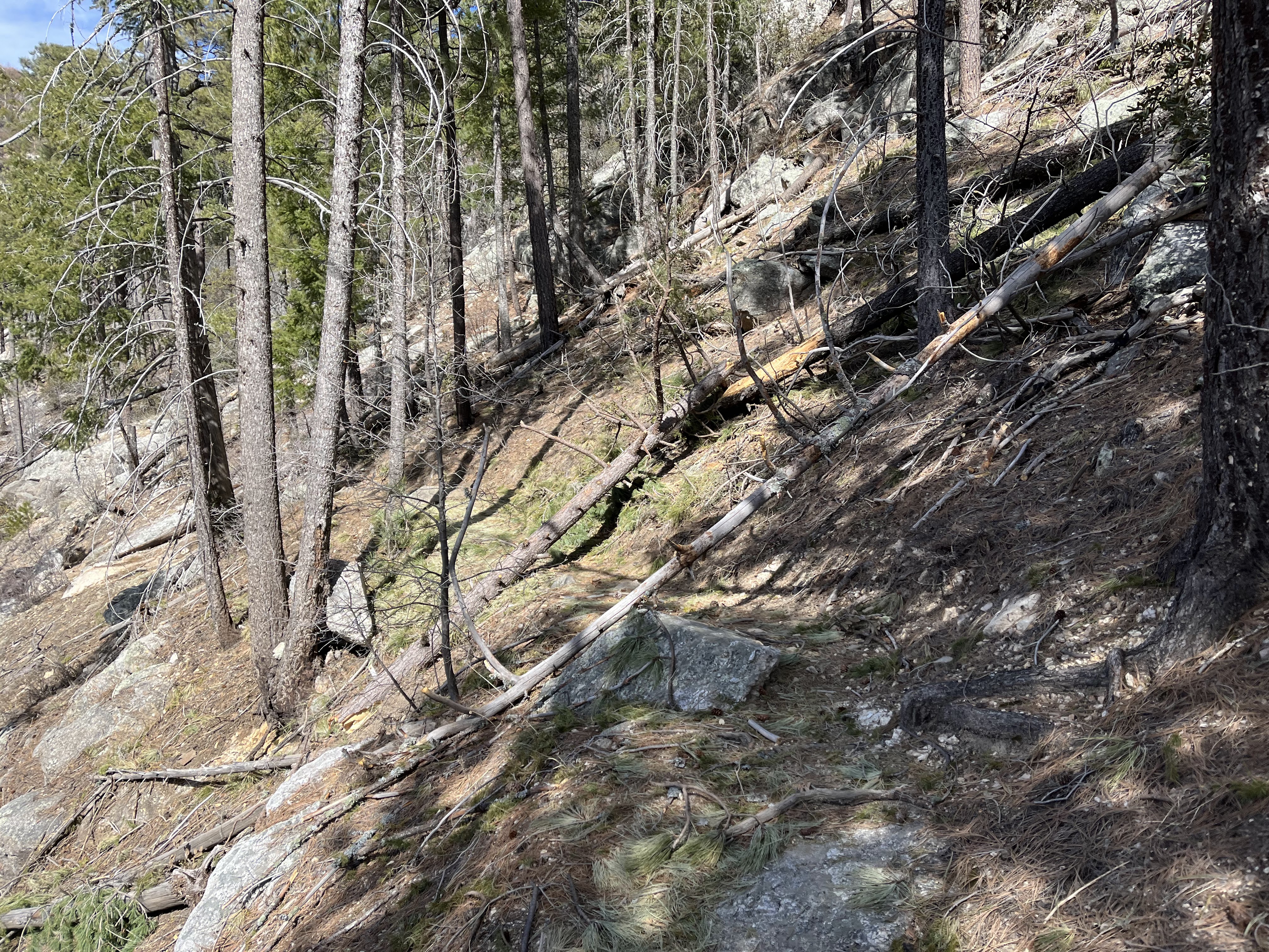
| Massive downfall across the trail |
 |
| More downfall. This was after a challenging bolder hopping part that is awkward and has large penalty for failure. Take extreme care navigating it. |
The water was flowing huge down here and part of the trail had been washed away. Somehow I kept my feet from getting too wet and finally was able to begin the uphill slog to the town.
 |
| Great success. |
There was a waterfall that was accessible by the road, so I used it to wet my microfiber cloth so I could clean up my face and get a bit refreshed before heading to the general store. Felt great. As I was leaving, there was a couple hiking up behind me and they said I had dropped my glasses! Thank you! That would have been disastrous to not have them.
I stopped at the general store and got what I thought was enough to get to Picketpost. I really didn't want to go to Oracle. I ended up getting one of those pickles in a sealed bag. It looked real good. Plus a ton of other stuff. A sandwich, a tub of macaroni salad - that was a first for me lol.
I went outside and crushed the pickle and drank all the juice. It was good... but do you ever eat something and something just isn't quite right about it? I had a weird vibe from it but didn't think much about it. I tend to have a pretty bulletproof stomach.
I headed up the hill to the restaurant - it looked pretty damn busy so I just said screw it and bypassed it. Not getting a meal here almost really screwed me.
I stopped at the community center to use the restroom and top off water. Of course being the end of the day, the people are in there wanting to clean it and I just wanted to clean up in peace. Oh well. I didn't linger long, I wanted to get out and take advantage of the remaining light to tackle Oracle Ridge.
 |
| It's not all HAB... yet. |
 |
| Vegetation starting to take over again after it all got burned away during the last fire up here. |
My guts started to twist up in here. OK whatever I can just work through this, it's not the first time.
 |
| Had to find a way around this guy. |
Suddenly out of nowhere, my body told me that I needed to get off the bike NOW. A wave of panic hit me and I threw my bike down and worked on taking off my helmet, pack, and shirt so I could get my bib straps down. All while trying to scope a place as far as possible off trail. Options were limited but I found a suitable place next to a barbed wire fence. Dropped the bibs, held onto the fence, leaned back and held on for the ride. Holy hell. I haven't seen that color since the last time I changed a dirty diaper. Pretty sure it was the pickle/pickle juice.
Through some stroke of genius/luck I was very fortunate I still had some previously used wet wipes back in my trash. I would use the old ones to do the bulk of the cleanup and then use fresh ones to finish the job. I had an extra pair of socks that could be sacrificed as well if needed but luckily I didn't need to.
I am still thinking about this "interaction". Did someone really say that or did I imagine it or what? All I know is I was hungry and needed calories - I had been daydreaming of eating my macaroni salad. I decided to ride down a bit on the jeep road before eating even though I really wanted to rest my back against the AZT gate but as mentioned I wasn't staying there due to the mystery voice.
 |
| Crushed the whole thing haha. I had cell service since I had clear sight of Oracle so I checked my phone for any urgent messages. Nothing really of note so back on airplane mode it goes. |
It was at this point that I knew I was stopping early. The next segment I am familiar with as I spent a lot of time this fall on it while I did trail trimming. I knew it was much more rideable, at least in the daylight. I knew if I tried at night it would be more hiking.
Before this segment though are some horrendously steep jeep roads covered in rubble/babyheads. I pretty much walked all of that but I knew when it mellowed out I would find a place to crash. Sure enough, I spied a spot to the right and set up and crashed out in minutes.
 |
| Shitty moon pic just before camp. |
Day 3 Garmin Totals:43 miles
8,225 ft climbing (RIP)
Day 4:
 |
| Wake up! Big day on tap. |
I had basically an eight hour break here, and I woke up feeling great and motivated - I was looking forward to seeing how far I could get today. The furthest I have ever gotten on this day of the race is the ADOT yard in Kelvin. Both of those times, I was starting within a half hour of the Tiger Mine trailhead. I was still three hours from there. Let's GO!
 |
| The start of the segment I am a steward on. I was curious to see how the trimming I did in October had held up. I also know there had been some other maintenance by the VET trail crew and I was curious to see it. |
 |
| Still gotta make my way all the way down. |
 |
| As the trail gets lower, it mellows out and is fun to ride, save for some of the very awkward and janky waterbars on Cody Trail. |
I noticed a few spots of excellent trail work by the crews who were out there recently. Including fixing the badly rutted area before hitting the waterbar section. Excellent work, folks! My trimming job was still holding up pretty well but I am going to try to catch a trip up there during a weather window hopefully in September. That manzanita grows fast!
 |
| The AZT in Oracle State Park is great, fairly easy riding which is good because the trail is gonna get more challenging soon enough. |
 |
| I made it to the HWY underpass in pretty good time. I took advantage of the shade here to eat a bit of food and apply sunscreen. Cool mural underneath and I think my bike is just her size! |
 |
| On the Tiger Mine segment and the initial climb gets some big views for you. |
I noted it was feeling really "snakey" today and I was gonna be shocked if I didn't see one. Almost right on cue, as I was descending to the first wash, I heard one of to my left. I didn't stop to investigate though.
I rested here for a bit and drank two liters of water/electrolytes and topped off my containers. Should be more than enough to make it to the ADOT yard. That is still a big ask of a day though. That is the furthest I have ever gotten on this day, remember?
 |
| Leaving beehive well, there is a sandy road that is too much effort to ride usually, and that was the case today too. |
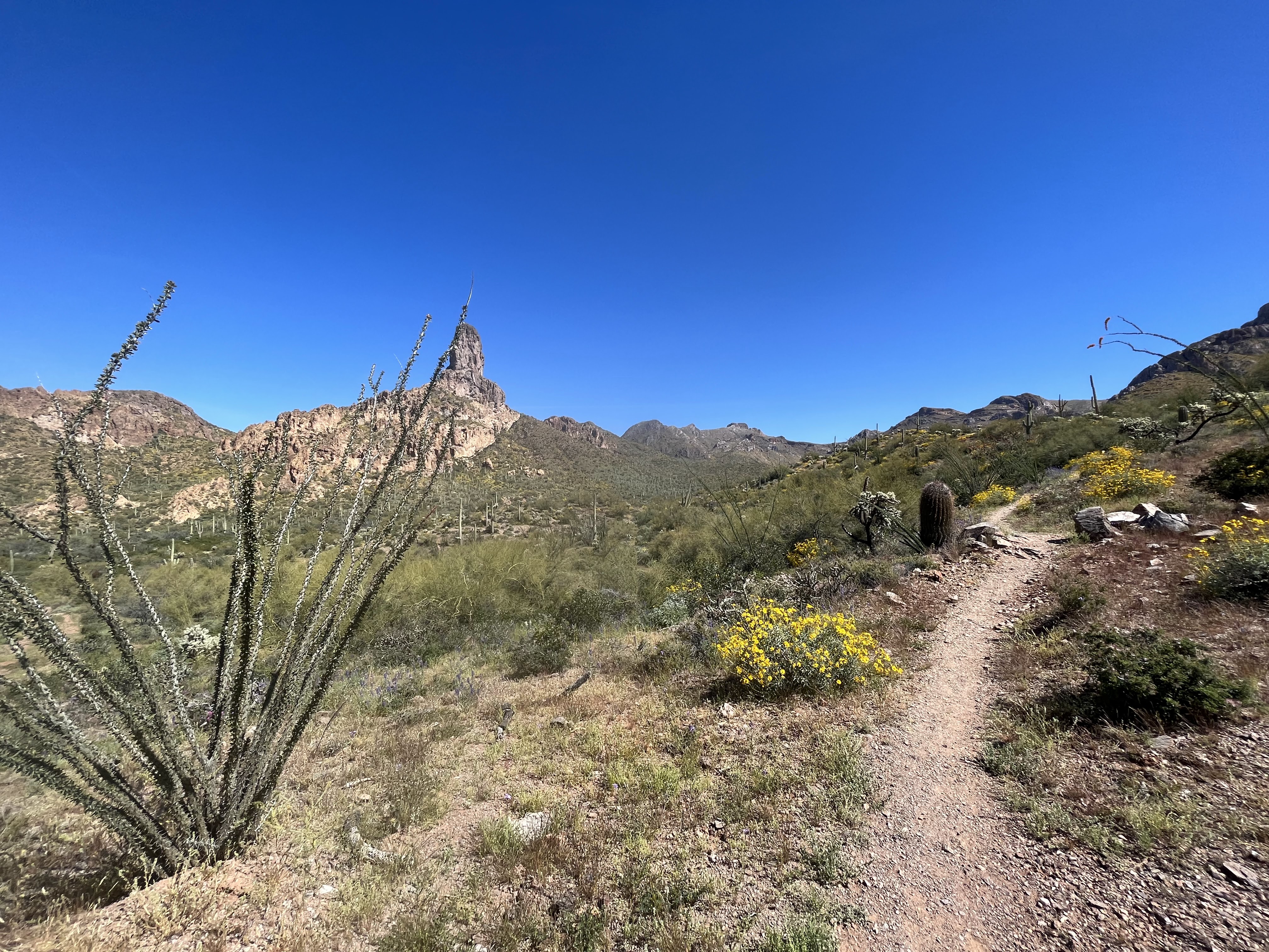
After the sandy wash, there is a pretty gross HAB to get out of there but then it is primarily rideable and Antelope Peak becomes a short term objective after staring at it all day.
I have no idea what happened, but I felt super, super strong in here. It was so amazing feeling so strong and that momentum just built and built and built.
Bombing through the tortilla mountains/boulders segment, the only thing challenging was the sun was in my eyes for most of it. Came across a few thru hikers including one who started a conversation after I passed him. He was MOVING, so I pedaled about 10 feet in front of him and we talked about the last bits of trail. He asked how us bikers were able to get through Oracle Ridge and I said "by doing the same thing you are" lol. I finally said I had to bolt and we said our goodbyes. Before I knew it, I was at the famous self closing gate which is in better shape than the last time I was here - just don't decapitate yourself on the wire lol
 |
| Prepping up for night riding here. |
 |
| Night falls rapidly |
 |
| This is cougar hill. Named for good reason. Can't wait till it is officially adopted so it sees more traffic and won't look like this lol. |
Before I knew it, I was approaching "the big hill" AKA Ripsey. That seemed impossibly early, but damn I'll take it.
 |
| This was the first of many enormous fallen saguaros. Most had been cleared from the trail thankfully. |
It's kinda spooky down in the wash, not gonna lie but I didn't get any weird vibes so it was all good. I was listening to my downloaded AZT playlist and Michael Jackson's "Thriller" came on and as soon as I heard that first wolf howl in the song I skipped that one. Yelled out "fuck that' to whoever might hear me. Made myself laugh.
Before I knew it, I was on the many switchbacks en route to the top of Ripsey. I turned the corner on one of them and was blown away by a fireball colored moon in the sky.
 |
One of the coolest things I have seen on trail, ever.
|
I passed a few tents on the top of Ripsey, and prepped myself for the ride down. Last time I didn't do so well but I was pleasantly stoked at how much better I rode this time.
 |
| Right before the descent down to the Ripsey TH. I was bummed to miss seeing this in the daylight, there were so many flowers along the trail. I bet it looks amazing! |
I made it down to the TH and knew I had a bit more trail on the other side of the road before reaching the ADOT yard. I was so stoked to have made it, I knew I was going to get at least started on the trail along the river which would mark the furthest I have made it at this point in the ride before. Stoke was high.
I got to the water spigot and downed some water and took stock of my food. Shit, I was gonna be cutting it really close with food, Should have either gotten the burger back in Summerhaven or gotten more food at the general store. I sure wasn't going to wait here until the pizza delivery place opens (yes you can get pizza delivered here!) so I'd just have to roll with what I got. It was doable, but not great.
I decided to get started on the trail and see what presented itself for camping. I was debating pulling an all-nighter but ultimately decided to sleep for 5 hours. If I had to do it again, I would have pushed though the night.
Day 4 Garmin Totals:74 miles
8,560 ft climbing
Day 5:
I woke up feeling good and excited - it was Easter Sunday and I was beyond grateful to be in this place on this day. I KNEW I was going to finish this. It was going to be hard, but it was getting done, no doubt about it.
 |
| I lucked into a beauty of a spot. |
 |
| Moon showing off looking to the west. |
 |
| Absolutely 100 percent magical. |
 |
| Train trestle below above the Gila River. |
 |
| Close to river level here. So lush. |
 |
| Gila river shrouded in trees and usually hidden from view. Visible here. |
 |
| The visual of these flowers reaching to the sun had me contemplating all kinds of heavier spiritual matters on this day. |
 |
| Absolutely huge saguaro had fallen down from above. |
 |
| Stunning visuals around every turn |
 |
| Sea of purple here. |
 |
| Right before the notch you get a great view of the river. Flowing super well. |
The climb up from the river to picketpost is intimidating - no doubt about it. And I am glad that this area is hard to get to and travel through. Because if it was easy it would be overcrowded. It is easily one of the most awe inspiring places I have ever been through.
 |
| Not long after starting the push up, I came across this pair of rattlesnakes mating. So cool. |
There is plenty of rideable stuff in here. And lots of pushing. It was getting pretty dang warm. I probably should have rested more but just pushed through knowing the end was in sight. I know if I was riding beyond picketpost, I would have rested more through here.
 |
| Cool geology in here. |
 |
| Top of picketpost becomes visible. |
 |
| These things SUCK! I might hate them worse than catclaw. Super sharp and right at handlebar level. Hitting them at speed meant needle like penetration into your hands. Wish I had leather gloves for this. Or a flamethrower. |
 |
| Final gate on the AZT! |
 |
| I was getting roasted. There was a bit of flowing water here and I used it to wet my clothing. |
I was ready to be done. But man those last couple of miles take forever. So many stupid rocks, and it's just like "WHERE IS THE DAMN TRAILHEAD", then suddenly out of nowhere you get dropped into a wash and the final rise out of it. It is so unexpected every time. It's almost magic. I saw a few people cheering under the new shade structure and WOW it was Alexandera and Johnny! Oh and Crispin too! He had just finished his ITT the previous day.
 |
| Photo by Crispin! Thanks dude! |
I sat down next to them and asked them if they think they add rocks to those final miles every year. Sure seems like it to me. We all laughed about it. Johnny offered me a cold beer and I gladly accepted.
Alexandera and Johnny took off to finish prepping for their southbound ITT's starting the next day and Crispin and I hung out for a bit and chatted. He too eventually left and I sat there contemplating my options.
As I sat there a trail angel "Paint Your Wagon" or just "Paint" offered to take another hiker back to Superior and asked if I could use anything. I put in an order for a couple of sandwiches, chips and sodas from the circle K. He obliged and at this point I found out from someone else that if you stand by a certain tree near the parking lot, you can get better cell service. I ended up explaining my situation to my sister and she said she was on her way. OK sweet!
Paint showed up with some "sandwiches" from Circle K and they were gross but I crushed both of them and got started on the chips. Oh, did I mention I finished the ride with a half bag of corn nuts? lmao. Cut it real close there.
Paint asked if I wanted another beer and I said hell yeah and I ended up having 3 before my sister showed up. I was feeling good lol! Post ultra beers hit way different! We talked about all kinds of things and I enjoyed the company.
Next thing I know my sister rolls up, I apologize for my haggard and stinky condition and I loaded up my stuff and we were on the road.
Day 5 Garmin Totals:35 miles
5,584 ft climbing
I learned a lot from this one. Heading out on these routes solo is a very unique experience and I am thankful to have redemption from my last DNF of this route. Nothing is a given on it, so having a 2 out of 3 success rate is something I am really proud of. Looking forward to October!
I want to thank John Schilling
(John's blog) for all the work that goes into this route. It can be thankless at times and downright cruel at others. I'm not gonna get much more into it, but let me put it this way: we need more people like John, not less.
Also, if you enjoyed reading this adventure, consider donating/joining the
Arizona Trail Association - without their tireless work and vision this adventure would not be possible.
Some short videos/commentary I took on each day can be found at
youtube