The dirt. The solitude.
The desert.
It calls me. It pulls me - through the days and months of an existence that in lots of ways is a strange mix of tethered yet also adrift. I think parts of me are just broken and jacked up beyond repair. I'm jaded and the current state of the world certainly isn't helping any of that either.
The desert doesn't care.
It doesn't care about my problems. It doesn't care about politics. It doesn't care about the pandemic. It doesn't care how fast or slow (mostly slow) I move through it. It just offers itself as a respite from the daily meh.
Note: This is a modified version of the official route found here. I live in the northwest valley, so I changed up the routing so I could start and finish at home. Ultimately, this cuts off some mostly flat mileage mainly to end the ride. I ended up cutting off the "optional" northern loop of the BCT. I'll get into the why later on.
Day 1 - Home to the first riparian area after Sheep's Bridge
I knew I wanted to get past sheep's bridge today. I had a feeling according to some map scouring that I would have some treed options about ten miles after the bridge so that would make for about a 70 mile day, so I got out right at sunrise at 6:30ish.
 |
| Ready to roll. Yeah it's inside the house idgaf! Who's gonna tell me not to? |
 |
| Good morning - Pyramid Peak on the neighborhood rollout. |
 |
| Skirting along the edge of Deem Hills. |
 |
| I-17 pedestrian bridge |
 |
| Entering PSP for a brief ride through |
 |
| Tasty singletrack |
 |
| It's balloon season... |
 |
| Landing literally wherever the wind takes them... |
 |
| The flatlands northeast of Apache Wash |
 |
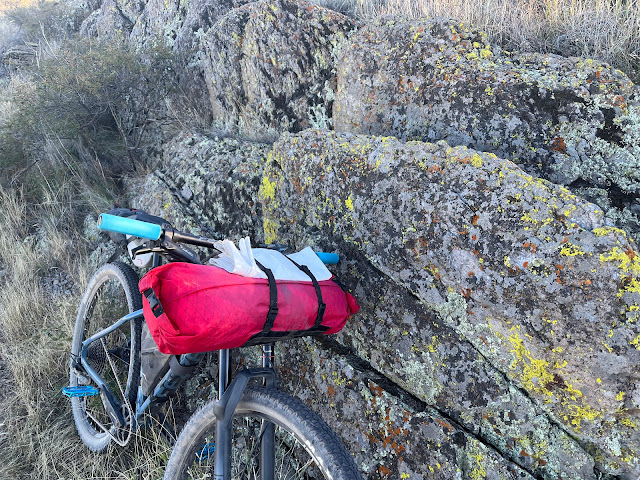
| Bikepacking. Fueled by poptarts. |
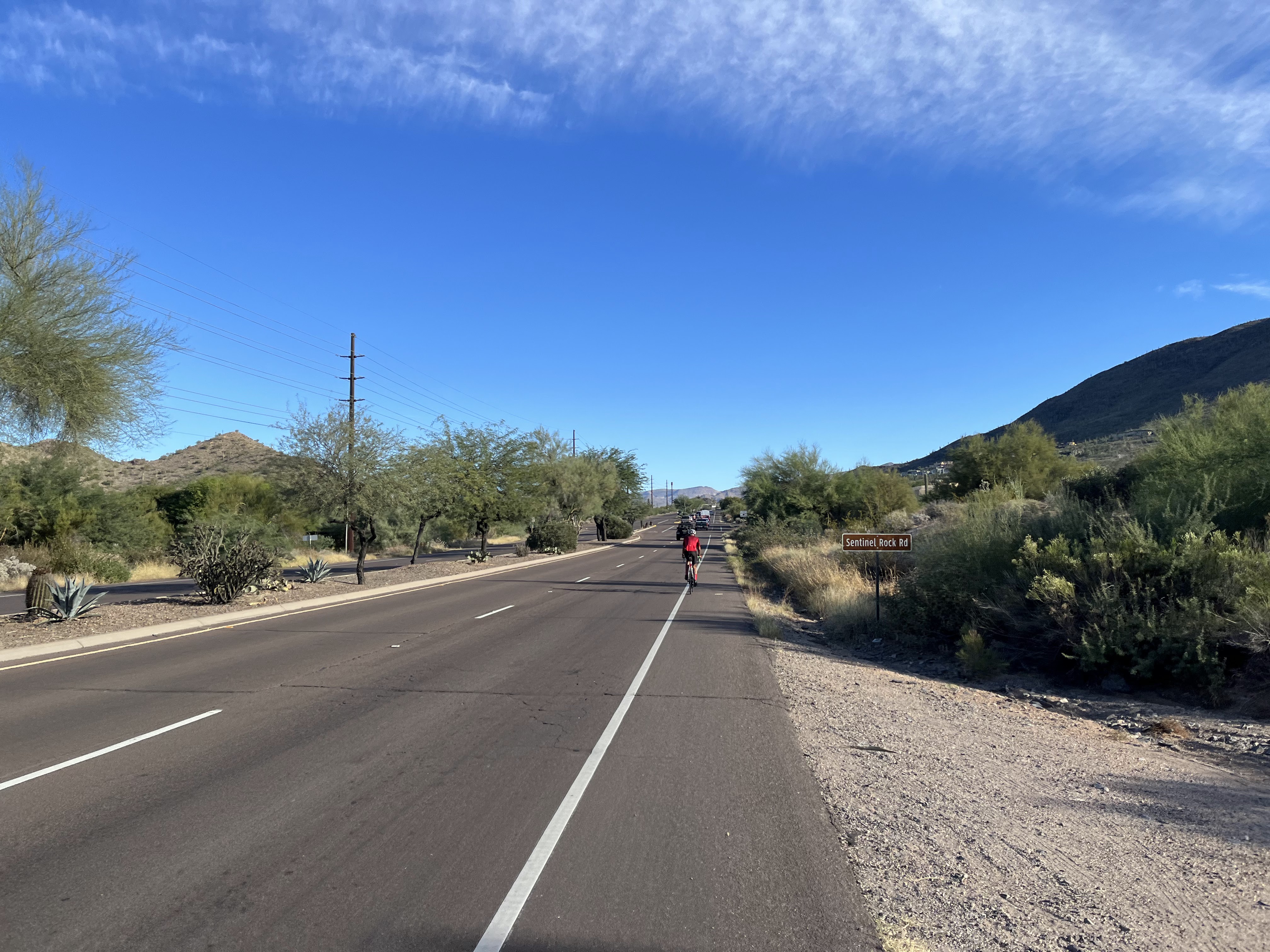
I grabbed some pavement via Carefree HWY and Cave Creek road. It was just about rush hour, and carefree hwy was especially unpleasant. I made the turn to head north on Cave Creek Rd, and the vast amount of traffic was reduced, though the smell of diesel exhaust was hard to escape for a bit.
 |
| Entering the quirky town of Cave Creek. |
 |
| Kept up with this guy for a while. Somehow I got a PR on a segment out here even though I was loaded down with gear. LMAO.
|
 |
| After turning off of Cave Creek Rd, I am riding into brand new territory for me. |
 |
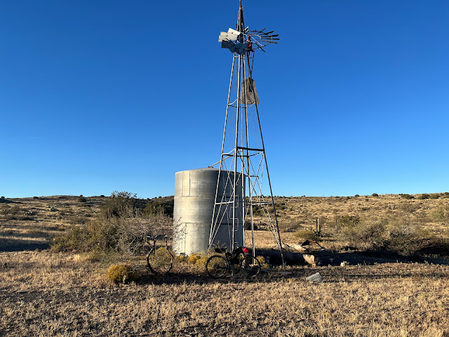
| Message board and convenient water refill location |
 |
| I disagree with the message of the sticker :) |
 |
| Not everyone's idea of a "forest" |
 |
| Mild climbing and some burning descents. On this climb, I was sure to dial back my effort to stay within the speed sign recommendations lol |
 |
| After turning off onto Horseshoe Dam Rd, broken pavement turned into dirt. There was a lot of damage in here from the monsoon storms this summer, but had been somewhat worked on. The amount of sand that was pushed off the road was amazing. There was still plenty on the road, but that actually helped keep the speed down on the descents so I didn't have to use my brakes as much. |
 |
| First view of surface water |
 |
| Desert doing a muted version of "fall colors" |
 |
| So many saguaro! These were massive. |
 |
| Heading up towards the dam, can see the river on the downstream side. |
 |
| Horseshoe Dam |
 |
| Would love to see this in times of high water. Water flows over the top of this walkway. |
 |
| Surprised to see the gate wide open. I bet it gets locked up when water is flowing over the top. |

 |
| Found a shady spot to have lunch. |
Leaving the dam area, it was a bit after noon and I knew that I wanted to get to Sheep's Bridge and beyond. I was shooting for some riparian areas so I could camp in an area with big trees... a rarity in the middle of the desert. But first, I had some fairly level riding to get done, though there were some steeper bits that had me pushing my bike on occasion. The heat of the day wasn't helping but it wasn't unbearable.
 |
| Cows had the right idea and were hanging out in the shade. |
 |
| Some steeper bits had me walking occasionally. |
 |
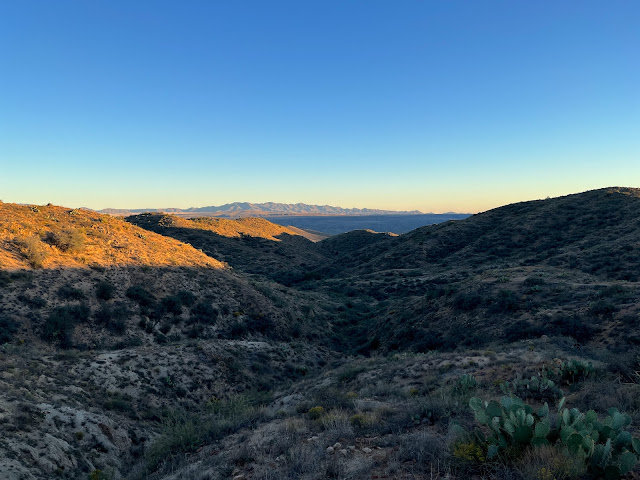
| The views in this area were really neat. |
 |
| Steep and rubble filled road equals HAB (hike a bike) |
 |
| A forest of saguaro |
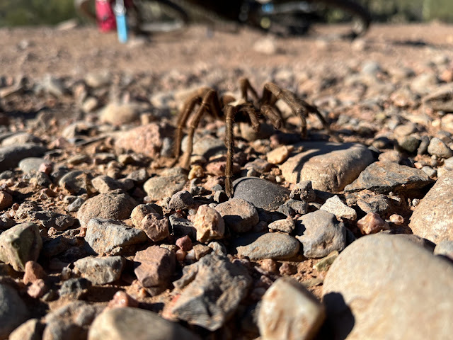
There was a little descent prior to arriving at Sheep's Bridge and I almost ran over this tarantula. I saw several of them during the trip.
Right after this, a SUV came up the hill from the bridge area. They seemed a bit concerned to see me, they asked if I was good and I told them I had only stopped because I wanted to grab a picture of the tarantula. The driver asked me if I was doing the big loop so I confirmed that yes I was. The older passenger told me to be careful, that nobody was around out here. I told him that's just the way I like it :)
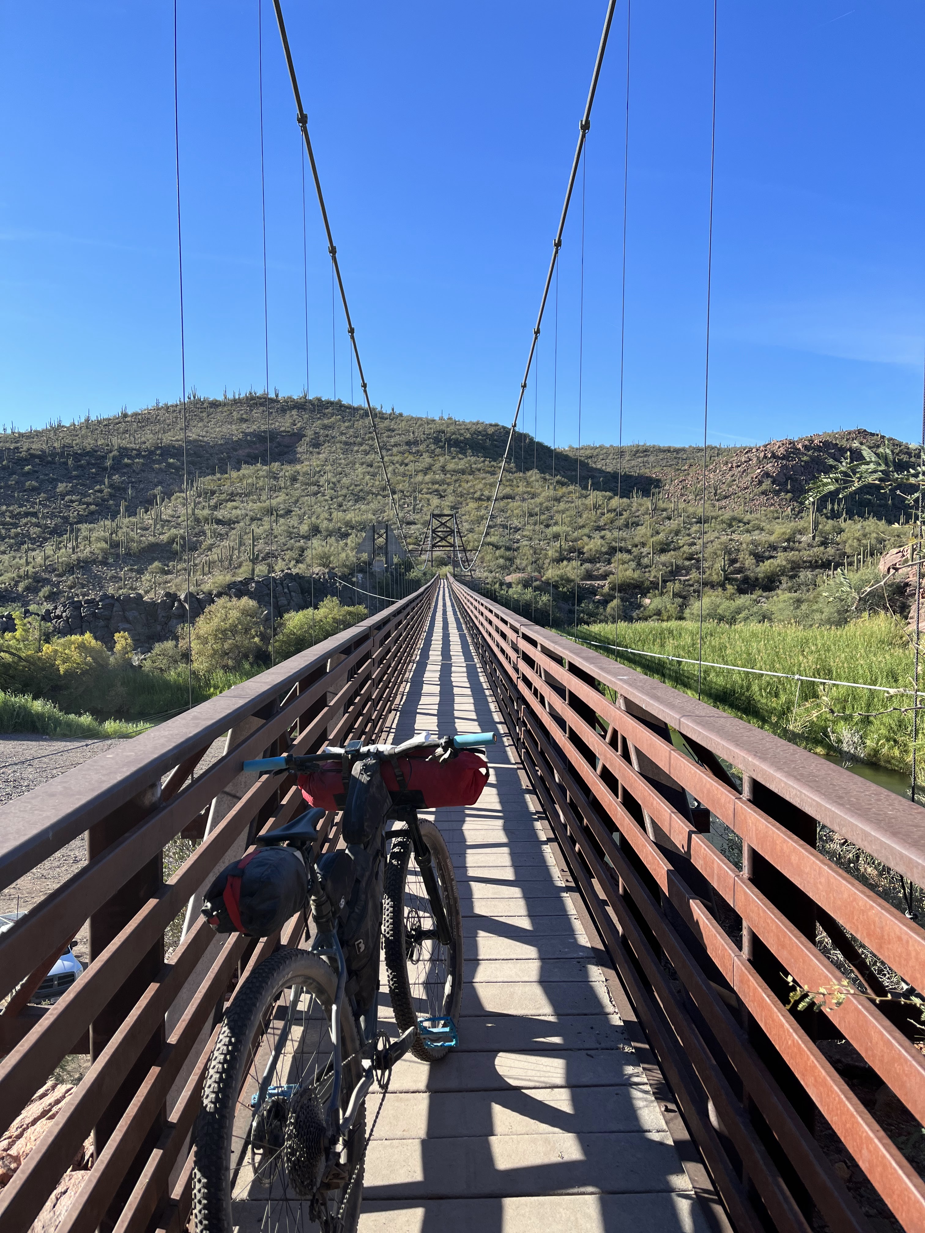
After that, I went down the hill and around the corner and I see the bridge I have been so anxious to see.
 |
| Sheep's Bridge |
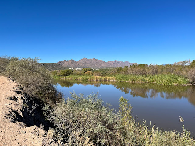
This place is literally an oasis in the desert. Towering trees and reeds and cold water. I took a bit of a break here to filter water and have a brief rest before starting the climb up towards Cordes Lakes. I knew it was a hefty one. Also, my goal for this whole trip was to not really ride at night. I wanted to enjoy downtime at camp. Didn't really want to suffer too much on this adventure...
 |
| Shade and water - not much else a desert bikepacker could want. |
I pushed my bike up to bridge level. It's a really impressive structure, and its purpose really is to facilitate moving sheep across the Verde.
 |
| View while crossing to the other side. |
After crossing the bridge, the climbing started in earnest. It didn't take long to be high above the river.
 |
| A couple mini homemade bean/cheese burritos and an orange soda for dinner. Using my shoe as a can holder to prevent spills haha. |
 |
Lovely spot. I might not choose this if it was a weekend due to being right next to a road. Since it was Wednesday night, and I hadn't seen anyone I was pretty sure I was good for the evening.
Pretty amazing first day. Here's the Strava link...
|
Day 2 to BCT near Crown King Rd.
I had a really relaxing evening and good rest. It was colder than I expected and woke up to my GPS saying it was in the 30's. It felt like it and I was able to see my breath. I was in the low point of this mountain area, so I guess it make sense.
 |
| My bike dreams of going that fast... |
 |
| Damn, I need a haircut. Also, excuse the crusty salt on my face. |
 |
| Food and drinks! Burger and fries for now. And a burger to go for later... |
 |
| Yes. |
I took my time here, relaxing and hydrating and staying out of the mid-day sun. Taking the northern BCT loop out of the equation moved the ride back to the fun side of the scale. I really underestimated my motivation for longer solo rides when there is no event tied to it. I also now realized why bikepacking.com states this is a 4-5 day ride. That would definitely be a more fun pace. Noted.
After a nice break, I decided I needed to get going. I was going to hit up the gas station in Spring Valley to top off my water and pick up a special treat to go with dinner. Then I figured I could get down to the bottom of the Antelope Creek section of the BCT and still make camp while it was light out. I was excited to hit some amazing singletrack. Let's go!
Also, I listened to some episodes of "The Session" which takes myriad styles of modern music and breaks them down including getting the isolated studio tracks so you can hear the details that you might not have heard in context of the whole song. It's really cool if you are into music.
Anyway, the one that got me super emotional was a breakdown of Queensryche's "Silent Lucidity". In short, the full orchestra parts are something of a masterpiece. I was already in my bivy but was tearing up and needed some fresh air so I poked my head out and saw the vast universe. It felt like it was mere feet above me. It's really hard to capture night photos without a tripod, but this got pretty close. There are a couple of phantom light dots but this was actually pretty close to what I saw.
Anyway, I pretty much lost my shit right there in the desert, but I am really thankful that I did. I won't forget it.
Strava link of day 2:
Day 3 - Crown King Rd to home
I slept great and woke up to pleasant temps, but it was warmer than I was hoping. The BCT gets notoriously warm - the canyon walls retain and radiate heat it seems like. Shade is also scarce. To compound this, BCT miles are also fairly slow miles. Lots of turns and switchbacks drag down average speed. It's just work even on fresh legs and an unladen bike.
 |
| Early morning light touching the Bradshaws |
 |
| The light glistened off a spider web. I went to check it out and was hoping to grab a picture of the spider in the middle of the web. It sensed me and ran off to the side of the web. Still got him though. |
 |
| Always changing artwork on metal |
 |
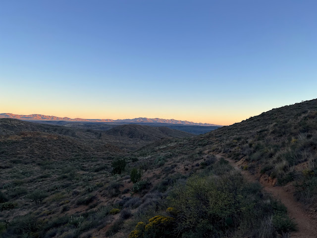
| Trail is fairly fast and flowly at first |
 |
| Winding trail. Sunset point rest area is perched on the hillside on the left. |
 |
| Definitely rode slow.. you know, for safety. |
 |
| Definitely #loco |
 |
| Still had plenty of water so didn't filter here. Didn't want to carry extra weight that's for sure. |
 |
| Bumblebee Ranch below (which I skipped) |
 |
| The trail here is cool and was in the best shape I have seen it surprisingly. It sure does drag on though. |
 |
| Do this many times. Rinse and repeat. |
 |
| Views of the north part of the valley on a fast downhill. |
 |
| There were some puddles remaining upstream a bit, but no running water here today. |
 |
| Tough switchback and steep climb here. |
It was definitely getting hot. My GPS unit broke the 90 degree mark around 11am. Ugh. I was having trouble staying hydrated, and I was looking forward to reaching some flowing water at the Agua Fria, which is a reliable source on the BCT - well at least the crossing immediately north and south of Rock Springs.
 |
| Easy crossing and cold water to filter. I tried to tank up as much as I could. I was behind on fluids. |
 |
| The climb up from the river is steep. But don't worry, you get to bomb down the other side. And then climb again. |
I briefly thought of dropping down to Rock Springs, but the pull of getting home was getting stronger. Was figuring on a two hour round trip if I went into town if I were to get food at the cafe. I didn't need the food, so dropped down to the Agua Fria again.
 |
| It was damn hot. I soaked my clothes with the water while a bull watched. |
 |
| Bull in the background if you zoom in. |
 |
| Doesn't take long to gain plenty of elevation. |
I was melting and the lug-nuts on the wheels were starting to get loose haha. Temps were still in the 90s and I was desperately wanting the sun to go away. The number of pictures I took started to diminish as my mindset did the same.
 |
| I felt like this dead saguaro. |
Sometime after this, the sun finally was low enough to allow me to remove my long sleeves, which I did at a dry river bottom. I noticed a bull a hundred yard away and for some reason I decided that I wanted to communicate with him by yelling random bullshit at him. I have no idea??? I was just kinda out of it. Next thing I know I look up toward him and there was some dust behind him and he's moving my way. Uhhh. I talked in a more calm manner to him but he didn't stop just kept creeping closer like a damn serial killer in the summer horror flicks of old. I decided I didn't really want to figure out what his intentions were so I hastily decided I had to get the hell out of there.
Of course, my stuff was scattered like a yard sale. I was in the middle of switching clothes, putting lights on the bike, had snacks out, etc. I'm a damn idiot for yelling at that stupid bull haha.
I can see it now. "Bikepacker found dead after being gored by a bull after talking shit to it. Film at 11"
Luckily, it was an uphill push of about 50 yards and there was some fencing and a half gate that I hopped over. I felt better and didn't see anymore of that guy. I won't be yelling at bulls anymore.
Continuing on...
 |
| Trying to find the beauty in the suffering |
 |
| Another bull that I coaxed of the trail. |
By time I reached Table Mesa Rd, I was completely shelled. I had nothing left in my legs and the effort of the last couple of days had rendered be unable to ride the last couple of upcoming major climbs. It might have been doable on an unloaded bike and fresher legs. But the babyhead strewn trail was too frustrating for me to attempt. So I walked. Almost all of both climbs. Brutal. Even some of the descents were slow going just because I was feeling tired and sloppy. Just had to get to Emery Henderson TH and I would be home free.
Narrator: He would not be home free
 |
| Doesn't look bad, but it was tough riding. This is the final rise to Emery Henderson. I didn't even realize it till I got up to the reflective sign. I think I was expecting some lights to be on there, but there weren't any. There was a bikepacker crashed out on a table though. |
That was my last picture. I was looking forward to some flat and not rocky riding to get home. I did find that the BCT was better signed through here than I remember. That's good because the trail isn't super visible on the ground. Even the Agua Fria crossing had good signage. It was easy to navigate through the boulder field there. Partway through this section, I swore I heard a crazy man yelling at me like he was losing his mind. A few seconds later it clicked at it was just a donkey vocalizing his displeasure. Freaky.
As I reached the terminus of the BCT at Carefree Highway, I noticed that the state trust land on the other side was now marked with many construction signs and.... pavement?!?! wtf?
On one hand I was stoked because it was slightly downhill and fast moving. However as I approached the 303, I realized the fence I was anticipating to jump over was replaced with many flashing lights and also security personnel. I didn't realize that this land had been purchased on this side of the 303. They are putting in all kinds of infrastructure for the semiconductor manufacturing facility. Anyway, I really wanted nothing to do with gatekeepers, there was plenty of heavy construction equipment around and I figured my best shot for getting home was to try to avoid them and find a way to go under the 303 at Deadman Wash. I wasn't sure if there was a fence under it, but I figured worst case I would continue west along the 303 until I got to the CAP canal.
I was now out of water, hungry, and in a bad mood haha. So close, yet so far from home. I was bushwhacking and had to jump a barbed wire fence which led to a concrete culvert which led me to Deadman Wash. Started under the freeway praying for no fences. Wish granted. That was just the first challenge though.
Now I was in the desert north of my house in the pyramid peak area, but I was having a hard time getting south to where I knew there were some jeep roads that I could use to get back to my neighborhood. It was so frustrating - open paths would just dead end with impenetrable brush/vegetation. Or barbed wire. Or steep banked washes.
Mercifully I came across a familiar cattle tank that allowed me to understand where I was and I knew that a jeep road was on the other side of it. YES!!!
Got to the house, immediately slammed a bunch of water and put a frozen pizza in the oven. I guess that's livin'
What a trip, and what a great route. I need to do some easier bikepacking rides haha.
If you do this, I recommend taking the recommended time as per bikepacking.com. Also, don't do it if temps are forecast in the 80s for Phoenix. 70s would be better and 60's would be ideal.


'I need to do some easier bikepacking rides' Where have I heard this before?? Hmmmm. Well done, Mike. Really enjoyed the read. Let's ride!! Perhaps something not stupid?
ReplyDeleteHi Mike thanks for this detailed write up I’m just going through it now as I’m planning on riding the loop mid April I had a question how far is it from your first night campsite to tangle Creek?
ReplyDeleteHey Paul. Technically, my first campsite was right after a small crossing of tangle creek. From there, you are in close proximity for the next couple of miles which is where you would come across the big tree flat area that I took a couple of pictures of (with the very worn sign).
DeleteAs far as your timing, just watch the temps. It's gonna be hot here the next week or so but then looks like a potential cooling trend. Who knows how long it will stick around. I highly suggest a good amount of caution if temps are above 80 especially on the BCT or if you are trying to make the big climb to Cordes Lakes in the heat of the day.
Thanks Mike. I’m coming from NorCal so yes heat is a concern. Sounds like a tent would be optional as there’s not much chance of rain.
DeleteTent definitely can stay home. I brought my bivy just because I wanted some practice using it. It added a few degrees of warmth for first night which was nice but not necessary. Cowboy camping at its finest.
ReplyDeleteIf you have the flexibility, riding the route in warmer temps is more doable if you can plan on finding some shade in the heat of the day. Easier said than done at times but possible.
We have ridden the Baja divide so definitely know what you’re talking about as far as getting out early and taking it easy in the middle of the day really appreciate all the tips!
DeleteHi Mike we’re heading out tomorrow. Any intel on where to leave a car safely for a week?
ReplyDeleteTruthfully I am not that familiar with the airport area (start point) in regards to "safe" parking, but if I were in a position to make that decision, I would likely eat the cost of parking in the economy lots at Sky Harbor - it's like 14 bucks a day but to me it's a bit more legit.
DeleteYou could always take your chances stashing it at a larger parking lot (grocery/warehouse store) or maybe a larger hotel that offers free parking??
Like I said for lack of stress I would choose to pay the long term parking fee at the airport. Have fun - temps are gonna start shooting up here...