I don't know how the thought of doing the Colorado Trail Race (CTR) got in my brain, but it's likely due to just needing a change of scenery/focus in my bikepacking endeavors. I had gotten so focused on the AZT800 route that ultimately got shut down by a very wintry year in northern AZ. When that idea fell apart and I ended up settling (bad word, I loved every minute of it) for an ITT of the AZT300 in the spring of 2023. I just had to let the AZT go for a bit. Doing a trip outside of AZ (Escape LA in the fall of 2023) further solidified that it would be a good thing to broaden my experiences.
I had experienced small glimpses of Colorado dirt over a couple of years - even a small overnighter. That said, I was overwhelmed and intimidated by those big mountains. It's nothing like anything here in AZ, and the majority of my apprehension was centered around the average elevation of the route (above 10k feet) and the weather associated with those high elevation mountains - particularly during monsoon season - which of course the race falls right into.
I'm not particularly fast out there; I tend to be very cautious and calculating both in my riding style and decision making, so I knew I would be out there for quite a while. I was hoping for 8-10 days, figuring I would be on the longer side of that. Turns out I was pretty good in that estimate. I likely could have gotten to that 8 day mark if I chose to ride more at night, but as I thought about it, this really was a case of "this might be my only year to try this route" and I really wanted to see as much of it in the daylight as possible. There was a scenario where I saw myself doing an overnight push, and that actually ended up happening, but you have to stick around for that part of the story. To be completely honest, most days put the hurt on me and I think the altitude bothered me more than I was realizing at the time. I suffered from some pretty bad headaches that essentially stopped me in my tracks on a few nights. I never get headaches. So even if my ego says I could have moved more, my body during the event was yelling back at me, "umm, no". I had no intention of having a battle with the CT - I would graciously accept what it allowed me to earn and tried to be OK with that.
In retrospect, I am really pleased with how I executed out there and how I ended up at the finish line in Durango feeling surprisingly healthy, having seen a vast amount of the route. For that, I am beyond thankful. While it might sound cheesy, I really did feel the momentum of the riders in front of me pull me forward on the route. That combined with the idea that this might be my once in a lifetime shot at the route was always enough to keep me moving forward. That and snacks. Plenty of snacks.
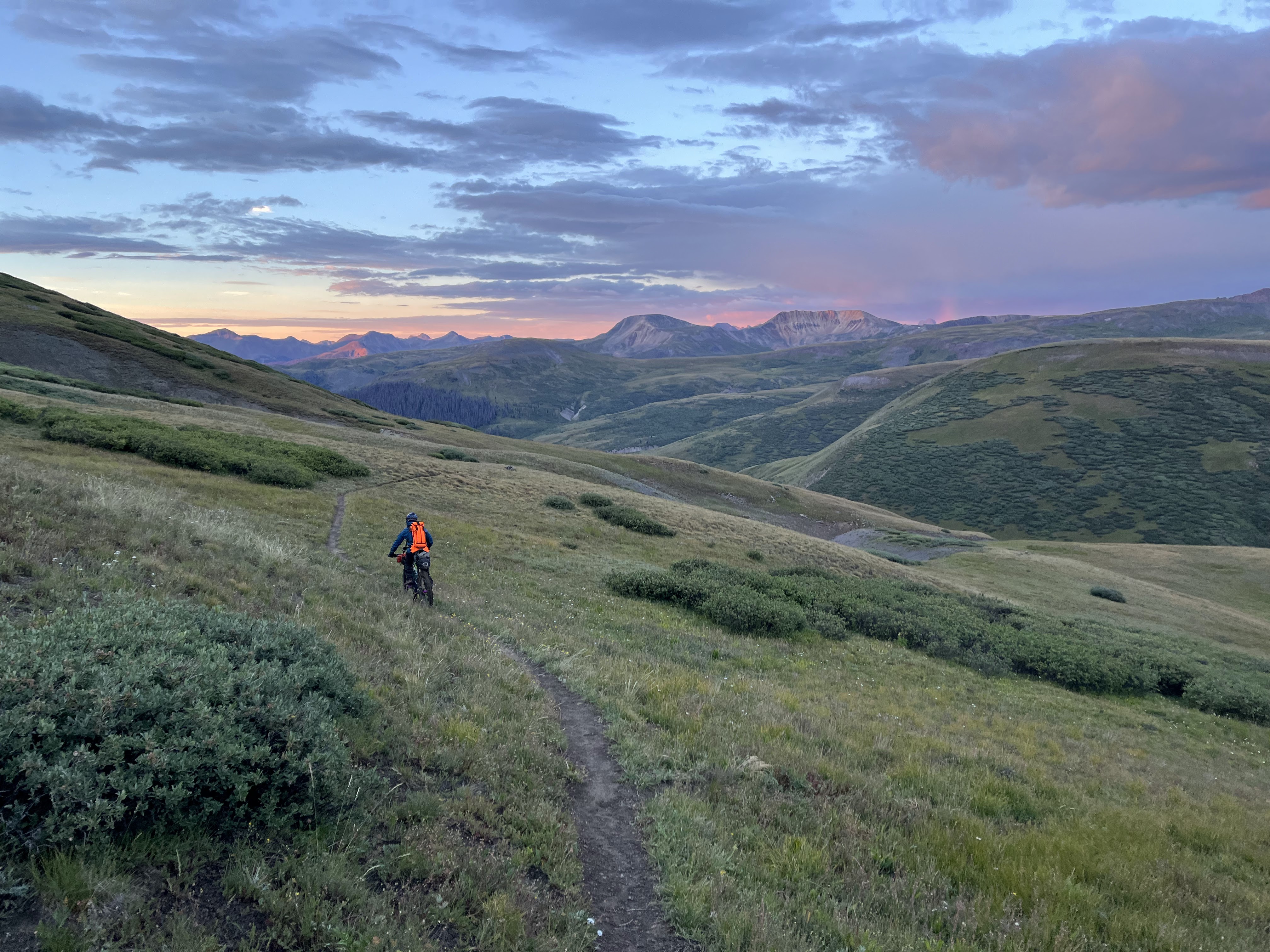
Day 1 - (PS the fast people like to call this day 0 because technically that's correct)
This race is pretty unique in that it starts on a Sunday at 4AM. Oof. I was hanging out with my brother in Golden for the handful of days leading up to the race and he dropped me off at the Waterton Canyon parking lot, where there was a large group of bikepackers gathered.
Wait, hold up let me backtrack. So I ended up driving up to Colorado from Phoenix. That's about a 15 hour drive. I broke it roughly in half and then once I was there, I ended up working remotely primarily from a Starbucks close to my brother's place who didn't quite have the internet reliability I needed right off the bat. No big deal, but I guess a combination of the drive and those hard seats at Starbucks gave me some kind of saddle sore type thing. I noticed it during a preride the day before the race start. It was noticeably very painful, but I sure as hell wasn't going to not start. I figured I would be walking enough that it wouldn't be an issue. Turns out that was true, but I had to wait till the second day because the first was really ride-able.
OK back to the race start... Gerrit M managed to spot me and we chatted for a few. Nice to see a familiar face in the darkness. I wanted to find Dylan T and say hi and I did that. Spotted Johnny P and said hi to him too. I told all of them I hoped I didn't see them again, because they are all much, much faster than me.
 |
| Jefe (veteran of the CT and many other ultras and current race director) said a few words and then 4AM hit and we were out. Well, I hung out towards the back, with no interest in trying to keep up with the unnecessary frenzy at the start. |
It was a really nice ride up Waterton on a slightly uphill graded road, I really was just glancing around trying to find eyes up on the canyon walls using my headlamp - the only thing I saw though was a group of deer right next to the road. Johnny caught me from behind and we chatted for a few minutes - such a good dude and one of the strongest riders out there with a super positive mindset that is impossible to not notice.
 |
| Water flowing over the spillway |
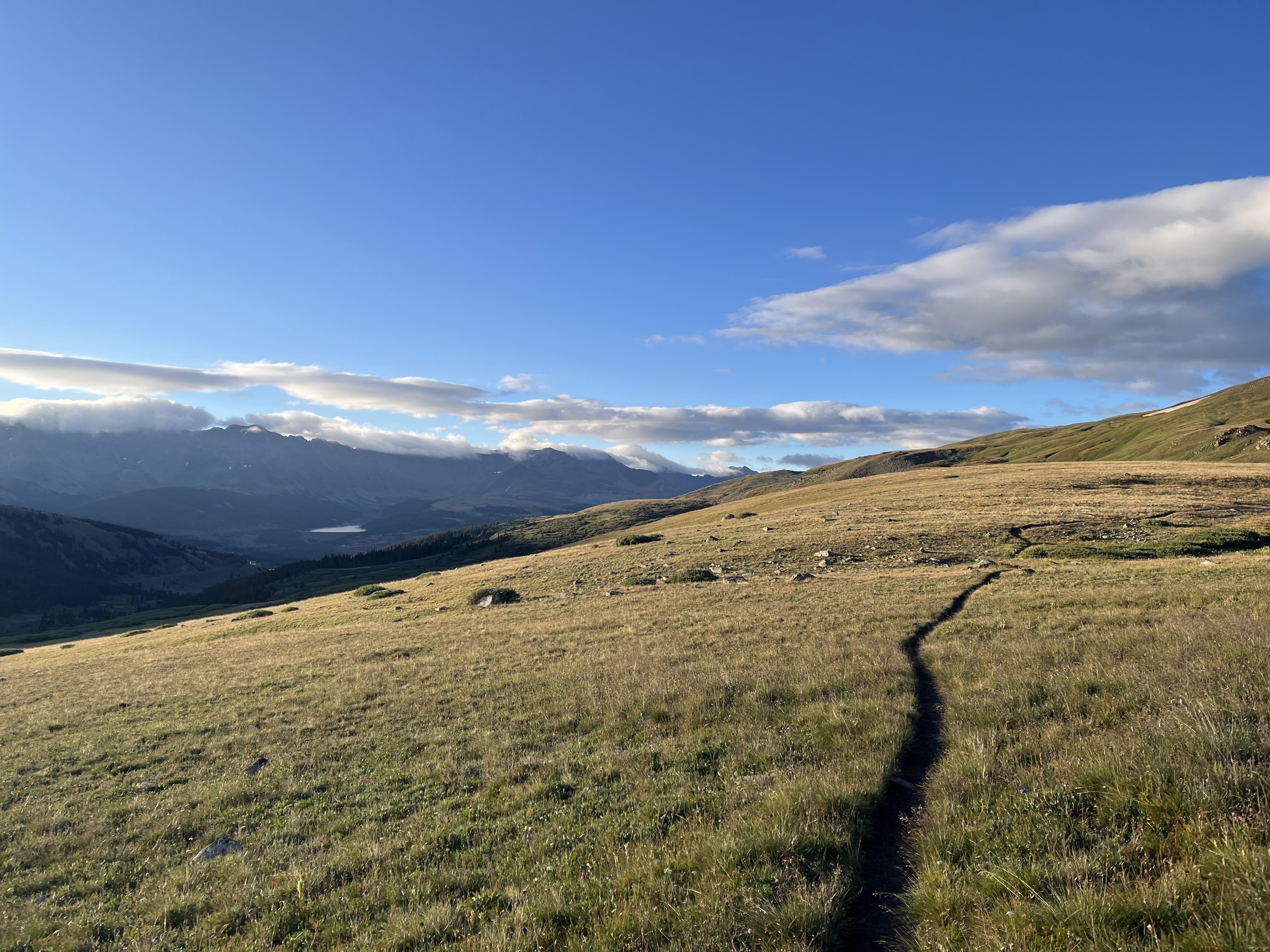
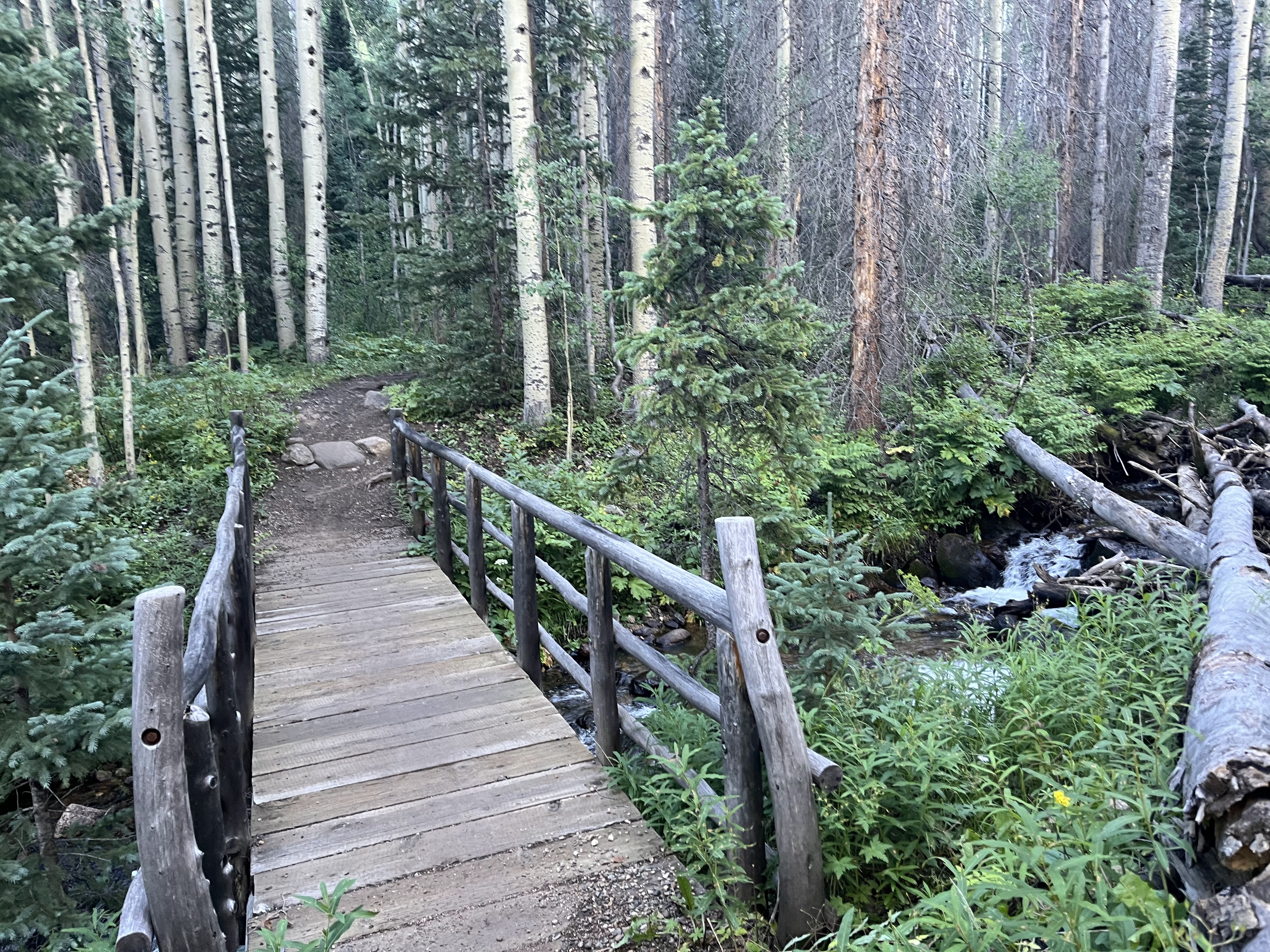
After a handful of miles, we ran into the CT proper, and while steep it was initially pretty ride-able. It was noticeably humid and quite warm so I had to fumble with layers a bit. Eventually the grade steepened and I started pushing my bike quite a bit. To that end, make no mistake, this is a hiking trail that bikes are allowed on. Everyone pushes their bike at some point, I likely did it more than others. It's always a bit of a mind game though. There were plenty of times when I thought I was pushing my bike excessively, when I would come across the telltale sign of bike shoes (with cleat outline) prominently displayed right next to where my feet were landing. "OK, I'm not the only one pushing" - this was a thought I had pretty much every day out there.
 |
| Morning light starts to illuminate the sky. One of countless CT markers to see along the trail. |
 |
| So many beautiful ribbons of trail out there, impossible not to be entranced by them or to take pictures. |
 |
| A bit of a view for the first time and right before a fun descent down to the South Platte River. |
 |
| Cool seeing bits of clouds hovering in the valley below. |
 |
| South Platte running well |
 |
| It was a steep climb up from the river, I stayed on HAB (hike a bike) pace with a couple others for the duration. You can see them if you look closely. |
 |
| The tread did mellow out on occasion allowing for some riding. |
 |
| Still riding, other riders still in view. |
 |
| I don't know a thing about the plants out there, so didn't eat. Haha. They looked tasty though. I went to the known nutrition in my feedbags, and the nerd cluster candies were the closest thing I had. |
 |
| Amazing how seeing just some minimal tread disturbance turns this from ride-able to "easier to walk this" |
 |
| These signs have been around for a while - at least a few years - because I have seen pictures of them in other blogs. No idea what kind of flying stuff there might be (besides the dust being left by the fast racers haha) |
 |
The pristine singletrack delivering travelers to viewpoint after viewpoint.
|
I think right around here myself and some other riders went slightly off route to the fire station where they have kindly provided an outdoor spigot and a bench for thru hikers/riders. Although water was plentiful, it's always nice to not have to filter water especially with just a small detour to do it.
After the water stop, I had pulled off trail to take a leak.Nobody was around, right? Wrong lmao. Some other cyclists were coming up from behind. Oh wow it was Kristen and Joe T - we had met earlier in the year during the
Queen's Ransom and it was great to see some familiar faces. I got some cowbell encouragement and Kristen wished me good weather which for the most part worked - so thanks for that!
 |
| The morning had been primarily overcast and pretty cool. Perfect riding conditions - for now. |
 |
| This day was one of the most ride-able of the entire route, The grades were pretty manageable and elevation not too extreme. |
 |
| Water flowing near the trail frequently. An oddity for this desert rider. Tramway Creek here. |
 |
| Mushrooms were also prevalent along the route. This was a pretty good sized and bright colored one about the size of my pedal. |
I eventually had to leave singletrack and begin a detour of the Lost Creek Wilderness. This meant a 70ish mile detour of both dirt road and some pavement. Yes it's a bummer, but those are the rules/law. Thankfully, this didn't make things any less scenic.
 |
| Bonus: the detour takes riders past Wellington Lake, which has a little store. I made a pit stop with a few riders - Chrissy, Brad and others to get cold drinks and ice cream. It was about 1PM and we were already nine hours into the ride. |
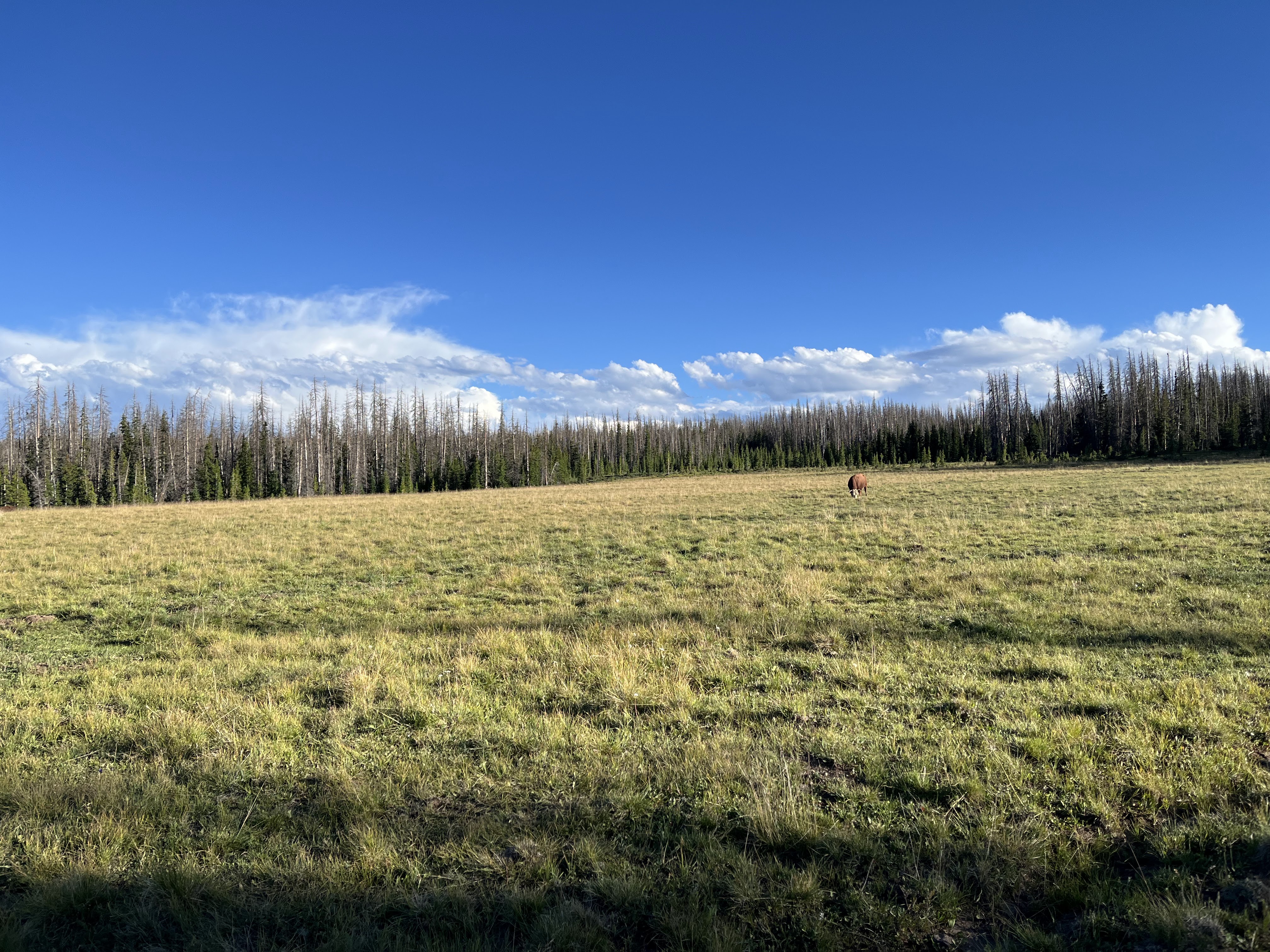
Leaving the lake was a bit of a gut punch. Pretty steep jeep roads forced me to walk while digesting my mini-feast. It eventually relented and got more ride-able. Passed a large pasture area with signs warning of the bison. Huh?
 |
Indeed there were bison out there. Cool.
|
 |
| Wide open spaces and still a bit overcast. So nice. It would have been nasty hot if the sun was out. |
 |
| The clouds did start to break up a bit and it got toasty. That combined with some slightly uncomfortable grades started to make this section a chore. |
 |
| Bike wanted to take a break in the shade. |
 |
| The shade of this tree was perfect. Ate some oreos with peanut butter. Power foods... |
 |
| A little lady wanted to sit next to me. Much obliged ;) |
 |
| Lunch break over - back to it. |
I stopped to filter water near Goose Creek campground. The heat of the day was starting to break a bit and I was about to get into more trees - it was around 4pm so I had already been at it for 12 hours. Still feeling pretty good!
 |
| Much like Arizona, cows can be found all over the route. Here's a little fella... |
 |
| And the rest of the crew. |
 |
| Big sky country |
 |
| Saw this neon green guy in the middle of the road. Cool. Ushered him off before any cars were able to get to him. |
 |
| Tiredness hit me out of nowhere, but still moving forward. |
 |
| Cool smaller Aspen grove |
Somewhere around here, the route turned primarily downhill and it was fast down to the paved section of the detour. While I had full intentions of knocking this out before getting some sleep, the reality had me pulling off around mile 83 on a road marked for dispersed camping, didn't make it too far up the road to an official space, but it seemed good enough to me. Didn't bother to set up the tent, I just hopped right in the bivy I had for more emergency downpour scenarios. It was plenty warm in there - didn't need the sleeping bag.
I should mention, this is when I discovered that I left my main battery bank back in Phoenix. I went to plug in my GPS when I discovered this. Slight panic set in, but then I remembered I did have my dual battery charger with me for my Fenix lights. A side benefit of this charger was it could act as a battery bank itself. So I could charge my Garmin and my phone with it with the extra batteries I was carrying. It wasn't ideal, but it could work, especially with limited night riding. I also decided at this time it would be best to put the Garmin in battery save mode. The route is well marked, and I have alerts set on it to notify me if I go off course. This would buy me a lot of extra runtime with it. It wasn't what I was used to, but I figured it would be OK and it was - once I got used to trusting the device to warn me of any deviations off course.
It was close to 8PM by time I laid down and I planned to get up fairly early to knock the rest of the pavement out before cars were more prevalent.
Even though this was a pretty easy day in comparison to the rest of the days, I think it might be my biggest day on a bike, especially considering I was loaded for bikepacking. The only other ride that kinda compares would be the Picketpost Pulverizer "A" course.
Today ended up being about 83 miles and 11,500 ft of climbing. 17 hours. I'll take it.
Day 2
Woke up and rolling a touch before 3AM. Even though it is a paved section, it's not a very busy road, but still - I was glad to be avoiding cars. I was missing some views, but that's ok - can't win all the battles. It was supremely peaceful, but this day was going to be sneaky tough it turns out. Just a consistent gain in elevation all day and the next thing I know I am just shy of 12k feet on Georgia Pass.
 |
| I had finished all the pavement when I got back to dirt and the sky started to catch on fire. |
 |
| I didn't stop at stagecoach for the outdoor spigot (actually never saw the building in the dark) - but I was hoping this cattle tank was still there from previous reports. It was and I topped off my water. |
 |
| It was really nice through here, and I was supremely thankful for the sunshine as it had been damp and cold for a bit. |
 |
| About to wrap up the detour and get back on the CT proper. |
 |
| Here we go. A slice of easy riding singletrack but like usual, the grade turned up after a while in order to attain Kenosha Pass |
 |
| Beauty comes in many forms on this route. |
 |
| Not a cloud in the sky which boded well for getting over Georgia Pass later without weather drama. |
 |
| A little rubbly and uphill here. A single speeder passed me here while I walked. He was grinding away and riding strong. |
 |
| It's hard to capture or describe these wide open views. |
 |
| Getting closer to Kenosha and the trees and vegetation become denser. |
I got to the pass which has some pit toilets (luxury, honestly) and I rested a bit and had a snack. Even though it was only 9:30am, I had to remind myself I had been going since 3am. Up next, my first high mountain pass of the route - Georgia Pass.
 |
| Interesting shelter right off the trail. |
 |
| Super dense vegetation provided good cover from the sun. |
 |
| Started to gain some altitude and caught a view of this expansive ranch. |
 |
| This little crossing is way weirder than it looks. |
 |
| I filtered water here and prepared for the final push up. Do you ever wonder how things get their names? Me too... |
 |
| Jefferson Creek here. |
 |
| I thought this was going to me more ride-able, but so many rocks and exposed roots made it easier to walk for me. |
 |
| Interesting twisted up remnants of a tree. |
 |
| This is better. |
 |
| Weather had been good, but was looking like it maybe wanted to play soon. |
 |
| Just about out of the trees. |
 |
| Looking back where I came from |
 |
| Just about to the pass, and the clouds are breaking up. Victory. |
 |
| Time to head down. |
The downhill started out pretty buff and smooth and degraded into a technical rock fest. It was beating me up pretty good so ended up walking a bit more than I wanted.
 |
| Started walking more as I approached Middle Fork Swan River. |
 |
| It sprinkled a bit on me here as I took a snack break. |
I knew there was one more roughly one thousand foot climb before starting to approach Breckenridge. Really wanted to get there, but my head started pounding so I just resolved to get as far as I could up the climb and find a nice camping spot.
 |
| Into a nice dense forest. Everything starts looking real comfy haha. |
 |
| Almost camped here, but kept it moving for a bit longer. |
I ended with a worse spot than that, but what can you do? I needed to get horizontal my head was pounding. I went ahead and set up the tent, because I really couldn't tell what the weather was going to do and my view was blocked by mountains/trees on all sides. It was early - only around 7PM but that was going to give me plenty of rest for an early-ish start the next morning as the next challenge was on deck: the ten mile range.
53 miles; 7100 feet of climbing. 15.5 hours
Day 3
 |
| Packed up and pushing up the rest of the climb with the first light of the day. |
 |
| It didn't take too long before I was having a blast on the trails getting down to Breck |
 |
| Looks like a real nice day on tap as long as the clouds don't start consolidating. |
 |
| What a rip through here. Primo. |
 |
| Must be spooky time? |
 |
| Right before the final descent down to Breck. This was the intersection of the Hippo trail which made me smile as it reminded me of the board game "Hungry Hungry Hippos" haha. |
 |
| The switchback section that drops down basically right into the backyards of the folks who live here. Kinda weird, but whatever. |
I didn't need anything from town so crossed the road and started up the ascent of ten mile. This would be my first real taste of what was upcoming later in the route. There was a cooler set up right after crossing the road for CTR racers. It shouldn't really be there, but I grabbed a coke for later.
 |
| Blue River crossing |
 |
| Copper Mtn, my next lower elevation goal is in 12 miles. Just gotta get over a huge mountain range to get there. |
 |
| Elevation is gained rapidly |
 |
| I leapfrogged with this guy most of the trek over the mountain. He would be faster than me on the climbs, I would catch him on the descents. Passed him for good on the big descent to Copper, but funny enough we ended up at the same restaurant. |
 |
| Looking down on Breck, already way below my perch. |
 |
| Filtered water and ate a bit here. |
 |
| Here's my hiker friend again. |
 |
| These dirt drawings were seen quite often over my trip - not sure who was doing it, but it definitely made me smile every time I saw one. |
 |
| Still getting used to seeing water everywhere. |
 |
| I was feeling like this flower. Happy to be here, but a little roughed up. |
 |
| Ugh, wtf. |
So nothing strikes a cold fear into bikepacker's heart like the above photo. Notice the pale blue line. That's me. However normally there is a more prominent track that shows where I am supposed to be - you can see it in the upper left hand corner of the screen. I thought there was a reroute around here, but was this it? I freaked out after continuing to drift away from the track. I checked the "Far out" app and another map. According to all of those, I wasn't on the CT. I ended up throwing the bike off trail and hiking back down to the deviation where there was nothing on the ground. Ugh. I was on the reroute. Another bikepacker saw me hiking down and asked if everything was OK. I was like yeah, I'm just afraid I am off route. Regardless, ended up hiking back up to the bike and continuing forward. Eventually, this trail merged with the track on the screen and at that merge point you can see where the old CT was naturalized. Didn't really need that stress - nothing like figuring out track issues above 11k feet.
 |
| Getting close to breaking out of the trees. |
 |
| Begin the traverse above treeline. |
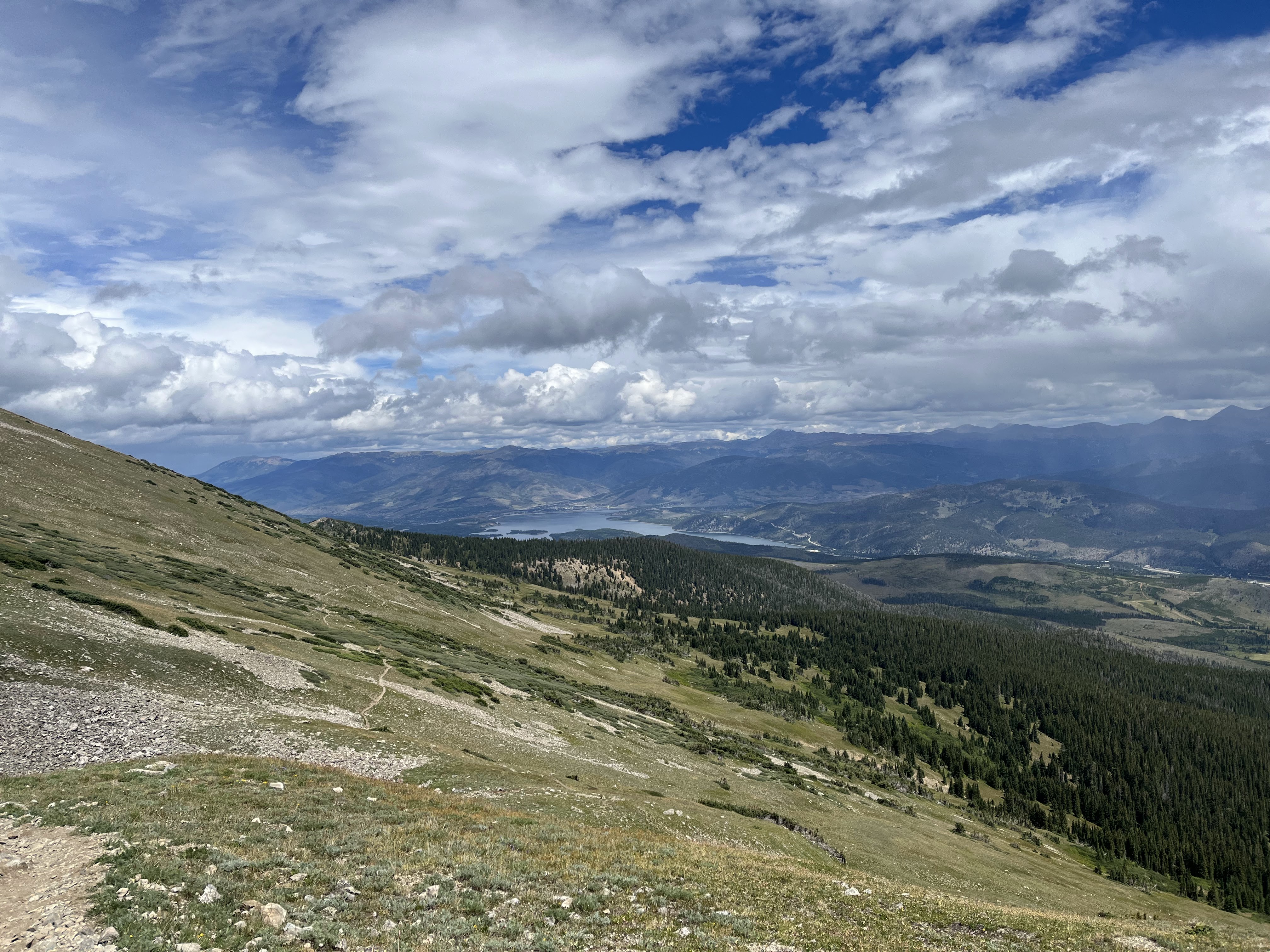
Even though this next bit is really just a small taste of the views and exposure to come, it was still mind-blowing. The sense of scale was very hard to take in. Welcome to the appetizer for the big mountains of Colorado.
 |
| I think the lake in the background is Dillon Reservoir near Frisco. |
 |
| Rain was sporadic but thankfully no thunder and all the heavier showers stayed one mountain over during my traverse. |
 |
| Some bits were super ride-able. |
 |
| The blurry shroud of rain right in front of me. |
 |
| Up, up, up. Came from those trees way below. |
 |
| Finally topping out. |
 |
| The trail is there, somewhere. |
 |
| I can see a touch of singletrack there on the saddle. |
 |
| Time to fly. |
 |
| Crazy fun. Always had to be aware of hikers but only ran into a handful on the way down. |
 |
| Copper Mtn comes into view. I will be there shortly. |
 |
| There was a detour to get into town due to some construction activities. |
I went to a couple shops in the village inquiring about battery banks, but struck out. Oh well, I'm just gonna have to deal with what I have. I ended up landing at Sawmill Pizza and Taphouse. Got a very large pizza and a beer and utilized the wall outlet to top off my electronics. I chatted with a thru hiker to pass the time.
Day 4
 |
| Packed up the wet tent and moving before 5am. That's a win. |
 |
| Sun was coming up behind me, so I had to remember to look back often. I loved how the light was reflecting off of the small ponds in the valley below. |
 |
| After a rainy night, the day is looking stellar. |
 |
| The view just keeps getting better. |
 |
| Janet's Hut nestled in the trees below. |
 |
| Another dirt message... |
 |
| Attaining Searle Pass |
There was a bit of a traverse here - it felt really special to be riding this pristine area. I had it all to myself except for a large canine (wolf?) and another larger animal further below. Might have been an elk or a moose maybe? Hard to tell from where I was.
 |
| Postcard type stuff. |
 |
| This seemed like a good spot for a break. Leftover pizza and water pretty much straight from the last remaining bit of snowpack above. |
 |
| Had to summon my inner moose to bash through this. |
 |
| Ahh, the marmot greeting party. Haha. I laugh every time I see these guys. |
 |
| This fella was chowing down and completely unbothered by me. |
 |
| Large mining operation below. |
 |
| Final traverse to Kokomo Pass. |
 |
| 12,022 ft. |
 |
| Leadville now in my sights, time to blow this pop stand. |
 |
| I'm back in the thick trees in no time. |
 |
| Another deviation/reroute of the route forced me to double check myself. Hiking back to my bike here. |
 |
| Nice waterfall on Cataract Creek. |
 |
| Transitioning to another mountain via a small valley. |
 |
| Remnants of bunkers from an Army training facility - Camp Hale. |
Right at the bridge over the East Fork Eagle River next to Camp Hale, I rinsed out my sun hoody in the flowing water because I was sick of smelling myself and ate a snack while a curious weasel was waiting for me to leave my pack unattended. At least that's what it looked like. I was anxious to get to Tennessee Pass, but I had no idea it was going to be so hard. It was nice in there, but it was work. There was a surprise in store for me too...
 |
| Up, down, up, down. Like a Nintendo cheat code. I hit B, A Start but never got any extra lives ;) |
Not long after I got back on trail, a blazing fast runner came by. Complete with number bib. Wtf? On a Wednesday? Apparently it was part of the TransRockies stage race. Well shit, I am going the wrong way haha.
 |
| Chatted with these race volunteers. They said they had 300 runners coming my way. OK Cool. |
The trail to Tennessee Pass was littered with runners, and wanting to respect their event and preserve my sanity, I walked a whole lot of it. It was just so much easier to navigate that way. And it was super cool giving and receiving encouragement.
 |
| Wide open sightlines so I rode this. |
 |
| Not bad here either. |
 |
| Incoming racers. |
Finally made it to the pass where the pit toilets smelled like all 300 runners blew up in there so I promptly left.
 |
| Good fun in here albeit brief. |
 |
| Sign basically said, if you break yourself it's your own fault. Fair enough. |
 |
| Swinging benches??? |
 |
| Pavement to Leadville. |
 |
| I didn't need much, but was looking for a hot meal and an outlet to charge my stuff. Turns out the two options I had in mind were both closed, so I backtracked to the Tennessee Pass Cafe. Burger and a beer were nice while I charged stuff. |
I was feeling kinda worked while I sat in town. I was doubting myself after a rougher than expected morning. I was only 200 miles into the route and was wondering what I was doing out here. Do I belong on this route? It had been a while since I had seen a racer and I figured I was at the back of the pack. That doesn't bother me really, though it can help reinforce those negative thoughts. Ultimately, I had to shut that shit down before it took a foothold. I reminded myself that I was still moving forward on the route. By now, plenty of people had scratched from the race, and they were strong riders. My race was against myself, my own perceived weaknesses, my mental strength, and of course the terrain I had to cover.
I had to grab a couple snacks from the Circle K at the end of town and then got on the road. I remember being super excited that they had giant chocolate muffins, of which I bought all three on the shelf and would have bought more if they had them haha. My debit card stopped working here (damaged chip apparently) and was thankful I had a backup card and some cash.
 |
| The afternoon was threatening with rain but it never caught up to me. |
 |
| Started from town with pavement, which started to deteriorate. I did manage to get an 18 wheeler to honk his horn for me by doing the old arm motion to do so. I hope he got a kick out of it like I did. |
 |
| Back on dirt and I really was needing these simple, easy miles. |
 |
| Having a blast in the early evening light. |
Just after this section, there was a detour around a fire closure. That avoided a climb and put riders on dirt roads for a bit through some ranch properties. I wanted to end on a high note, so decided to crash out after I rejoined the CT and gained a little bit of elevation in the drainage so as not to sleep in a cold sink. Found a nice spot just off trail just after Cache Creek, slipped into the bivy, and was out. Tomorrow was gonna be an easy start to the day, a massive resupply, and a major commitment point to finishing the route. I was feeling good and positive, which was a drastic change to how I felt in Leadville. Time to sleep.
59 miles, 6,000 ft of climbing. 16 hours.
 |
| 18 whole dollars? No complaints here. |
At City Market, I had a good idea of what I would need to get to Cathedral Cabins so it didn't take me too long. I did utilize the indoor plumbing
to the fullest and it's just amazing what modern facilities we take for granted. Running water, plentiful soap, paper towels. Went outside to load up my bike and my bags looked like some kid had robbed a convenience store.
 |
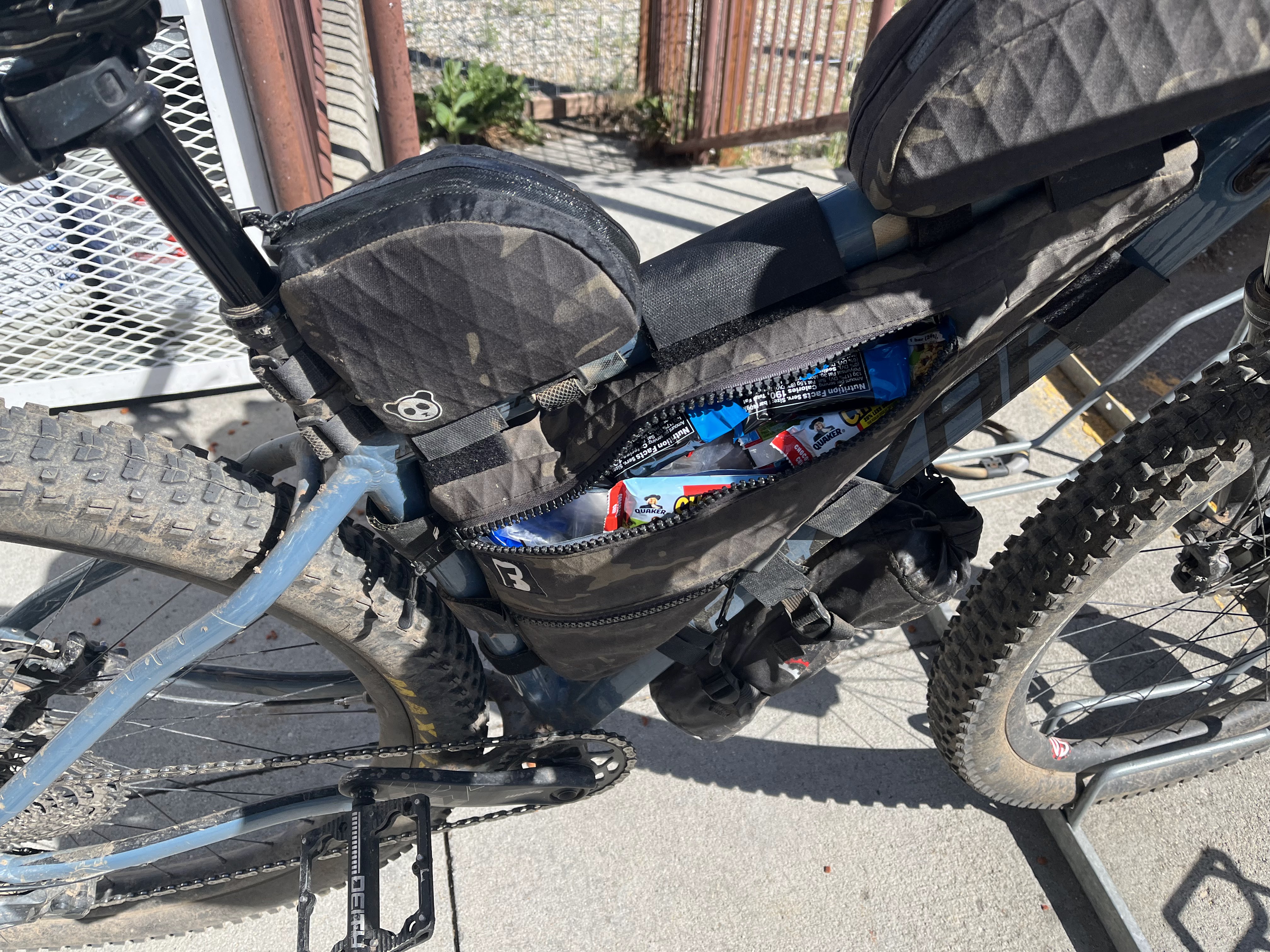
| Snacks anyone? |
Somehow I think I was only in town for a couple hours so that felt pretty efficient with the sit down meal. Got on the paved climb out which I wasn't looking forward to due to lack of a shoulder, but it likely would have been way worse on a Friday or weekend so counted my blessings.
 |
| I thought the idea of a drive in theater here was funny. I would rather just watch the mountains and clouds. |
 |
| Hey, a bike |
There was some residential stuff on my right side, and I think after this last picture, some guy was out "checking his mail" (sorry totally forgot your name) and he said "Hey, Mike" I was semi dumbfounded and asked "How do you know my name" when I damn well knew the answer before I asked - He was clearly dot stalking on track leaders but he lives directly on route. We chatted for a few minutes and he said I was halfway through and that the rest was going to be a big step up in every way compared to the first half. I agreed with his assessment. It was nice talking to someone for a bit. Had to get going and kept grinding up the climb.
As I climbed the pavement (pretty much shoulder less) I was trying to judge the sound of vehicles coming up behind me as I climbed. If it sounded like a big truck I was definitely just pulling off the road if at all possible. This seemed to work and I didn't have any close calls.
Properly fucked, and I was kicking myself for not better thinking this through.
 |
| Looking back after being rescued. Camera never picks up the details well enough. |
Anyway, I must have been sitting there, frozen for maybe 3 minutes when I hear a voice behind me - "How can I help - or do you want me to go away" - I laughed and said I literally have no idea, but please don't leave. My saving angel told me she could probably hop down the embankment and scamper up the other side of the washout and grab my bike. I was like "can you do that?" She said "I think so". So while snacking on a granola bar, in a bikini, she hops down and up like a ninja, grabs my bike and pulls it to safety. I hopped across the washout and we exchanged high fives. I told her she totally saved my stupid ass. I'd probably still be there if it wasn't for her being there. So shout out to my trail angel for saving my day and possibly my entire ride.
 |
| Calm, cool and collected - ninja trail savior walks back to the picnic area. Thank you! |
My adrenaline was sky high, and I had to calm down a bit after that fiasco - sheesh!
 |
| Nice meeting you, Alan! |
 |
| I ended up passing the resort without stopping at the store. I didn't really need anything, and this ride is taking too long as it is haha. |
 |
| Passing through a beautiful little neighborhood. |
 |
| Ahh, looks like Chrissy up ahead. |
I ended up catching her right before Chalk Creek, which marks a major decision point. First off, the HAB here is heinous. Not overly long, but very steep and tough. Secondly, moving forward on the route from here is very committing. If you are the verge of scratching, this is as good a place as any to do it. She was having some knee issues and we chatted about it. Eventually, she told me that she didn't want to bother me with her issues, and that I should get going. I read the writing on the wall and said goodbye. She ended up scratching there :(
 |
| Decision time for Chrissy. |
 |
| In the middle of a challenging HAB |
 |
| Started in the valley below - the view did not suck |
 |
| Saw this on the ground, and it reminded me of the bags on Alexandera H's bike. I took it as a positive sign from the universe. |
 |
| When I did finally top out, the riding flattened out and the sparse tree cover reminded me of northern Arizona. |
 |
| Very Flag-ish |
 |
| Gates are pretty rare on the CT as opposed to the countless ones on the AZT. |
 |
| The forest did start to thicken up as I continued to gain elevation |
 |
| A little bit of rubble to up the challenge factor. |
 |
| Interesting bridge... |
 |
| Getting deep in the trees now. |
I didn't really want to get to the next tough section - the trail next to Fooses Creek because I figured it would be cold and damp down there - so I resolved to just keep moving until I found a place to camp. Problem is it took forever to find something. I passed some official campgrounds near Mt Shavano, but those had campfires going and I didn't want to be close to the smoke which I was already smelling. Plus they had barking dogs. I just wanted a peaceful evening so up, up up. It took forever for some flat spots to reveal themselves, but it finally happened and I was thankful.
 |
| Last pic of the day, with a nice moonshot. |
No tent tonight again. Ready for a big day tomorrow...
62 miles, 7500 ft of climbing. 16 hours.
Day 6
 |
| Pretty amazing where you can sleep when you are tired enough... |
Once again, greeted to a beautiful morning, and I was excited to get going.
 |
| It was proving to be an easy cruise down to the US50 |
 |
| Starting to head downhill towards the highway, |
 |
| I thought the differences in plant life interesting. On my side of this valley, small shrubs. On the other side, dense and tall pine trees |
 |
| Little bit of breakfast at this spot |
 |
| A bear was here not too long ago. |
 |
| The 50 comes into view and with it, the next major challenge will begin. |
 |
| Crossing over Fooses Creek. This trail would roughly parallel the creek the majority of the way up to the saddle. It's close to a 3,000 ft climb |
 |
| Oh, I have to walk my bike? Screw that I didn't sign up for THAT ;) |
 |
| Super lush down here. It is very apparent the amount of precipitation this place gets. |
 |
| Thought I heard an Elk bugle right here but didn't see anything. Came up across a guy about a 1/4 mile later. Asked him if he had eyes on that elk - he said the call was actually from him. I told him well done and he smiled. |
 |
| There was a re-route of the official trail here which in theory makes it easier to ride, but I still pushed. A lot. |
 |
| Starting to top out... |
Finally hit the saddle where some day riders were hanging out. I laid the bike down momentarily and remarked that that had been really rough. Happy to be up here though.
 |
| On tap - more riding right around 12k feet. |
 |
| It really doesn't get much better than this. |
 |
| Nice snack break location |
 |
| A little shelter cabin there in the trees. |
 |
| Trail crosses a scree/boulder field here. |
 |
| With rocks, you can always count on various critters being around. |
 |
| Right at Marshall Pass I ended up running into a group of guys and we ended up leapfrogging for a while. That was good for the ego, cause I was feeling worked. Trail wasn't overly difficult, but in hindsight the elevation was bugging me more than I thought. |
 |
| I was looking forward to an easy-ish descent down to tank 7, the next water source on route. |
 |
| Joke was on me, this section was completely trashed. I'm sure people ride it. Not me. Very frustrating and pretty out of character to the rest of the trail in my opinion. |
 |
| Saw a mini excavator out there so maybe they are rerouting it (and hopefully they keep the motos off of it) - not hating on the motos necessarily, I am sure those are the guys who get out there with chainsaws to clear deadfall. |
 |
| I had been trailing behind a young female hiker for quite a while. I tried to call out to her to let her know that I was there (didn't want to scare her), but she had headphones in based on the fact that she was singing some songs very loudly. Haha. Also heard her yell in frustration with the trail a few times. She finally noticed me and pulled off. Said hi and told her I would see her down at the tank. |
Not long after that, I ran into another female hiker, and mentioned the trail conditions. She was like "oh, I really didn't notice" which kinda seemed like an odd response. Down at the tank she noted she was doing the CDT, not the CT. Suddenly her response made a whole lot more sense, as the CDT is a whole different animal that the CT.
 |
| Tank 7, the last good water source for a bit. My head was pounding again, but I had to at least get up on Sargents Mesa proper before stopping. |
 |
| I was pretty beat down so walked way more than I should have. Had to get the climb up to the mesa done. |
 |
| Solo cow here, but there were plenty hanging around. |
I stopped taking pictures right around this time. Head was crushing me and I had to stop and lay down sooner than later. I was up on the mesa and it was slightly downhill and initially more ride-able than I thought it would be. This allowed me to scope out terrain for a place to sleep. Tons of bark beetle killed trees up here so it wasn't easy. I did find an open space with only one tree that could potentially get me. The prevailing breeze was pushing the tree away from me so that was good, and I figured I had about a 1 in 360 chance of if it fell it would hit me, and honestly I was of the mindset of I didn't care if it did. Today had put a beat down on me, but there was literally no escaping it. I was in the thick of it with forward being the best way out. I sure as hell wasn't going to go back the way I came. I knew the following day would be better. Just had to finish off Sargents.
I loaded up on a bunch of peanut butter and cookies, laid down and instantly felt better. I think I heard a rider pass me around 8:30PM, but I might have been dreaming. Slept on a ton of rocks and it didn't matter one bit.
35 miles, 6,600 ft of climbing, 13.5 hours
Day 7
I woke up feeling so much better, head was clear and I was motivated to finish off sargents and enjoy some fairly easy miles to cathedral ranch cabins.
At various points on these roads, I was consulting with the "Farout" app, which is good for seeing distances to different points on the route. I had checked a while ago, and it said cathedral ranch cabins was 10 miles out. Should be getting close now, it had been an hour since I checked. Still says 10 miles wtf?!?!. News to me, but since cathedral isn't technically on route, I think the algorithm of the app just uses an "as the crow flies" distance calculation for things off route. I had been making the mistake of neglecting my food/hydration because I thought I was so close. I had also just taken my last sip of water, so was now on the lookout for a stream to take a quick break. I found a perfect shade tree and stream that wasn't completely demolished with cattle hoof prints and the related output of said beasts right above McDonough Reservoir.
 |
| I enjoyed this tree very much. The mosquitos liked me just as much, so I got motivated to get moving. |
 |
| The final approach to los pinos pass was much steeper than everything else in the last few hours. Had to get off and walk a few times. |
 |
| Victory is visible just past this cattle guard. |
 |
| Next up, cathedral ranch cabins! |
 |
| Funny how you can curse a long descent when a resupply is near. |
I must have checked the map a handful of times on the way down, I didn't want to blow past the steep turn off route to get to the cabins. Finally got to the turn and pedaled the mile off route to the cabins. Pulled up to the "office/store/lounge" and found Patty G out at a picnic table. I was immediately at peace but also highly overwhelmed with my options. I wasn't planning on staying long, but I wanted to do laundry and grab a shower. Also wanted to get all of my devices fully charged, so no pictures were taken - you just have to go visit for yourself!!
Got cleaned up, then while in a set of spare clothes while waiting for my laundry, I went next door to the store and started my resupply. I had a pile of food when I noticed Annette outside - I went outside and said hi. Told her what I had already utilized and also said I had a pile of food inside. At this point, I didn't know what my plan was - there was an ominous cloud directly where I needed to go. I guess I was going to hang out here until that subsided. I later met Brad and I felt encouraged by his calm eyes, and strong handshake. We were both wondering what the weather was going to do.
It started storming later in the evening complete with lightning, and Annette came into the lounge to see what my plans were. I said I really want to get out of here as soon as the weather calms down. I asked if I could just hang out in the lounge until that happened and said I would pay her for that - I wasn't looking to take advantage of the hospitality. She said there was no need for that. I said thank you and goodnight and took a nap while waiting for the storm to subside.
63 miles, 5,800 ft of climbing. 14 hours. One amazing place with two amazing people, Brad and Annette at Cathedral
Day 8
Slept longer than I wanted because the rain kept coming. Or maybe I was just tired. Probably both. It was around 3:30AM when I took off, I stopped in the "office" and left Annette with a note along with some cash for my slightly longer than anticipated stay. Patty and I crossed paths and I said "probably see you later". That ended up being very accurate.
 |
| It started raining soon after I left, so stopped under cover of a tree and put on rain gear. Cebolla Creek was running well off to my left but I could rarely see it. |
 |
| Rain dissipated but the road was a bit saturated and soft. Not too bad though. |
 |
| A couple cars had passed me and repassed me - they were making some sort of loop - finally I stopped next to one of them and they said - "do you see the moose?" Huh? Below, there was one nestled in the brush. Couldn't get a great picture, but he's there if you look. |
 |
| The big question of the day was weather. How would the day unfold? That's a problem for future me I surmised, and just kept going. |
 |
| It was a constant but mild climb up to HWY 149, but there was always something new to look at. |
 |
| Some free miles on quiet Sunday morning pavement. Then a climb up to Spring Creek Pass. |
Spring Creek TH was bustling with activity - took in the good vibes and positive energy and then started to trek up. The area had very large mud pits everywhere, it apparently rained pretty dang hard up here last night.
 |
| I knew it was going to be a long, long effort, so I just resigned to push the bike up these hills. I was encouraged by the blue skies. |
 |
| Jerosa mesa, AKA just keep pushing the bike over this rubble to the next post which MIGHT signal the end (but probably not) |
 |
| More rubble. Clouds building. |
 |
| Rinse/repeat. |
 |
| Definitely not liking how fast these clouds are coming together. |
 |
| Large flock of sheep |
 |
| Caught this guy and his two dogs driving the sheep to lower terrain. Part of me was happy to see someone else. The other part of me realized he was driving his sheep to lower terrain. I was one thousand percent sure this guy could read the weather better than me, so the anxiety meter notched up a bit. |

Not long after this shot, I was targeting the last rise in the terrain before a descent down to some trees and reduced exposure. Just had to get there. Then the first piece of hail hit my helmet. Followed by rumbles and lightning in the sky. Shit, here we go - the exact scenario I had dreaded in my mind for months leading up to this event. I ended up on a saddle between two hills, each with a storm cell over it, and I had to go over one of them. I decided to play ultra conservative here - I have minimal experience with this stuff so I did what seemed prudent - I slid into the emergency bivy next to some shrubs and took a nap to wait for it to dissipate. Luckily the precip stayed mostly in hail form. I dozed off fairly quickly - at one point I thought I heard a dog run by and sniff me? What?!?! A few moments later, I heard someone hiking up to my location. It was Patty! Hey! She noted she had been hiding down the hill a bit too. I observed that the storm cell over our target had moved off so said "let's get out of here and to the trees on the other side".
 |
| My nap position. Storm and lightning over the hill above. |
 |
| The other hill that I watched lightning strike the top of. |
 |
| Patty (PG) and I pushed up this steep ass hill then started to fly down the other side. |
Maybe a mile down I felt my hoodie flopping around which set off alarm bells. I grabbed fistfuls of brake and realized I had left my helmet down in my nap spot. I cursed at myself and knew I had to go back to get it.
 |
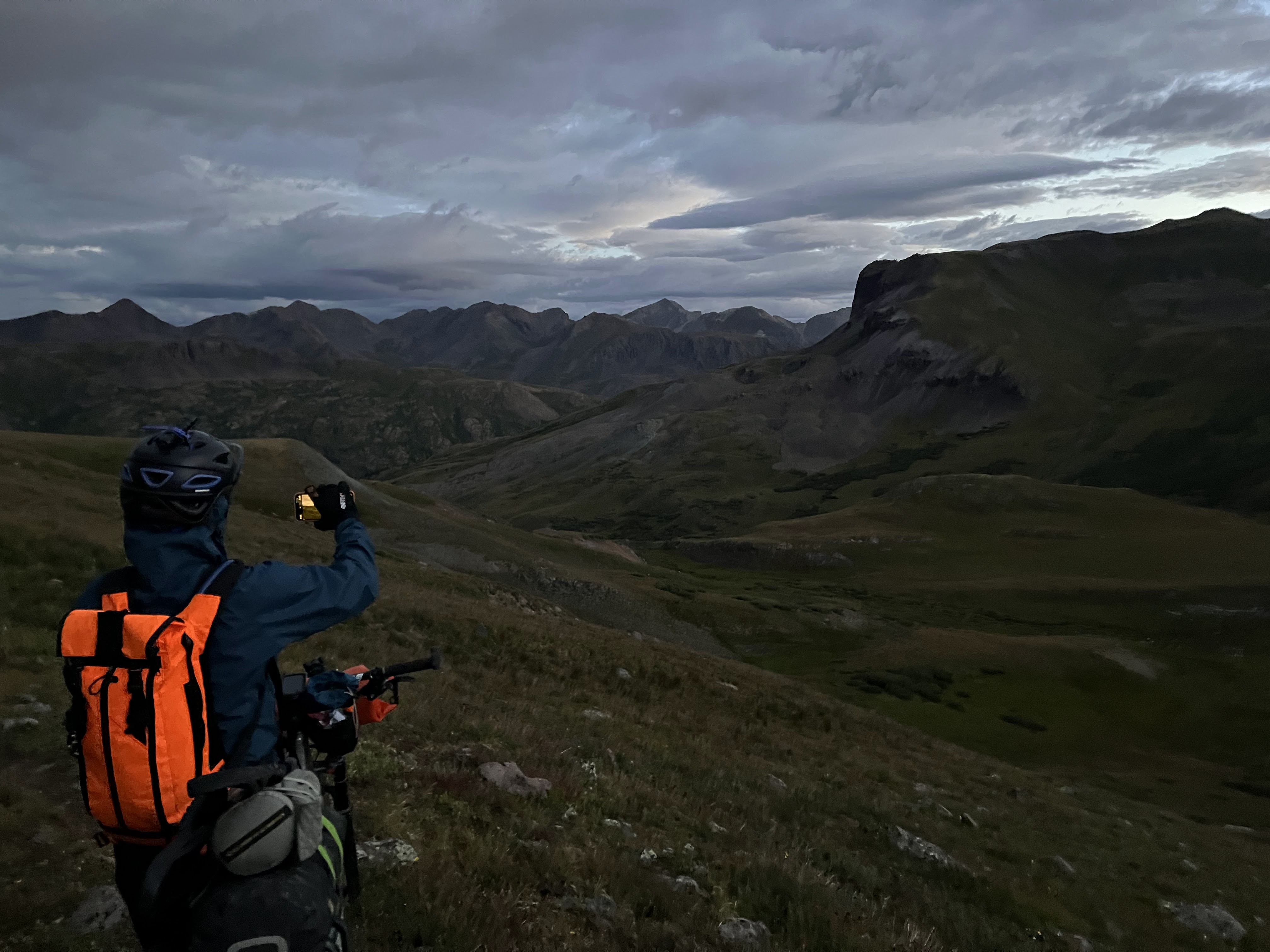
| My view as I hiked back up what we had just ridden down. I left my bike and pack behind, so this is a story not shown on track leaders, other than a stationary dot sitting in a highly exposed place with storm activity all around. |
 |
| 45 minutes later, I am back to the bike. Stupidest thing I have done in one of these things. |
We ended up getting to the relative safety of some trees, hiked nearly to the top of the hill they lived on, and got dumped on pretty hard. We ate snacks under a good tree and essentially decided to put the brakes on the day as I didn't feel comfortable going any further with how the weather was going. I don't think PG wanted to go any further either so I proposed a plan to tackle this next highly exposed 30 mile section of trail once the weather cleared. That could be as soon as a couple of hours or later tonight. She was game, but we needed to improve our location for resting, so we went back down this trail back near the meadow where we found Eric huddled in the place we were going back to. He was very cold after being caught in the storm earlier and trying to get warmed up. We hung out in that general vicinity and waited. Around 7:00PM I woke from a nap and noted the clear skies. PG said she had cell service down in the meadow, so I checked and sure enough so did I. I check the weather radar and it looked clear as can be. PG was still in her tent, so I went over there and asked if she was still up for our plan - things were looking good. She said yes, so I waited for her to pack up and thus we became a duo ready to tackle arguably the crux of this whole route. We tried to get Eric to go with us, but he needed to get more rest so decided he would leave later.
35 miles, 5,000 ft of climbing. 11.5 hours - cut short by storms.
Day 9 - actually beginning at 8PM on Day 8
We got out of the cover of the trees as the last light from the sun was leaving the sky.
 |
| Into the night we go. |
We rode where we could, but mostly hiked. We were at pretty high elevation now, and we both noticed how even a tiny effort when pedaling just made our legs burn. Hiking wasn't nearly as demanding.
 |
| High point of the CT, 13, 271 feet. Photo by PG |
I think we had been going for 4 hours at that point. I remember thinking to myself that we had to get this done, but also take care of ourselves. PG had been leading most of this because my hiking pace was going to be faster than hers - to be clear her cycling pace was stronger than mine - In any case, I told her how strong she was and that her pace was perfect. She seemed relieved to hear it, and I meant it. I said, "hey we should take a quick break to eat and rest for a minute". She seemed happy to hear that too and that's what we did. We also agreed on a brief stop every 2 hours to break up the effort and continue to take care of ourselves.
 |
| Losing a bunch of elevation on a jeep road. Ugh. |
We had passed a spot that looked pretty sheltered and PG briefly asked about maybe setting up camp for a bit, I had taken a caffeine pill and was still good to keep moving and I think my lack of response spoke volumes. I wasn't opposed to a quick nap, but didn't want to burn a lot of set up time to do it.
Just before Cataract Lake, we were hiking up a steep section of trail when PG again stopped for a second and inquired about a quick nap. It was around 4AM and time for a quick break anyway. I remember thinking that it was actually quite warm (weird) where we were and also thought that I should heed my partner's needs. Right then, PG's bike kinda slipped out and landed on top of her and we were both like "what about right here" haha. We basically just laid in the dirt and napped for a bit. I was in and out of sleep, but then we were both awakened by light sprinkles of rain on our faces. I said something about nature's alarm clock. PG was like "that was amazing I feel like I got plugged into the wall" in regards to her recharged feeling. Haha.
 |
| Scene of our amazing dirt nap. |
 |
| I had told PG that we should get an additional "power up" when the sunrise started. Here it comes!! |
 |
| Just an incredible place to be. Enhanced by early morning light and dramatic clouds. Pinch me. |
 |
| Trying to take it all in. |
 |
| Photo by PG |
 |
| Pretty funny looking at the elevation profile on the Garmin say this was flat. It was anything but, just up and down steep pitches. |
 |
| Zoom, zoom followed by push, push. |
 |
| These mountains make no sense to me, but they are so cool. |
 |
| Might be my favorite picture of the whole route. |
 |
| The route just wouldn't let up. HAB after HAB. |
 |
| Note the hiker below - we just came from there. |
 |
| Getting close to our escape point. |
 |
| The little climb of the jeep road up to Stony Pass was quick. |
 |
| I'm smiling and ready for this descent to Silverton. Narrator: he was in fact, not ready. |
I never want to ride that stupid ass road again. Super steep and littered with rocks, I had to stop multiple times as my hands were just pissed. I would almost rather push up the thing. Almost. Part way down, our agreement with the weather gods expired and we got rained on pretty hard, but briefly. I didn't care, we were in relative safety now as compared to earlier. also of note, Eric caught us here because he is a mad man and super strong. Not sure what we was doing at the back of the pack. He is so strong and had made up HOURS on us.
 |
| Finally hitting the outskirts of town. |
 |
| Wet roads and heading to a cafe PG had mentioned amazing breakfast bagels could be acquired. |
PG and I had officially completed our task together so we split ways and I told her I would probably see her again. We did in fact leap frog each other the next couple days. I was in search of more food and a place to get a final top-off of my electronics. I found a Mexican place that wasn't too packed - everything was a zoo due to people trying to avoid more rain that was now falling.
With enough juice to get me to the finish, I headed to the grocery where I bought way too much food and ended up running into Eric again. We ended up riding out of town together, but there was no way I was going to keep his pace so I said "see you later dude, I'm toast" and he dropped me in no time flat.
I literally thought something was wrong with me - this paved ascent was destroying me, why is this so hard? Looking back at the stats, from town to where I camped was like seven miles and 1600 feet of climbing. That's pretty stout even on pavement - so now it makes sense but on that day it was disheartening.
 |
| Off pavement and near Molas campground. I was looking to get comfortably away from the established sites and set up camp ASAP. |
 |
| No reprieve from the steepness. |
I found a spot suitably far from everything, set up the tent and was asleep long before the sun went down.
This was a long push when you consider the prior night's start time:
43 miles, 7,300 ft of climbing. 22 hours.
Day 10
I woke up and was for some reason in no mood to get going. I had told my brother who was going to pick me up in Durango that I should be done by 6PM the next day. That gave me two relatively short days to cover the remaining 72 miles. That said, both days were going to have some exposed sections that had very real chances of getting blocked off by lightning if storms formed.
 |
| Bluebird skies and a wet tent/gear had me dorking around waiting for the sun to get over that mountain. |
PG caught me while I was still packing up. I said see you later and with partially dried gear got packed and on the trail.
 |
| Breakfast dirt. |
 |
| A trio of riders passed me here while I was taking this picture. The guy asked if I was racing and I said indeed I was - trail sweeper and last of the group start. Slow AF! Got a fist bump from him. One of the ladies in the group asked what day I was on and I said I don't know, 9 or 10?!?!. She replied that was still fast and that made me feel real good. |
 |
| Those same riders up ahead. We would leapfrog a few times up the climb. The guy was hilarious and constantly encouraging. He even used a "radio DJ" voice to announce me as I passed him while he was eating a snack. |
 |
| Sure looks like a perfect day on tap. |
 |
| More lame singletrack. When does this get good? ;) |
 |
| Flowers showing off, but so hard to capture in photos. |
 |
| Super cool traverse on the side of this mountain. |
 |
| Talked to some other riders who caught me here. They said this was some of their favorite trail in CO and the weather looked like it was going to be perfect today. I'm pretty sure they jinxed me, but they weren't wrong about the trail. |
 |
| Looking back on this mountainside traverse |
 |
| Out of the cover of trees, and pushing up to attain Rolling Pass |
 |
| The pass is at the saddle above. PG can been seen if you look real close |
 |
| My view as I pushed. |
 |
| The view my Garmin had for most of the route. |
 |
| Looking down at the trail I just came up. |
 |
| Pass conquered. Time for a fun descent. What's up with the clouds? |
 |
| So much fun. |
 |
| This hiker didn't want me to pass. She was moving with a purpose, probably due to the building clouds. She finally let me go through - I said thank you and went on by. |
 |
| Into the trees for the foreseeable future. This section was just so dense with vegetation and trees. Water everywhere I looked. |
 |
| This was a unique and wide feeder into Cascade Creek. It was easier to walk across this large log then rock hop. Wanted to keep my feet dry. Turns out, my feet were gonna be wet soon enough. |
 |
| I found a log just off trail to sit on. Wanted to re-apply sunscreen and eat a snack. Speaking of which, I had plenty. #firstoneisfree |
PG caught me here and then she took off while I did my various chores/self-care. This slight delay ultimately led to me getting pounded the rest of the afternoon with heavy rain, while she went through relatively unscathed as she told me later.
 |
| Caught this waterfall off in the distance well off trail. |
 |
| Rumbles being heard overhead, I look up and storm clouds are coming in over the mountain. |
 |
| This bridge at Cascade Creek would mark the beginning of a slow paced afternoon |
Numerous storm cells went overhead. They ranged from 10-30 minutes each with small periods of respite in between. I just decided to roll with it. I was in no hurry to get to Blackhawk Pass in these conditions, so I spent the downpours under trees - my theory being that the best rain gear is dry rain gear - and moved when it wasn't raining. Took a couple of naps.
 |
| Storm activity further up the route, and a glimpse of a rainbow. |
30 miles, 5,500 climbing. 12 hours.
Day 11
Thunderstorms occurred off and on through the night, and rain was coming down at 5:30AM which is when I really wanted to be up and on the trail - this day was not off to the start that I wanted. I needed to get beyond Indian Trail Ridge and Kennebec pass before the rest of the route would be in the safety of the trees and lower elevation. I ended up starting around 6:30AM
 |
| Just slept in the emergency bivy so I was packed up quickly. PG was awake but still needed to pack her tent up. I wished her best of luck and that I hoped I didn't see her again until at least the end. I was going to be pushing hard to the finish - highly motivated. The day looked like a mixed bag and could either go very good or very bad. What side of the weather coin would today land on? Nothing I can do about it, so just had to move and hope for the best. |
 |
| Tame trails allowed a good pace at the start. |
 |
| Got really lucky with weather considering how long I have been out there. Hoping that today doesn't flip the script. |
 |
| Gigantic views while riding along the ridgeline. |
 |
| Interesting mushrooms |
 |
| Kennebec in 5 miles? Let's GO! |
 |
| Ran into this group of young hikers. Took them a minute to realize what was going on with me, then as I passed them I heard their leader explain how to handle cyclists on the trail. I said multiple thank you's then was outta there. |
 |
| What a magnificent section of trail. |
 |
| Indian Trail Ridge. Going up? |
 |
| I was pushing my ass off. I didn't like the looks of the forming clouds at all. The back of my left foot was starting to hurt like crazy from shoe rub. It didn't hurt when I was pedaling but joke was on me, I am not pedaling anything right now. Didn't think it was a good idea to stop to deal with it either. |
 |
| Let's go! One more section till safety! |
 |
| Taylor Lake and while still exposed, I don't feel nearly as bad as being on that ridge. |
 |
| A beefy descent to the valley floor |
 |
| Yes! Almost back to the trees though this scree field was pretty interesting. All kinds of colors represented. |
 |
| Looking back. Lol that's actually kinda sketchy |
 |
| Cue fast and furious descent. Indian Trail Ridge and Kennebec now behind me, I was pretty much home free. |
Let me tell you, nothing takes longer than any descent to end an event. It is advertised as a 20 mile descent to Durango and that is honestly very accurate. More accurate than the "ten mile descent to Picketpost" on the AZT. Yes, there is a steep one thousand foot climb in the middle of it. But other than that it is downhill it just turns out is lulls you into complacency by starting out as pretty buff but then it degrades to be more rugged until the very last bit before terminating at the trailhead.
42 miles & 5,700 climbing. 10 hours
Overall totals - including off route resupply miles, etc:
542 miles, 74,541 feet of climbing. 10 days, 12 hours and 50 minutes.
As I write this, about 11 days post finish I am still hungry all the time and am finally starting to feel like I don't need random naps. I clearly left a lot of time on the table, and with better acclimatization I think I could get by with less sleep - the amount I got is actually absurd given it was a race, but it is what I needed to continue to move forward and not suffer and hate being out there. Pretty weird considering that on the AZT I can do pretty good on six hours, but the altitude is a true factor out here.
I want to thank my brother Joe for being a major factor in me being able to even attempt this. Without him, logistics would have been infinitely harder to nail down.
Also massive thanks to all current and previous folks who showed up to the start line of this thing. It takes a lot of guts, and your presence whether in the present or the past was a very motivating thing to me. I think I read every ride report I could find and watched many videos. All of those things gave me the courage and knowledge I needed to think I could do this. Mission accomplished. Cheers!


That. Was. Awesome. Massive Congrats on finishing that beast.
ReplyDeleteThanks amigo - so hard but so glad to have pulled it off.
Deletewow! great job. and amazing pictures!
ReplyDeleteThanks Michael I appreciate it!
DeleteThanks for the bad ass trip report!! So inspiring. I'm hoping to make a run at this for 2025 and this was a great introduction to what I'll be getting in to.
ReplyDelete